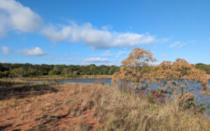
 It’s been two years since I last visited some of the off-road points on Draper Lake. Today was 2 through 4, but in reverse order. I rode the trail starting at Point 4, which is currently under reconstruction. Lots of dirt, rocks and heavy equipment, but not much to see right now. Much of the lake is changing and the various agencies have invested in a lot of heavy work like that. This first image is a cove between Points 3 and 4.
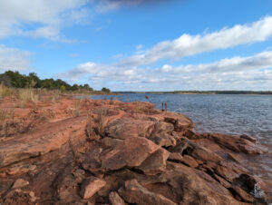 Meanwhile, nature has been at work in the past two years. Depending on what direction the shoreline faces, there has been some erosion that exposed rocky areas like this. Indeed, this one is a case of more exposed. These rocks were here the last time I came by, but they have been washed out underneath and have shifted some. In this case, the results are quite winsome. Given that today’s wind was blowing right onshore at this point, the waves were making a lovely noise.
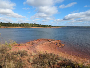 This is a case of the rock formations resisting the natural erosion. The shore on our right side has been eaten back a bit, but it served only to highlight the presence of the rocks. In this case, the rocks extend quite some distance out under the water, changing how the waves roll in. The rocks are not being undercut because they catch the waves too far out. Some of the construction is aimed at making some parts more accessible, but other parts less so, and this area is hard to get to unless you hike or bike.
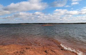 At one point, this island was attached to the shore by a long rocky isthmus, but it wasn’t very hard sandstone. I used to walk out onto the narrow outcropping, but the path has been washed away. Keep in mind that the general water level of the lake is quite low right now, but it’s been almost that low for the past two years. Rocks hidden in deep water don’t erode much; it requires wave action on the surface of the water. This long rocky point will not come back, but the harder stone out on the island will preserve it as is for quite some time.
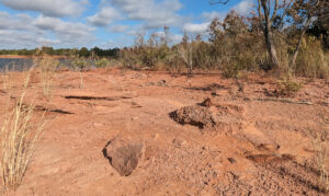 This is a bed of rose rock. I don’t know enough about geology to explain how it forms or where, but it’s about all that’s left of Point 3. This stuff forms in nodules that sometimes resemble flowers; if you poke around enough in places like this, you’ll find them of various sizes. This is very hard and heavy stone that isn’t likely to erode. This is actually being covered up. Point 3 used to be very lovely and dramatic, but because of where it faces, heavy rains have brought topsoil down over it, and this year an awful lot of grass grew up. The point is now just grass and dirt; the rocks are mostly covered.
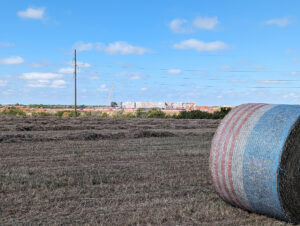 Meanwhile, the new Pratt and Whitney facility is making fast progress. I lined it up with a hay bale on purpose for contrast. Farming will continue all around this monstrosity for a long time to come.
My Zizzo folding bike isn’t a mountain bike, but it can do some off-road stuff if I’m not in a hurry. It was a pleasant ride, and there’s evidence the scant trails will remain open simply because of high foot traffic and a modicum of cycling. But for me, the changes in Points 2 and 3 were actually quite disappointing. They used to bear a dramatic face, but they are now just a place to walk and ride.


Is that a bale of hay (or whatever it’s called) painted in American flag colors? If so, that’s first time I’ve seen that.
The plastic wrapping does have a sort of flag pattern to it. I noticed it on several other bales.