 I’m trying to learn how to capture clouds. With our storms out here in the flatlands, the views can be dramatic at times. The problem is that, if there’s anything where the camera viewscreen deceives you, it’s surely with cloud formations. I can never tell how it’s going to turn out. Also, keep in mind that the sun was behind this particular cloud formation in almost every image, so the light balance was pretty tough.
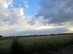
 So a major issue is dodging utility lines and capturing something in the foreground that helps to convey perspective. This image shows a storm forming out northeast of the OKC Metro. That means it’s not coming our way, since winds aloft from the east are exceedingly rare in this state. However, the unstable air mass can be large enough for the storm to grow outward and reach back to us.
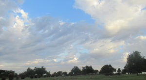
 Meanwhile, from the northwest we have these broken clouds moving slowly to join the storm cell. As it turns out, the storm did grow quite a bit. My ride took me up very close to the rain curtains as the storm kept growing back my way. I lost one image of them on the far corner of my ride due to camera malfunction. Had I stayed there, I would have gotten wet.
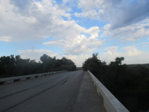
 This is the bridge at the apex of my loop, but facing back to the west, whence the clouds were moving into the storm cell. The wind picked up and the smell of rain was quite strong, so I mounted up and got out of there after this shot.
As it turned out, the prevailing winds aloft pushed the storm on eastward just about the time it stopped expanding. Radar shows that the bridge got some rain after I left, but not much. The smell of rain followed me most of the way home.


You know this is something I can fully support 🙂 I like these shots so far. Always liked the contrast between storm clouds and standard ones.
We haven’t had any clouds for the whole summer until recently. When the really big stuff starts showing up, it should be quite dramatic.