
Source: Google Earth
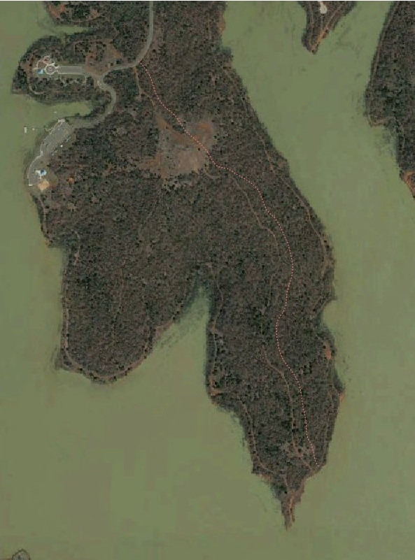
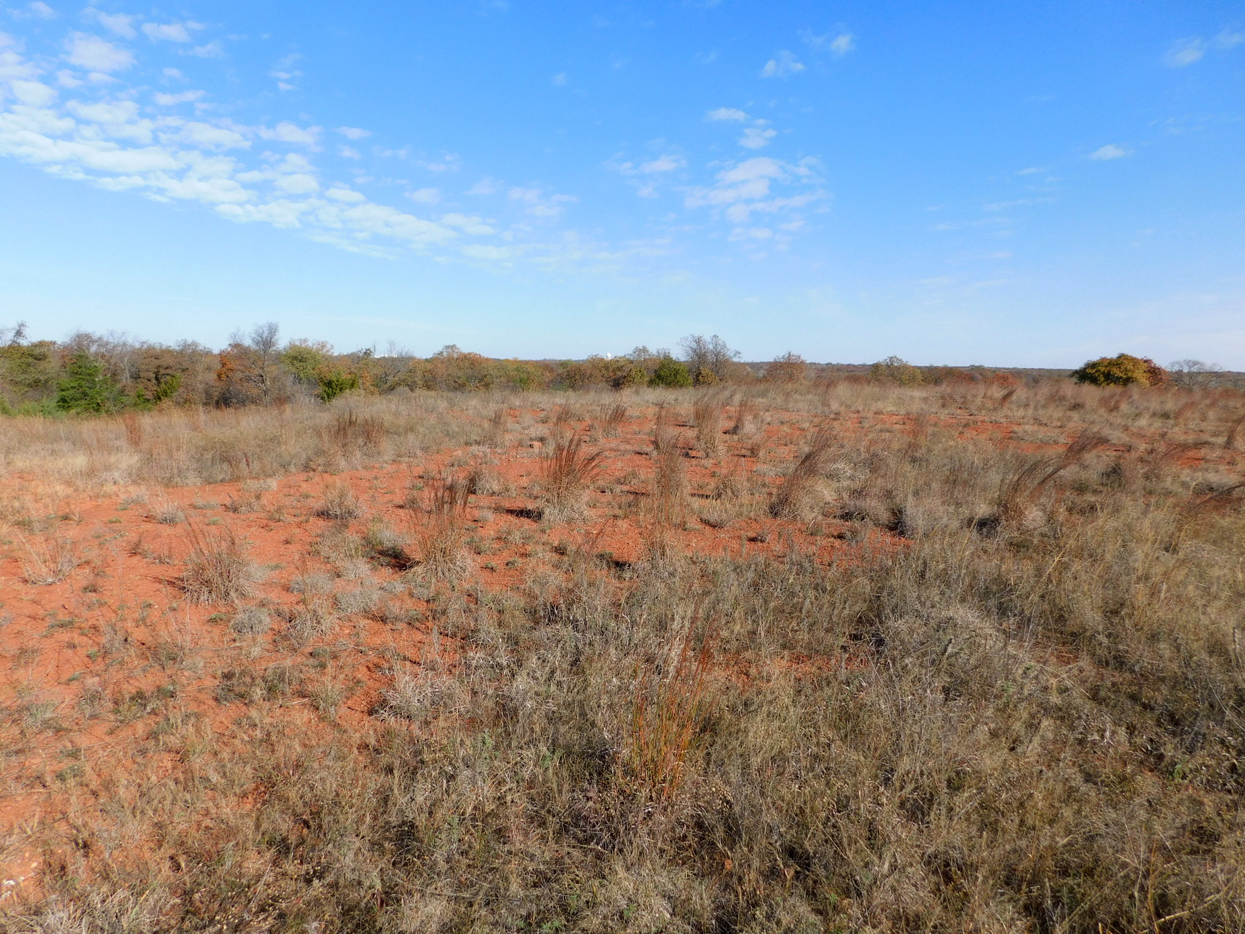 The thing about these explorations is that, since the main park was closed to off-road motor sports some twenty years ago (now confined to a small dedicated space on the SW corner), everyone who really knew the terrain around the lake has gone away. Some of the trails they left to grow over included jeep trails, and that’s what I followed today. You can see in the satellite image there is a very wide prairie, and my picture barely captures one part of it. It’s the crest of a ridge line, so the approach from the road was a climb.
 This trail was long enough that I knew I would have to ride it because I still can’t hike that far without significant pain in my right knee. Turned out this thing was mostly passable; I dismounted for a couple of sandy spots and twice to remove deadfall across the trail. In a few places there were washouts and I had to pick my way carefully. One stretch was simply plowing through tall grass. However, most of it has been well used by deer. I saw evidence of human passage in recent years, but no tracks other than a lot of deer and maybe something that leaves a dog-like print.
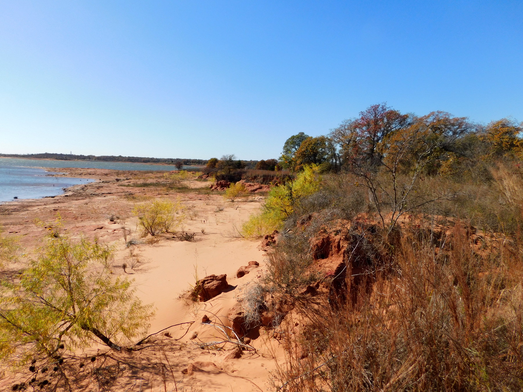
 From the prairie it was one long gentle slope down until I broke through the trees to see the lake. Shortly after that breakthrough I found myself at the top of steep washout and had to park my bike. It’s barely visible uphill in this photo. It was still a hundred meters down to the lake where the view of the shore was wild and also quite a drop to the water.
 I saw evidence of the old shoreline trail, but it is virtually impassable now, sporting small trees and places where it has collapsed from wave lapping. The return ride was a little easier, since I now had the sun at my back and the advantage of my previous tread marks to follow. I made it a point to check the legalese of the signs at the start and it prohibits only motorized vehicles. There are only a few small areas where bikes are notably prohibited, yet there seems virtually no limitation on hiking.
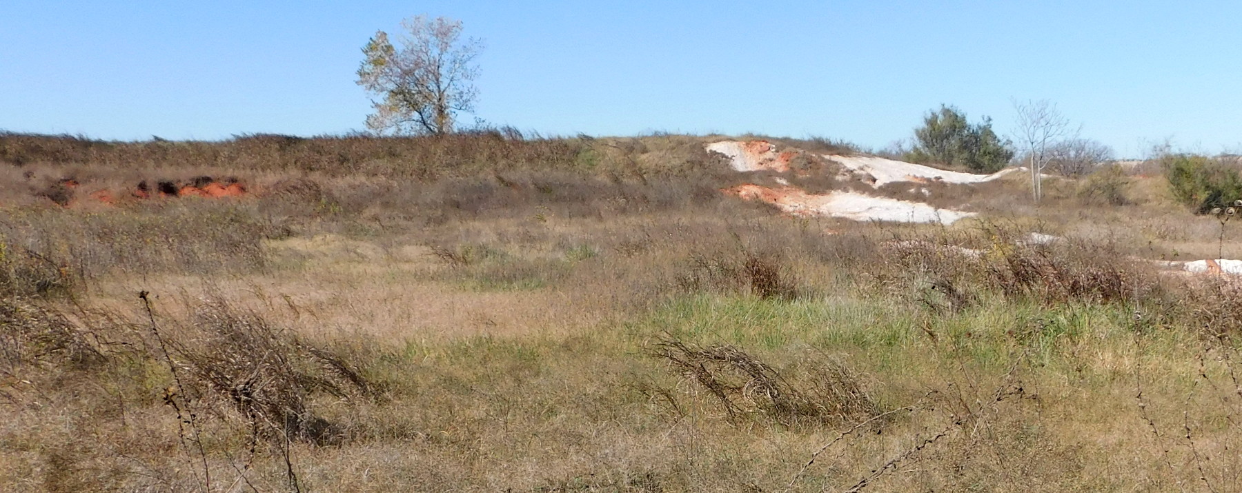 On my way out I was able to avoid all the heavy equipment; the final stretch of new road is almost ready for paving. I stopped near a huge open area that was once the main entry point for motocross riders, up near the NW corner of the park. I spotted this whitish spot exposed in the red clay soil. It turned out to be a concrete dump. When cement mixers are ordered out, sometimes the leftovers can’t be sold as “hot concrete” that opportunistic buyers have to work right away when it comes out. When they can’t find a hot buyer for the leftovers, they dump them on this low bluff. There must be several tons there.
With the winds out the north, it was a long slow slog pedaling home.
Wow. Another serious ride/hike. Once again, enjoyed it!