
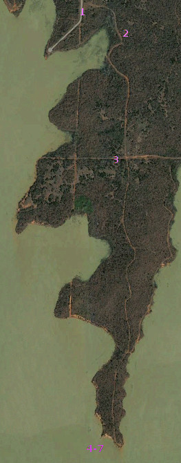
 As always, click on any image to see it full-sized. CTRL-click will open the image in a separate browser tab. Today’s satellite image has numbers to indicate where the camera shots occurred. This is the second longest peninsula, but the longest trail I can find. That is, the longest of the solid jeep trails that were plowed out with a bulldozer.
 The starting point is like the other unpaved trails, no longer open to easy access. In this image, you can see where the natural ridge was cut away way back when, but then at some later point they pushed a dirt mound over the entrance (to the right in the image).
 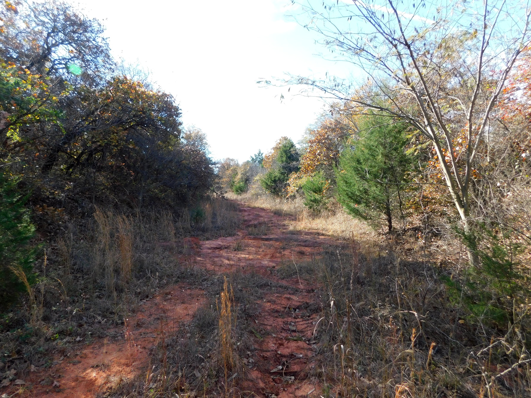 So now you have to clamber up a steep trail (just in front of my bike) and cut back hard to left and get on top of this remaining chunk of ridge. From there it’s rough picking your way through the woods to get past a massive pair of trees pushed over the head of the trail somewhere down from the new berm. Once on the trail, it’s pretty easy. Only tall grass has grown over it, and not too often at that.
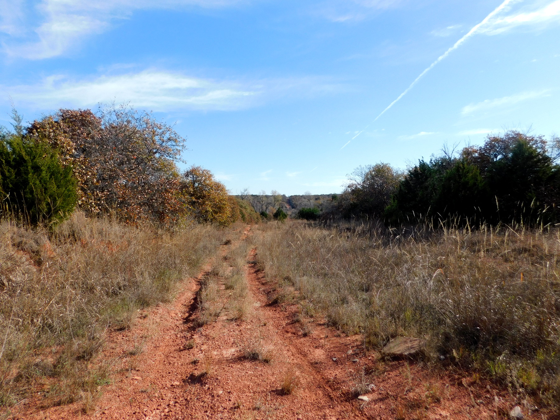 You can see where the old section lines were still visible when the satellite images were recorded. This image (right) is looking eastward on the one I crossed about one-third way along the trail.
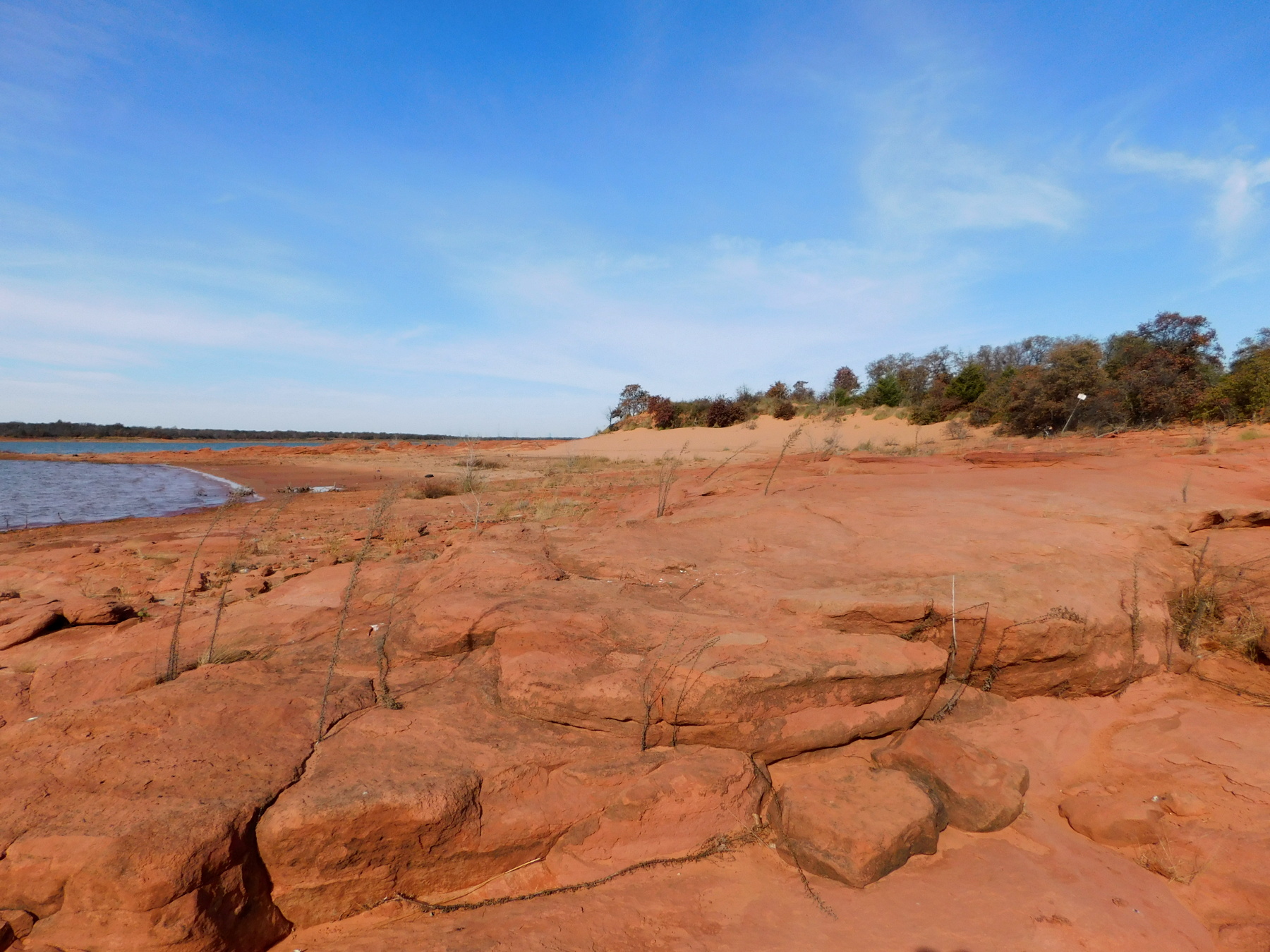 This is the first trail I’ve checked out that showed signs of human passage: boot prints, bicycle trails like mine and even a couple of motocross tracks. That would have been tough to bring in the way I came. It was a long hard ride, roughly two miles by my reckoning, and way too many loose sand bogs.
 However it was worth it. The old rocky point was just gorgeous. The water level was a little high in the lake today, so the longest end was isolated from the shore (image right).
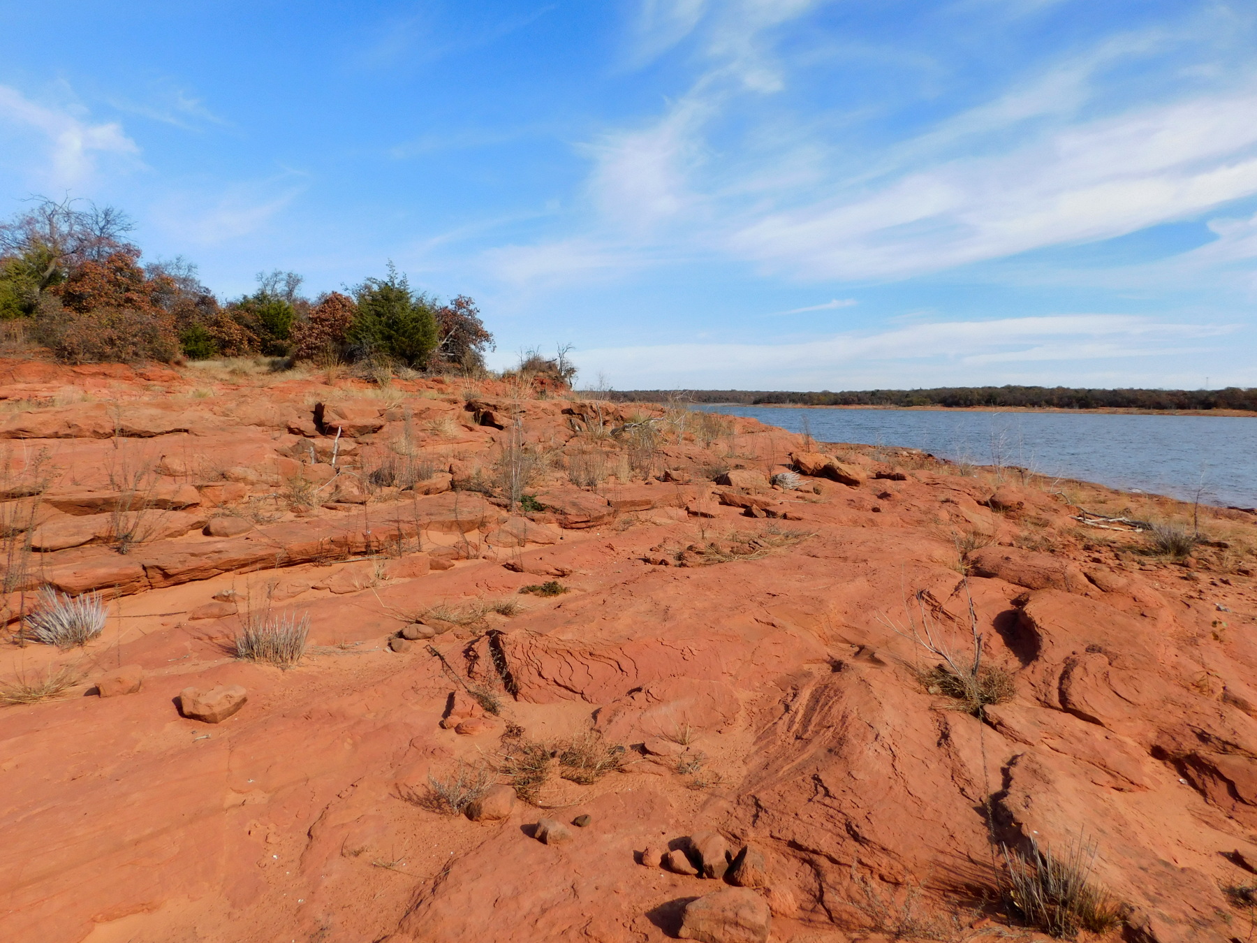 It’s a solid rocky promontory and today it was infested with seagulls. I took the shot facing into the sun with some telephoto, so it’s not the best quality.
 I shot peering around the eastern edge (above left) and then out on the secondary trailing point on the west side (right). The constant exposure to our dominant southerly winds had driven all the sand high up the shore and into the woods. Almost the entire point is exposed red sandstone and quite pleasant. It’s a great place this time of year when the biting sand flies hibernate from the cooler temperatures. I could have stayed much longer, but the objective today was a good long ride off-road on a trail that was just manageable. Wonderful exercise on my right knee as it slowly absorbs the last vestiges of visible swelling.
Pingback: Cycling: Unhappy Trails | Do What's Right