
 I skipped Point 5; that’s the marina and there’s very little of the natural condition there. Instead, I took the road toward the dock of Point 6, then jumped the divider and took the old shore trail just barely visible on this satellite image. As before, the pale blue numbers indicate the actual points as registered on the official maps, and the pink represents approximately where I was when the following images were taken. This is a pretty rough area, which I knew from previous explorations a couple of years ago.
 The first image is the old shore trail on my way toward Point 6. Ever since OKC decided to turn the lake area over to full conservation, the old shore trail has degraded radically in some areas. This one still sees illegal motor traffic, but it’s pretty rough as the ridge that forms Point 6 features massive sandstone bedrock very close to the surface.
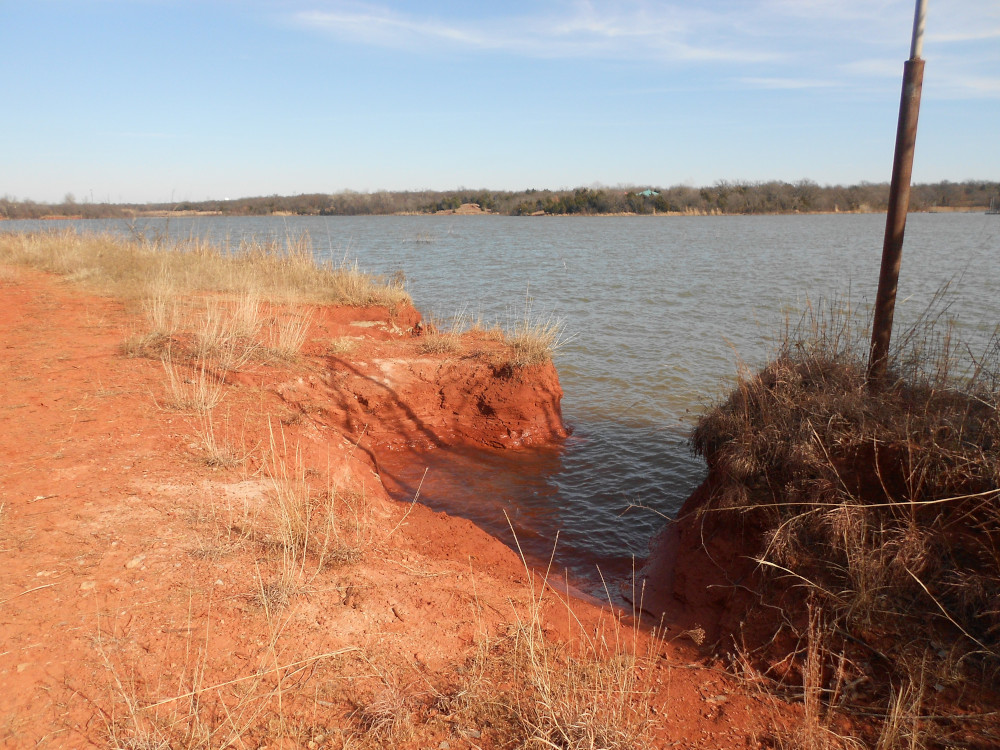
 Point 6 proper is quite a ways from the docking facilities accessible by the road. It was quite beautiful and frustrating at the same time. The red sandstone outcropping at the waterline was very wet and slippery. Getting a good place to stand for camera work was virtually impossible, especially for the pocket camera I was carrying. Some features just didn’t come out. There was a flat stone shelf sticking out over the water that doesn’t show very well in this second image here.
 The trail between the actual point and the dock is pretty easy to follow and features large trees on the shoreline. These are mostly oaks and small cedars, a very lovely part of the ride. The trees grow in a hump between the trail and the water. There is a small drop most of the way.
 At one spot, the natural rain runoff cut through the hump and created these little pockets. With the wind from the south, the waves were only moderate on this east-facing shore, but one of the pockets had a small hollow washed out at the waterline and made an odd popping sound in the waves.
There was nothing picturesque about the docks, and I rode straight through and back into the woods. The old shore trail north from there was thick with grass and underbrush. In some places it was downright swampy owing to the very high water level. The heavy layer of leaves and sticks made it possible to keep chugging through except for one spot where I had to dismount and drag the bike through a muddy pool. At some point the trail abruptly turns upland away from the swampy shore.
 In a previous visit to this area, I cut around the woods a bit because the old trail was heavily overgrown. This time I dove in, walking my bike through the underbrush. It wasn’t as bad as I was expecting. I encountered a deeply cut washout, but there was a detour across higher ground where the runoff had not cut deep, but was spread wide under some trees. It took some exploring a bit to find the trail bed, but I was rewarded with some interesting sights. This small basin of stagnant water, with a thin layer of ice on top protected from melting by the heavy shade, was formed by rain washing over a thick layer of bedrock. Again, it was very hard to capture with my pocket camera, but the big camera would have been at risk from the rough ride.
 I was still on the ridge that forms Point 6, and true to its stony nature, it was common to see sandstone bedrock like this exposed by rain wash. Of course, some of it was stripped by off-road motorbikes back when the entire area was open to them, but most of this was already exposed by natural processes.
The next ride out will be toward Point 7, and should include a look at that canyon I discovered a couple of years ago.
I’m still transfixed by all the clay and redness you have there. 🙂
Yeah, that’s the color of our dirt here. You can find brown dirt in Oklahoma, but it’s all south and east of here some 60 miles or so.