
 Here is a satellite image of today’s adventure. The pale blue numbers mark the points. The pinkish numbers match the following images in numerical order. Noteworthy is that the first image was several miles away from the lake, so it’s not on the map.
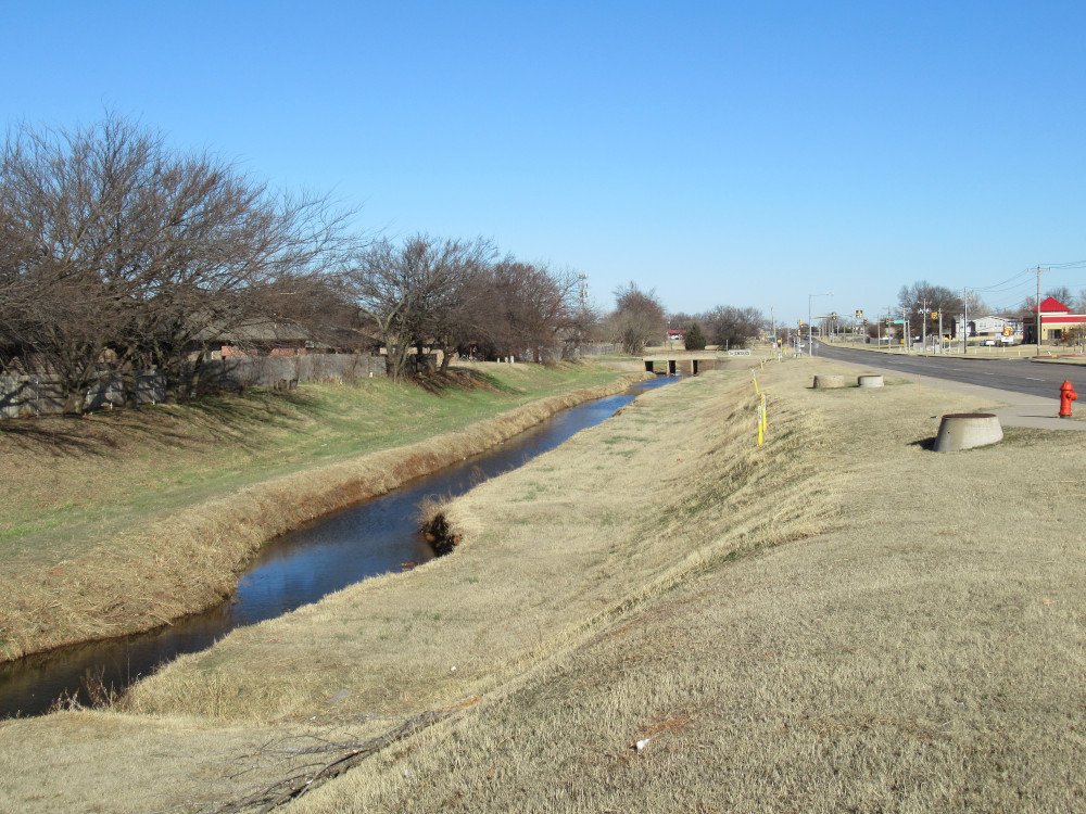 The new camera was on duty today, and it appears to have been the right choice. On my ride out to Draper Lake along the Sooner Road corridor, I pass this tributary to Crutcho Creek. Something called my name about a scene to shoot and this is what I ended up with. Crutcho Creek is just about a quarter mile off to my right (east) and this tributary was pushed over to it’s current position to make way for the housing addition to the left.
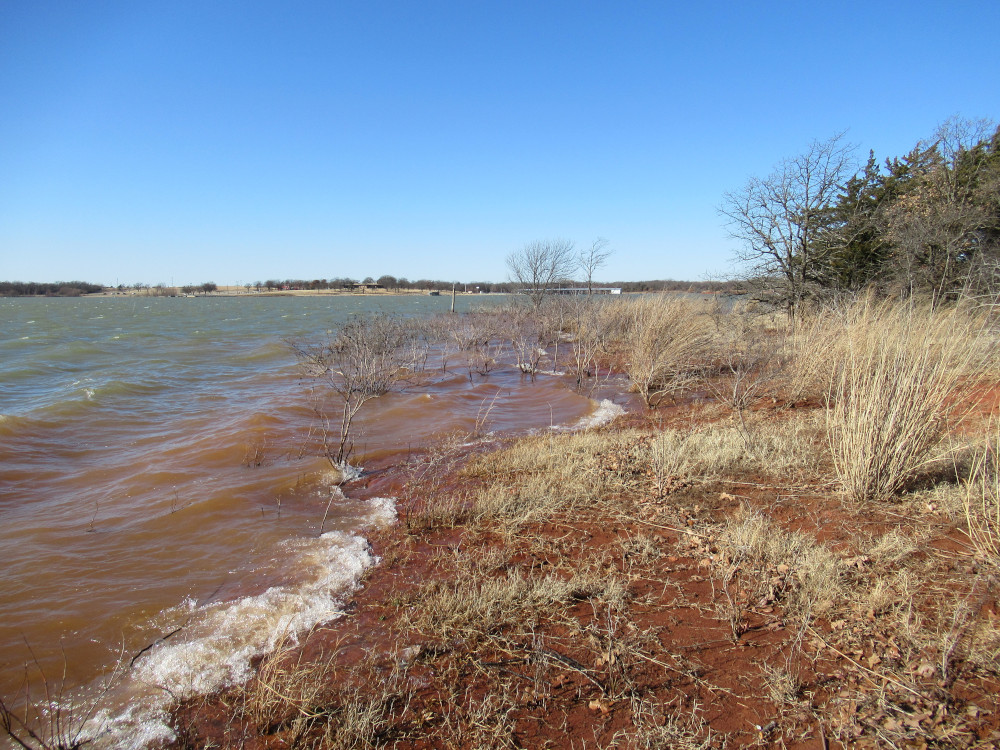
 Today’s target was Points 9 and 10. The former is where all the fanciest recreation facilities were placed. There was nothing to gain by traipsing along the trails to get out here. Once here, I went out on a fishing dock that juts far into the water. This shot is looking back north to Point 8, where I was Monday. The high lake level puts that grass out in the water.
 This park area isn’t actually on Point 9, but sits on the western side. At the southern end of this parking area is a trail that runs off into the woods toward the actual point. Most of the way we have this Pampas grass, a type I believe is actually native to this part of Oklahoma. At any rate, I see plenty of it in the wild, and I owe a debt of gratitude to the equestrians riding out here who keep a trail cut through it. It gets awfully thick in places.
 About halfway between the parking lot and the actual point is this spot where the shore is accessible. Today we had stiff southerly breezes so the lake had a good chop on it. This little open spot faces almost south, so the waves are clearly whipped up onto the shore. In the far background is the marina on Point 5.
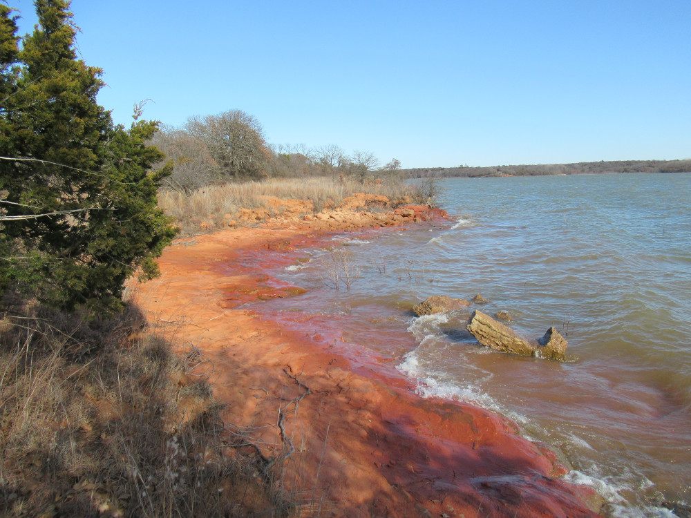
 Point 9 proper isn’t actually rocky, but very hard-packed clay. There are two tracks cut into the shore by water run-off. With today’s blustery conditions, the waves were splashing way up high on the shore. I really wanted to stand on the other side of this inlet, but that was pure thorns. Without a cutting tool I would not have gotten out there with my pant-legs intact.
 Father around on the eastern side of the point, the shore offers a little more visual appeal. You can see where a small tree was undercut and fell into the lake. There were several more much larger trees behind me, but there way no way to get a good angle on them. The shore here has lots of thorny stuff that makes it hard to crawl around.
 Point 9 is part of a very large ridge sticking out into the lake, split out on the end between Points 9 and 10. The shore trail on the way to Point 10 offers much lovelier shoreline with exposed rocks. This was shot with still a half-mile or so to go. You can see Point 9 in the background.
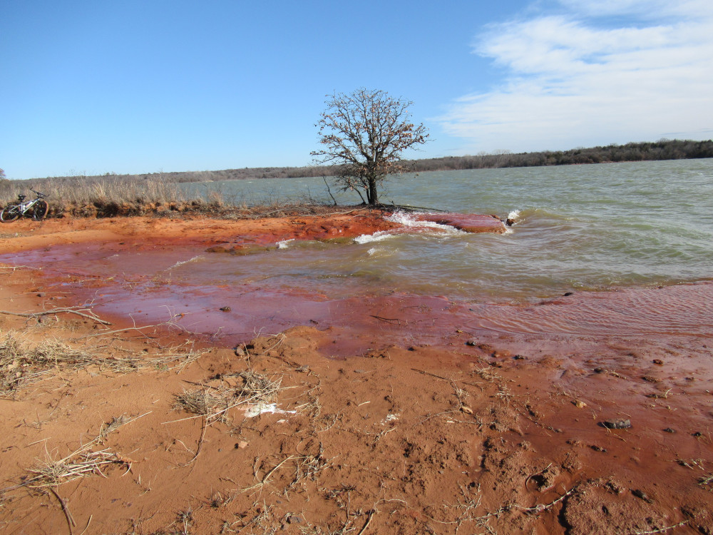 Point 10 itself is a low ridge split by a sandy trench that creates a natural boat ramp, but you could never get a vehicle out here, much less while towing a boat. This was actually pretty dramatic with the wind whipping in off the water and the waves splashing over a rocky bed that was just about water level. I couldn’t capture it with my camera because the water never dropped low enough to make it obvious. That lone Blackjack oak has almost all of its roots exposed by wave action.
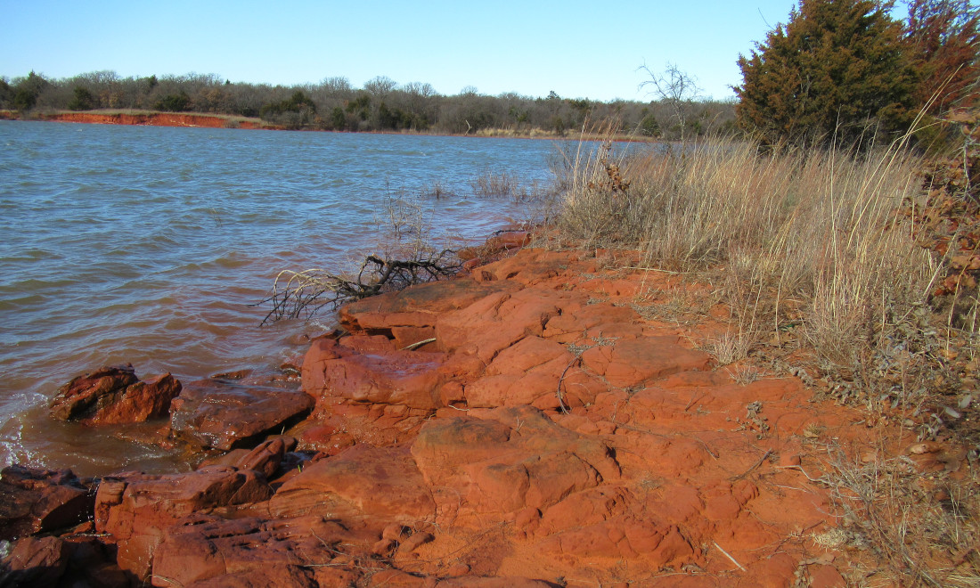
 After eating my lunch of sardines, I was able to get close to the eastern shore of the point in a couple of places. The rocky underlayer was bare in several places. It appears the lake bottom drops away quickly here, so you can bring a boat up very close to the shore. Where the stone base is lacking farther along the trail, the crews had to place a lot of rip-rap to prevent erosion cutting too deep into the shore line and threatening the trail.
 Here the rocks return. The trail runs through the tall grass on this side of the treeline. As I made my way north along the shore back toward the main road, there were places where the horse traffic had churned the sand into soft bogs that made it hard to ride. There were several trees down across the trail. I intervened a couple of times to move things or to reduce the barrier to something more manageable. I even ran into a family with little kids walking the old shore trail. The man commented that it was quite rare to see a cyclist on the trail, but horses and riders were common.
Love that shot of the oak by its lonesome. Poor guy is hanging on for dear life.
All the clay reminds me of this fellow. I just found him a few weeks ago, but going by his subscriber/comment count, he’s up there in popularity:
https://www.youtube.com/watch?v=wrTDJbaxhOI
I’ve seen his stuff before over the past couple of years. I seem to recall he said all of his videos are shot in Australia. He’s pretty sharp.
If you like that, you’ll definitely dig Mr Hueng, he’s a wiry Indonesian (?) dude who makes stuff in the jungle. Restoration of Everything is good too, they’re from Pakistan or India or someplace like that. “Don’t throw nothing away, you might could find some use for it later”, Hillbilly values are universal.
Thanks, Iain. I’ll have to look them up.