
We continue with the photos taken from yesterday’s trip to Western Oklahoma.
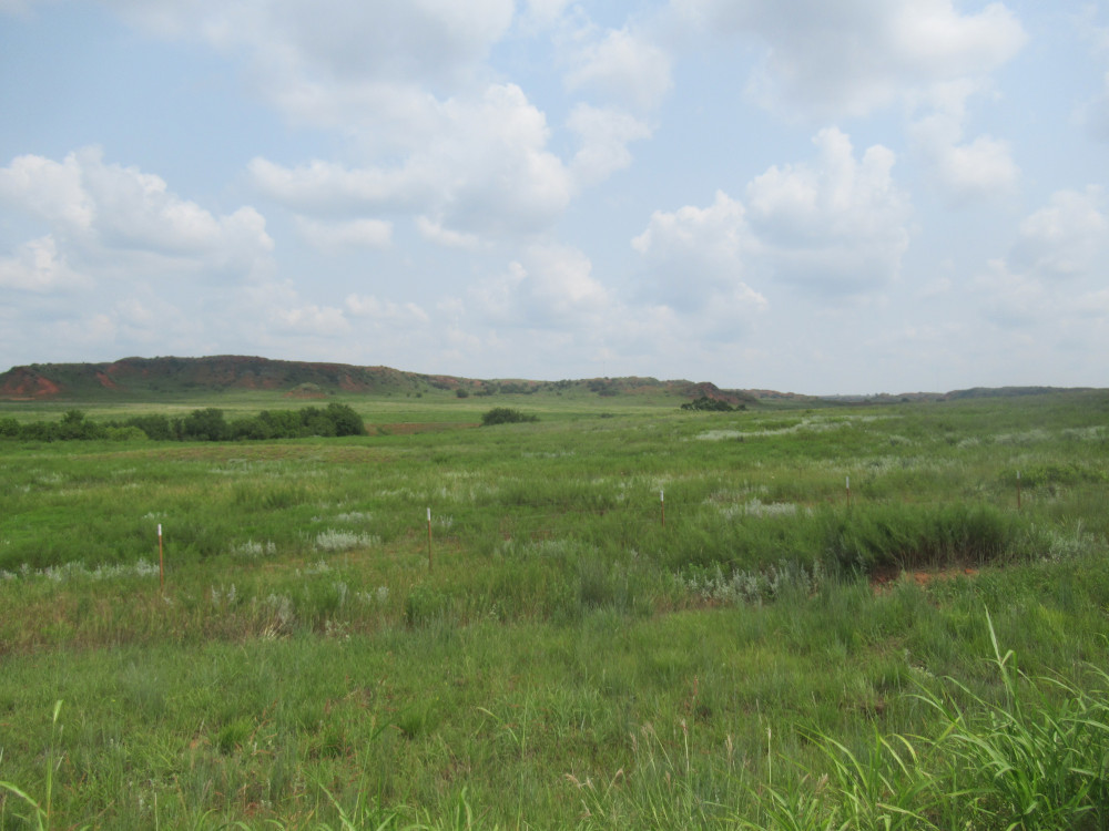 From what I understand, a major element in the declaration of the national grasslands is that it prevents people from changing the natural flora. Most of the land outside the National Grasslands is growing other kinds of grass, or even crops. This first image is roughly the middle of the grasslands, showing both the flora and the unique hilliness that makes driving through it so wonderful.
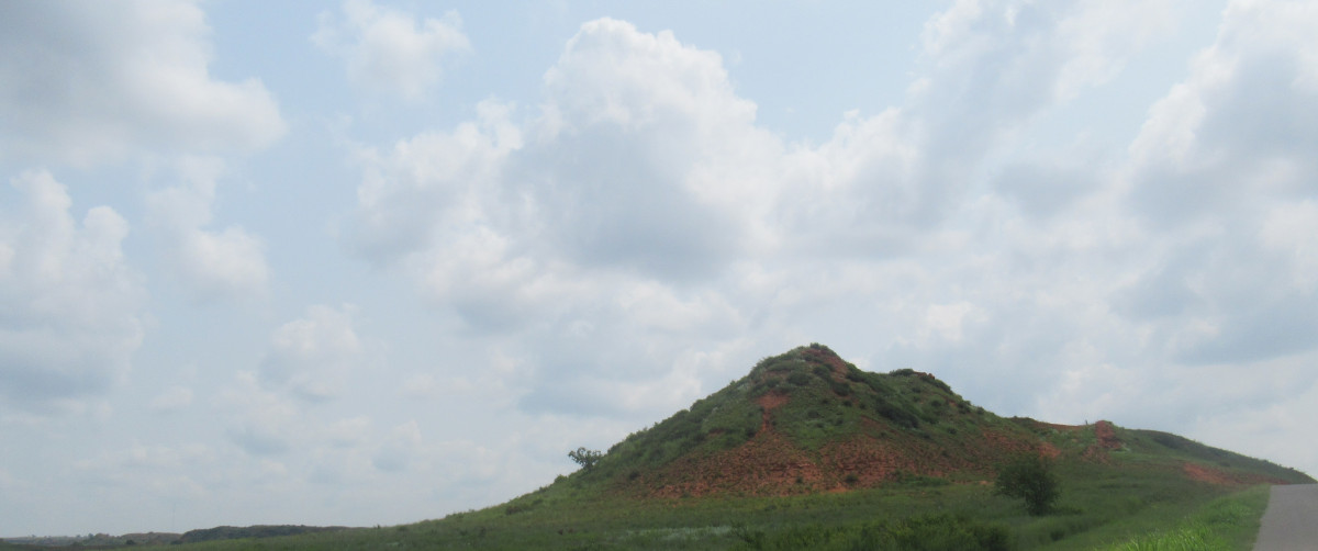 Where there isn’t a landscape deeply carved by water run-off, there are these hills everywhere. This one is typical of what you would see driving in this area. Keep in mind that most of the roads through the National Grasslands are oil roads; they are maintained by the county, but exist primarily to access the dozens of oil wells out here. There are a few houses and ranching is allowed, so most of the land is fenced, and the roads are littered with cattle-guards.
 Despite the fish-eye effect, I think this image does justice to how some of the hills look. It’s a panorama stitched together from five shots, where the road ran right up against the foot of one hill. There were cattle just visible on the far side as the road took us around this. It’s all gravel roads with few exceptions.
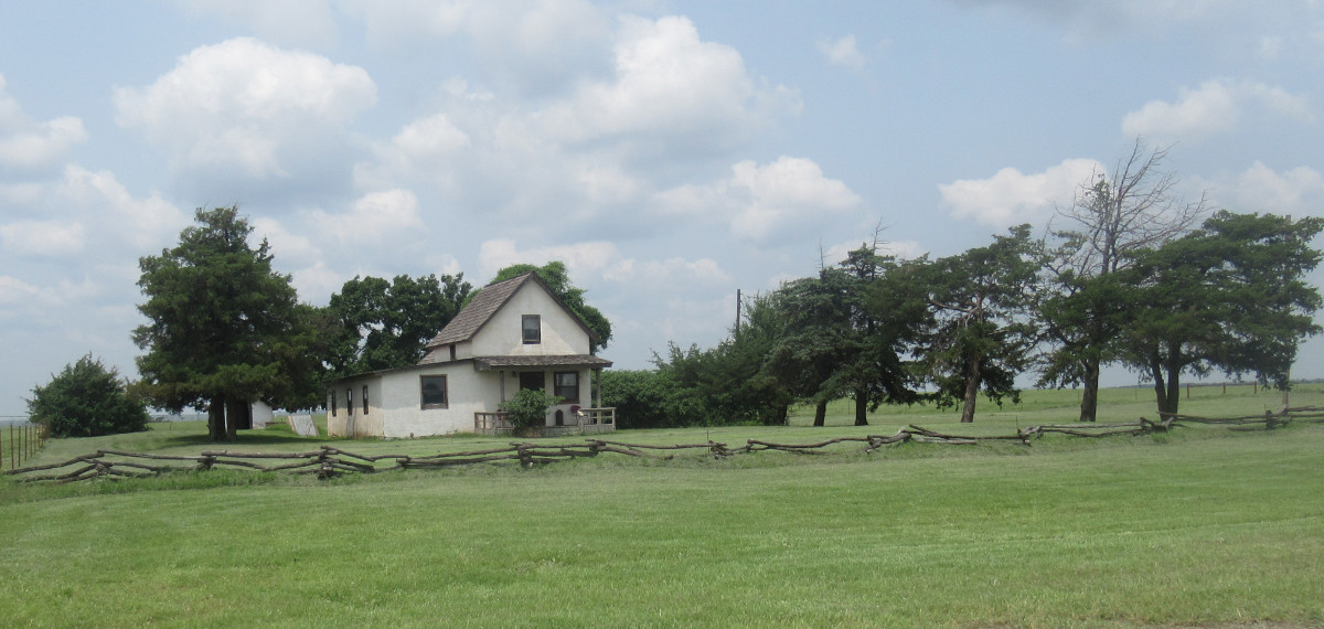 As we began moving toward the next natural wonder in the area, we spotted this very old house. From what I could tell, this is easily one of the first structures in this part of the country. It’s covered in a kind of stucco, and appears to have been added onto at some point. There aren’t many of these in the area.
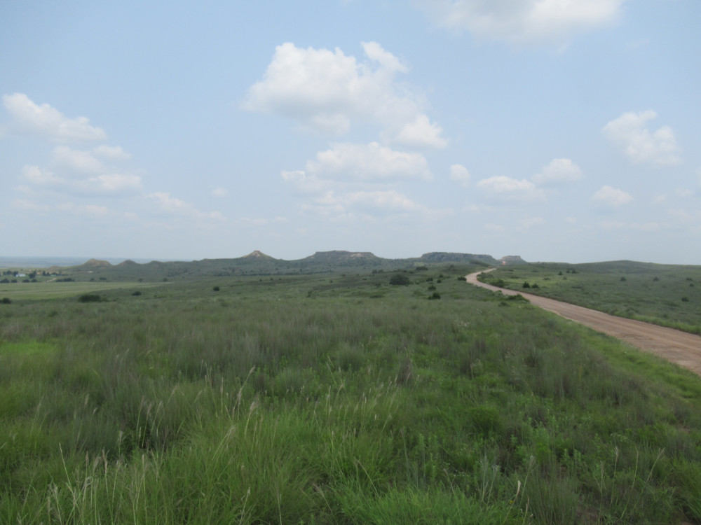 A few miles north of the Black Kettle National Grasslands is a state-owned natural monument called Antelope Hills. It’s a rather small collection of mesas clustered up against the southern bank of the Canadian River, where the river makes a wide sweeping bend to the north. What makes the Antelope Hills so unique is that it is mostly white sandstone, which is exceedingly rare in a state noted for its bright red soil.
 The oil road runs through a gap between two of the hills. In times past, schools would actually bring kids out here by the busload and let them wander at will. It’s just possible to climb some of these, but it’s no longer encouraged. A couple of them feature a layer of stone on top that looks almost like a fortress.
 This panorama was stitched together from two images inside the gap in the previous image. It shows the view from the bottom. There aren’t very many of these hills, and a pair of them are orphaned from the main cluster, standing off a mile or two east of the rest.
Sadly, several photos just didn’t turn out well. I’m hoping I can take a few more trips this year, maybe even going camping some.
Here’s a good thing with living in flat-ish areas: it’s much easier to tell where the hills are, just by sight. If you’re already among hills, you have no idea what’s beyond them since they block the landscape (unless, of course, you are on a higher hills and can see over them). Something of a paradox, but once you get a feel for the hilly area, I suppose the sight issue doesn’t matter much.
To be honest, I just enjoy exploring and having surprises. I could easily spend a few days out that area on a mountain bike. There are several different oil roads chasing different paths across the area, and I had time for only one in each landmark.