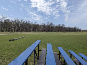
 I’m finally able to start riding again. The trick for me is, after nearly a year of physical therapy on my knees, I had to find a new equilibrium point on what my body can tolerate. It will mean fewer hills, but I believe I can still hit the same distances I did before. This is Ray Trent Park, showing how the underbrush among the trees has been cleared for the first time in years.
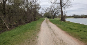 Some things have changed on the routes I formerly used, but this is Eagle Lake Park, which hasn’t changed much aside from a more regular mowing than used to be the case. This dual track path connects Del City with the OKC River Trail system. It wasn’t always this clear in years past.
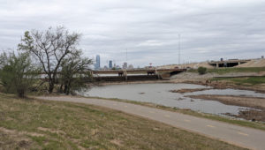 OKC has also been working a bit this past year. I was able to climb the river levee to take this shot of the lower dam on the OK River Recreation Area. Of course, they haven’t cleaned up all the homeless camp sites, but they seem to have a separate team for that stuff. If you look closely, there is some kind of construction along the far bank of the river. More on that later.
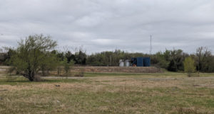 Along the Eagle Lake Trail near that dam is this very common sight all across the state of Oklahoma: oil well storage tanks. These tanks hold the product of several different wells scattered in this area. It requires substantial infrastructure because it’s just above a flood plain, and fouling the ground here would be a catastrophe. So, they build an expensive site for several low producing wells together.
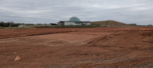 The Eagle Lake Trail ends out in front of the First Americans Museum. The museum is finally getting enough money for crews to finish the construction. In this image, all the land out front has been stripped bare and landscaped. I recall seeing proposals that would bring in a bunch of selected trees, gardens and assorted fixtures that match the new bike path they plan on paving alongside the river. We have been riding on dirt for several years, but not much longer.
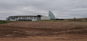 Same site, but a side view showing that large symbolic “war bonnet” structure out back. Again, when I last rode past here, there was an awful lot of dirt work going on. Now the equipment is all parked and waiting for removal. I believe the folks who put in the gardens and stuff is a separate contract. It will probably take years, because this is not strictly OKC, but the various tribal councils running this show. OKC can get stuff done fast when they want, but the tribes aren’t quite so light-footed (there are dozens).
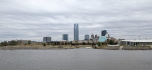 I was caught by the sight of the rippled cloud base over the OKC skyline. I didn’t ride past this area that day; I’m still getting my legs back. This amounted to a 14 mile round trip from home.
On my way back, I noticed lots of construction on the north bank of the river. It ran for miles. At one point I caught a glimpse of concrete pavement: a bike path. This accords with some proposal I saw several years ago in which the City wanted to add a bike path on both sides of the river running out at least as far as NE 23rd Street, and if they could gain control of certain lands, it would go even farther. I’ll be checking that out, and if so, I’ll take shots of some of that work. It signals that the existing trail along a portion of the south bank will be extended to match. That would add a lot of nice flat safe riding area for me.


A bike path would be nice, eh? Maybe 5 or 6 years ago, some parts of the streets downtown in Pittsburgh were redone for bike lanes, and the formerly two-way streets for cars were turned into one-way, or some such. There were even public bikes and stations littered all around the city. An okay idea, but there was no demand for it, so none of it really gets used. I doubt it was voted on but it looks good as a greenie PR thing.
I have no doubt the greenies have caused a lot of waste. But I’ve seen people already using the unfinished bike trail mentioned in the post. There has been a long demand for it.