
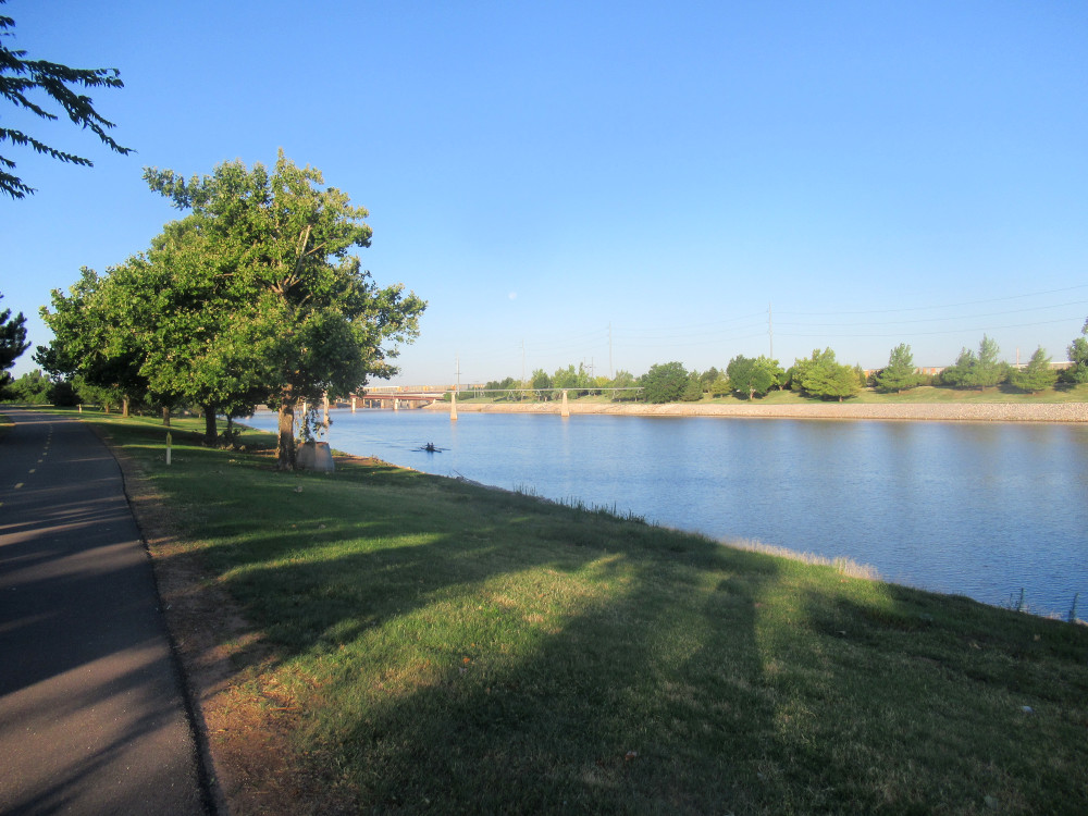
 The first two shots are from yesterday’s ride on the OK River Trails. Here we have a couple of kayakers training for races. This facility has become one of the premier training areas for kayaking in this part of the country. The city invested heavily in making this qualify for Olympic Trials, and added an artificial whitewater facility that was very quickly adopted for the same level of use. The city leadership claims it’s already paying off in terms of added tourism and boosted tax revenue. Think about it: competition rowing in OKC, of all places.
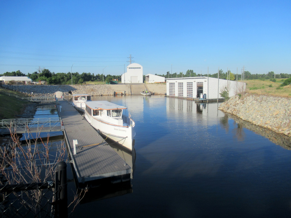 Devon Energy is one of the bigger investors in all of this stuff. They run tours on the OK River rowing area. This is their boat storage and maintenance facility. To be honest, I rarely see the boats doing their thing, which is almost entirely during warmer weather. Then again, when it’s at or near triple-digits Fahrenheit in OKC, I only ride during the early hours of the day, so I’m sure the tour boating service runs only after I’ve gone home.
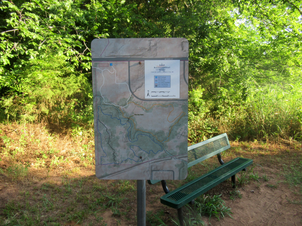
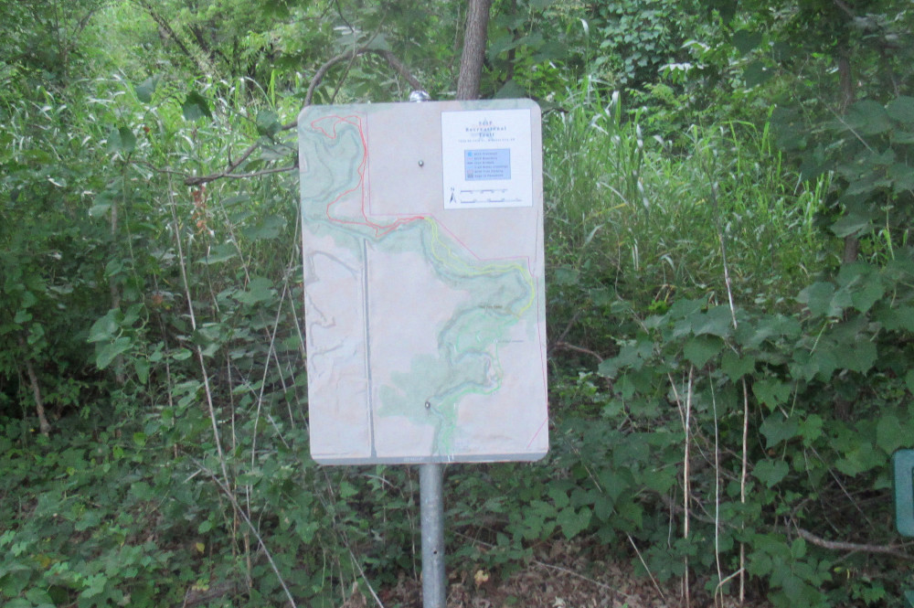 The rest of the pictures are taken from today’s SCIP Trails ride. Midwest City (MWC) has a much smaller budget than OKC, but there is a strong biker community here. The city had planned this area for industrial development (SCIP = Soldier Creek Industrial Park), but no one ever bought a single lot. So, when the biking community volunteered to build and maintain the trails, it was better than letting the land sit vacant. The city did kick in some facilities and it became a major recreational feature, since the trails are open to walking or other human-powered wheels. Now the city is investing more planning and money into the whole idea, adding paved biking trails all over the place. This is the trail map posted for the new northern section of the SCIP Trails.
 The northern half of the trail system is the latest edition, started a couple of years ago, and finished sometime later. The whole thing follows Soldier Creek until it feeds into Crutcho Creek. Thus, the northern section is along Crutcho Creek. They did a good job, and today I spotted someone doing volunteer trail maintenance. I had no trouble navigating the trails on my new mountain bike. Since there are no serious hills, it’s easy enough to pick a gear and stay with it all the way through. In my case, that was B-4 (middle chain ring and the 4th of 8 gears).
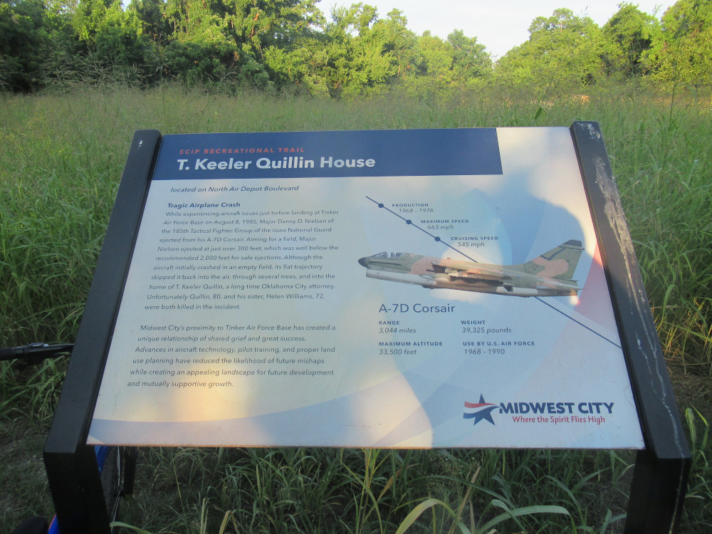 The north trail features a memorial to T. Keeler Quillin, whose house was destroyed in a plane crash. This part of MWC lies in the flight path for the main runway at Tinker AFB. Tinker was built originally as a production facility for Douglas Aircraft leading up to WW2. After the war, the Air Force took over the facility and named it after Oklahoma-born Brigadier General Tinker. This northern flight path all the way down to the end of that runway has seen crashes ever since then, though a lot less in recent decades. I believe the picture of the fighter jet is like the one that crashed.
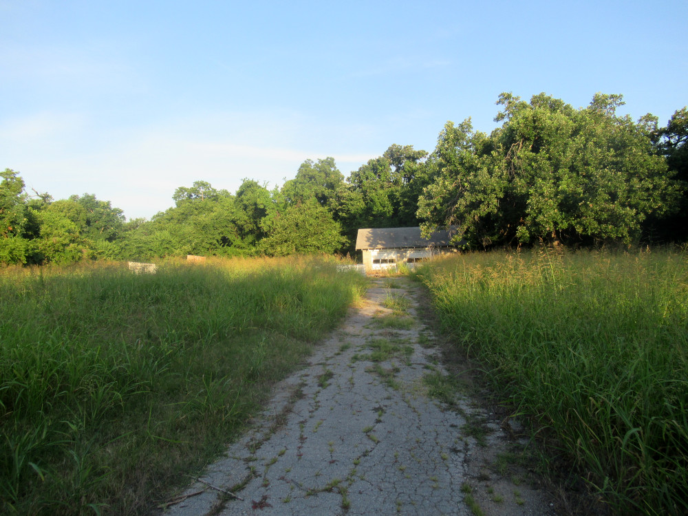 There’s not much to see of what remains of the Quillin property. The garage is still standing, but whatever is left of the actual house is overgrown in the tall grass native to this area. The pilot did his best to bring the plane down to a safe crash landing, waiting long past a safe ejection altitude. He survived, but the aircraft pancaked, then bounced back up and drifted over to the Quillin home. The impact killed both occupants of the house.
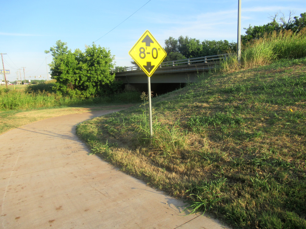 On my way back out, I turned and took this picture of the entrance to the northern section of the SCIP Trails. This paved path runs under the Crutcho Creek bridge on NE 23rd Street, a major thoroughfare across the whole county. It was once part of the famous Route 66. I remember watching the construction crew working on this a couple of years ago. However, the actual trail system was built entirely by volunteer labor. Today it’s associated with the Oklahoma Earthbike Fellowship. I can tell you that Oklahoma is way behind the curve on building open access trails. I’ll also tell you that part of the problem is that the membership of this group isn’t very accommodating of folks who don’t fit into their narrow social pattern. I’ve tried to work with them as a volunteer and never got anywhere because I’m not on Facebook.
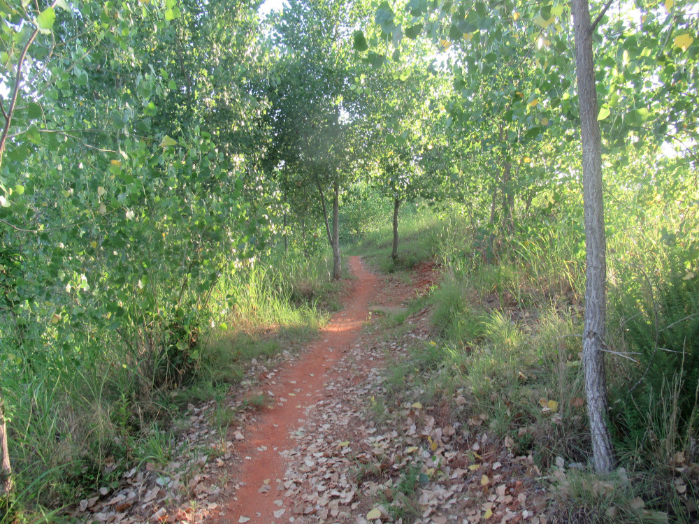 This is a sample of what the trails in the southern section look like. This is the older part of the project, but in the past two years, this southern section has been updated and improved. Also, they’ve added extra loops to make the trails longer. In one place on the Blue Trail, a massive dead cottonwood tree fell and cut off part of the trail, so they had to reroute. I rode two miles down to the trails from home, spent about an hour riding the whole system (minus the Black Trail) and I was whipped when I finished. It took a bit of rest time before I was ready to ride back home.
 This is the trail map for the southern section. To be honest, this part isn’t that well laid out. There are a couple of confusing junctions and you end up repeating some sections of the trail no matter which way you go. There’s one obstacle on the Green Trail that is too hard for that level. Green is supposed to be an easier level. I’ve seen similar flaws on other trails across the state. I can’t forget how the trail down near Norman (home of OU) was wholly unmaintained, and Norman is a major biking town, with our biggest university and lots of wealthy liberals.
I don’t want to turn this into a bike maintenance blog because there are too many other folks doing a much better job. But let me offer one “pro-tip” for those who buy cheaper bikes like mine. One of the first things you should do is lubricate the pivot points on your derailleurs. This really helps the cheaper components work better. It solves most problems with inconsistent shifting. Just use a good chain lube, the kind that has a gummy grease suspended in an evaporating solvent. Just a drop here and there will prevent shifting troubles.
Noticing a lot more sun vs shade in your photos. Is that because you’re out earlier and there’s more of an angle to the sunlight?
For sure. During this heat blast in our part of the country, I leave the house at sunrise. Most of my pictures are taken when the sun is still quite low on the horizon.