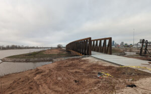
 While not officially open for use, this bridge represents the near completion of the newest bikeway, extending the north River Trail all the way to the Katy Trail. I missed the placement of this last bridge. Unlike other bike bridges in the OKC Metro, this one didn’t have a prominent bottom frame. Instead, the upper frame is bigger and heavier. The sides of this bridge are above head height. And I’m not the only cyclist ignoring the barriers and riding this trail already.
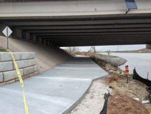 OKC didn’t play tightwad on this project. The amount of materials and work that went into this is substantial. There wasn’t too much room left when this bridge was built decades ago, but this isn’t dangerously close to ride under, nor is it likely to flood easily, since the entire section of the river for several miles has massive flood controls installed. The city actually put this up for a vote to collect extra sales taxes and so forth to fund it as a series of projects going back decades.
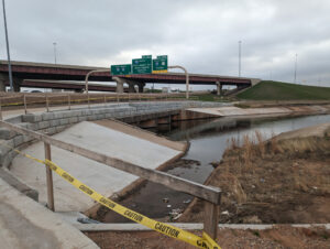 The trail was squeezed between the river and Interstate 40. Here, the floodway offered enough structure to put the trail on top, but that meant you are almost within arms’ reach of the vehicles passing on the highway. I’m not kidding; the “shoulder” of the interstate is almost nonexistent at this point. This spot is also no place for conversation, as you might imagine. Still, it’s well built and should last for quite some years.
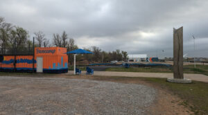 This trail starts at the Boathouse District, AKA Riversports facility. Some private sponsors got involved and they constructed a “basecamp” for cyclists. There will be safety classes (mostly for kids) and lots of training facility, as the following images will demonstrate. This is all supposed to officially open in about six months. That’s when they new trail goes live, as well. However, this stuff is wide open for use already, no fees. It will be operated mostly by the volunteers, from what I hear.
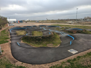 From the top of the converted shipping container in the previous photo, you can see the full layout of the “pump track” provided by Velosolutions. It’s for all wheels, not just bicycles. I rode across it, but it’s not my thing. Still, it’s nice to see this kind of stuff. You can find videos online to show it all off (beware, the video features country music performed by someone with a foreign accent).
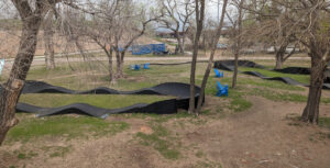 I believe these fabricated loops are relatively new, and they appeared to me too small for adult riders. I’m sure it’s all part of the skills development concept of the whole park. There are several of these scattered across one part of the park. I’ve seen local news videos of kids using them, which tends to confirm my impression.
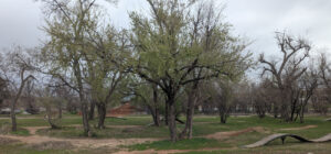 There’s also a real mountain bike loop with elevated features. You can find a video of it here. In the background is at least one dirt hill that appears to be some part of the whole thing. I didn’t investigate because it’s not my kind of thing. I was much more interested in how the city invested so much into biking in the past few years.
As of now, I no longer have to ride through the hospital district and Bricktown to get to River Trails. While there remains one patch lacking pavement, the city knows cyclists are using the entire trail now that the last bridge is installed. It’s just a matter of time before the near-useless barriers will be removed. I can now come in on NE 4th and turn left along the river bank, and ride away from motor traffic all the way to the Boathouse, several miles, and it connects directly with the north River Trail.


Do you know what that weird monolith is, in the basecamp photo?
The pumptrack maybe looks like fun. It also looks like an alien head from the overhead shots. I’m too old and unskilled to do tricks on it but it might be a good workout just to navigate it without falling.
That thing has some writing on one of the sides facing away from the camera. I didn’t pay much attention to it, but I recall it had the name of the facility and some other stuff.