
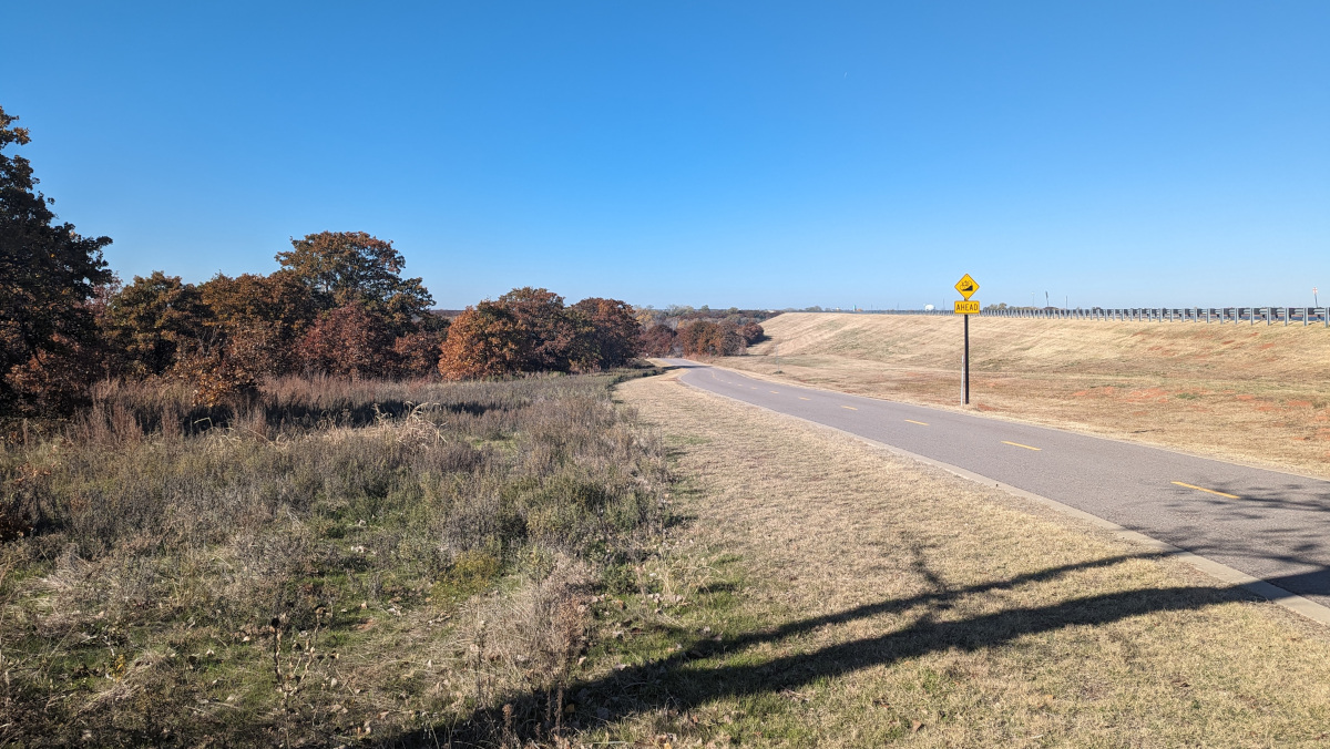
 Out at Stanley Draper Lake, this is the bikeway running down below the dam from the eastern side. This image doesn’t show anything special, but I thought the colors were so refreshing. We’ve had unseasonably warm weather, so riding is unrestricted right now.
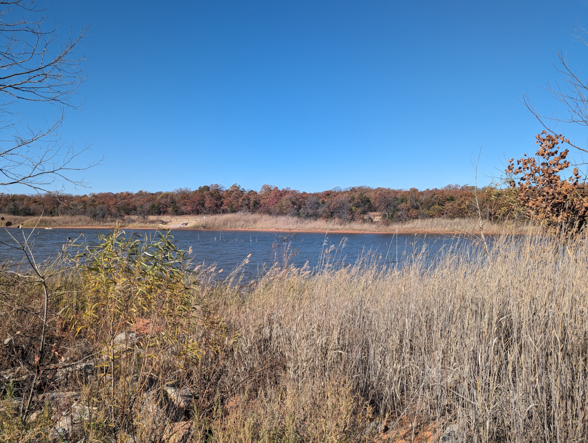 The tall grass has really surprised me this year. It’s one of the first things to grow on the shore when the water recedes, and the lake level has been low for two years running now. As it dies during the cool months, it leaves a tall, shaggy blond cover everywhere.
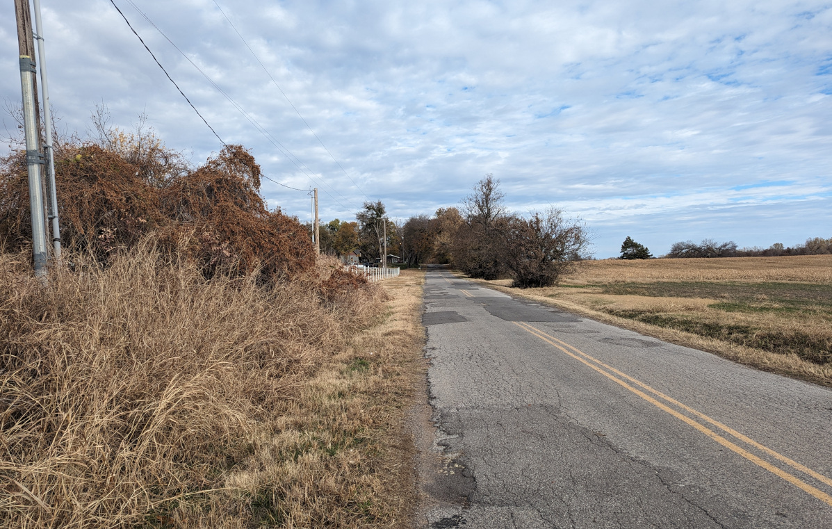 Douglas Boulevard running north from NE 63rd Street. This ragged asphalt does go somewhere. Back through those trees, there’s a fancy horse riding ranch (Honey Lee Ranch) with trails that run for miles along the river bank. There’s also a handful of obnoxious dogs that are penned up when visitors pay to ride the trails. When I rode through, they came out and harassed me. None of them threatened to bite, but they are overwhelmed by the chase instinct when I ride past.
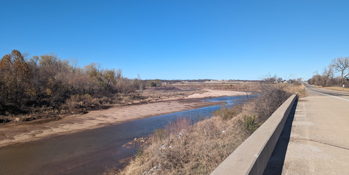
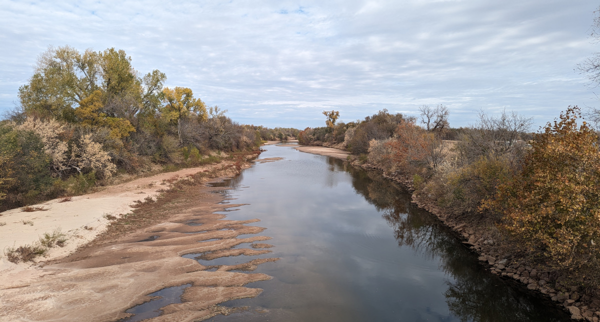 This is the North Canadian River running north from NE 63rd Street. It’s been dry lately, so the river is low. Back a ways on the right side is the location of those riding trails I mentioned. The river takes a hard turn left, making a very large loop around before returning to its trend to the northeast. The pocket of that loop is the riding ranch. The river has been carving a new path quite often in the past few years; there’s a high probability the next heavy rains could see those riding trails cut off.
 I made the 50-mile cycling loop around OKC a couple of weeks ago. This is the dam that created Overholser Lake reservoir. One or more gates have been opened a few times this year, tempting kids to get too close, and at least one has drowned. But there’s no sane way this ancient structure can be modified to keep them out. If they are big enough to wade across the water running over rubble to get out there, they can climb on the lower structure of the dam. Fencing isn’t possible because of jurisdictional issues, and it would not fly politically, since access to the river banks below the dam is very popular.
 The same North Canadian River some miles downstream; this is shot from the Midwest Boulevard bridge. Only a few fishermen visit this bridge right now; this is just north of the Crutcho Creek bridge that remains closed to motor traffic. Signs trumpet funding for bridge work that was supposed to have started already, but like everything else, it’s behind schedule and probably already over budget. So, the bridge became a very quite place with no traffic. This is a recent shot showing the winter dress.
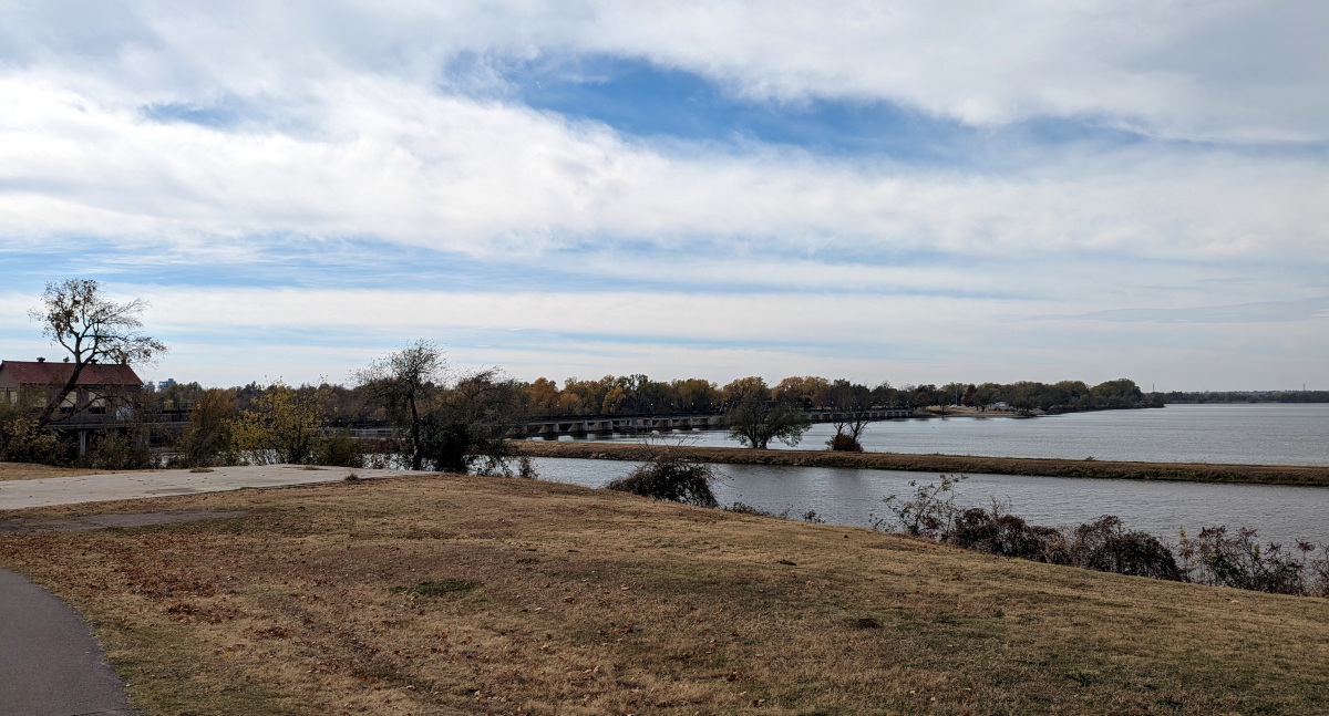
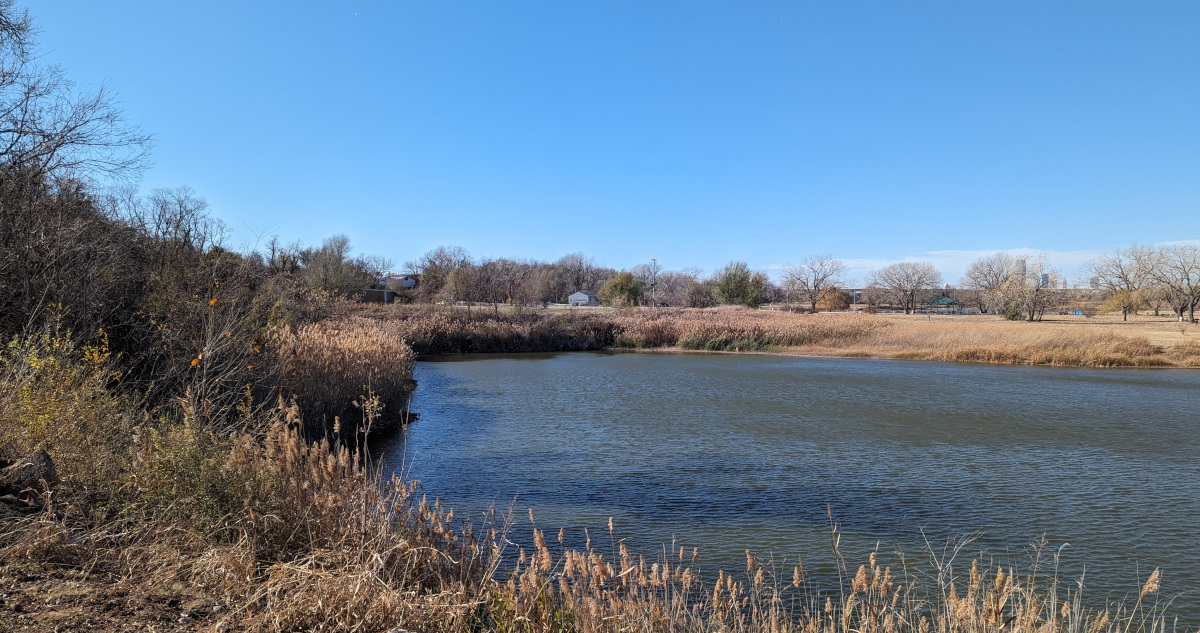 Now that the new bikeway is finished, it’s easy to visit parts of Eagle Lake that few have seen for quite some years. This cove is the eastern end of the lake. Of course, like most lakes in the North Canadian River Valley, this one was formed by sand and gravel mining. Someone noticed how the soil left resembled an eagle’s head from the air; that’s the mascot for the local high school, thus the name for the lake.
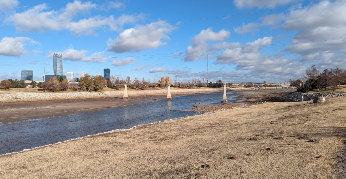 You can just make out a pair of men standing on the gravel bar in the river bottom. This is the Oklahoma River, part of the competition area currently drained. This is a good time to take a close look at what’s on the bottom of the channel. I shot this looking downstream from the confluence with Lightning Creek. The pipeline crossings, such as the one seen just beyond the gravel bar, were established long before the river became a public recreation area. I used to jog on some dirt paths in this area back in the 1980s; the place was essentially a municipal rubble dump.
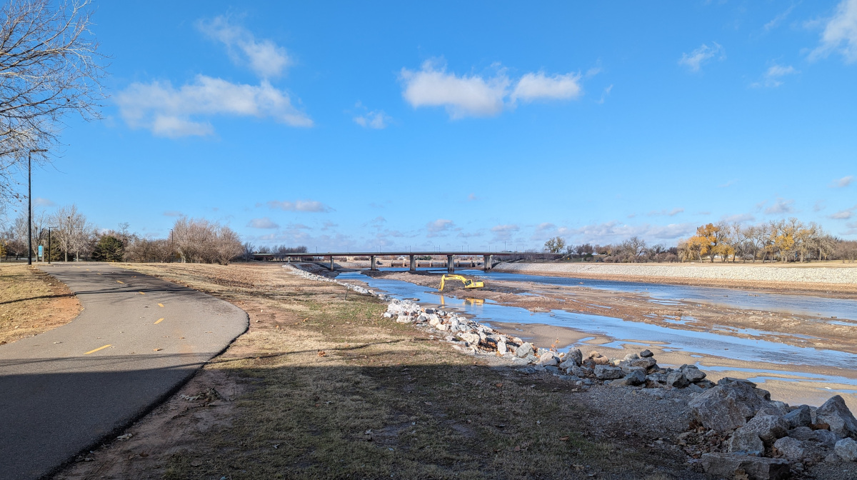 Apparently the city is seizing the opportunity for a little maintenance. This section of the river was drained ostensibly so construction crews could start work on a pedestrian bridge downstream near the lower dam along Eastern Avenue. That work has not started, but the river remains drained. So, the city has sent a crew down to this section near Robinson Avenue and Wiley Post Park for some dredging. This is tons of fine silt that constantly settles out from the flow as it slows between a series of dams the city built back in the early 1990s to create recreational areas.
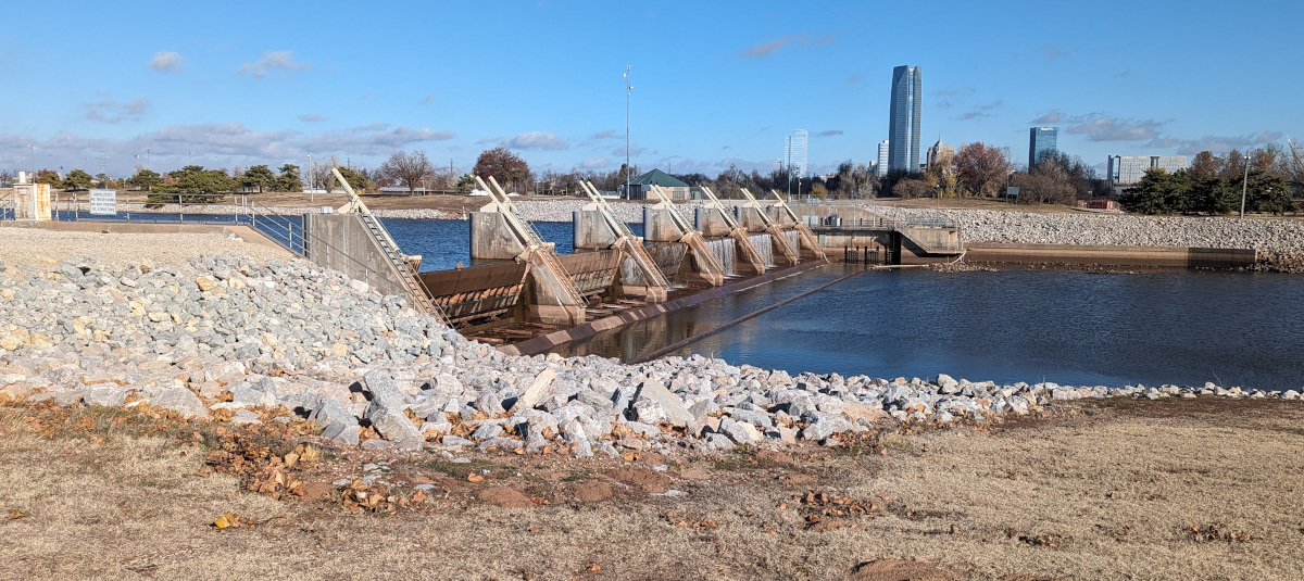 This is the dam at the top of the OK River competition rowing area. The gates are all the way up to reduce flow to just a trickle of overflow from upriver. The city chose to do this work during the winter of an expected dry season. With the water level so low, you can see some of the normally submerged structure of the dam. I’ve never seen it this exposed before.
Those low-water rivers are something you never really see around here in Pittsburgh. Maybe because we tend to have enough precipitation to keep them full? I don’t know how all that works. The big three rivers here definitely do go up and down, judging by the buoy markers I see on my rides to work.
Yes, PA has more consistent water supply. Upstream on our rivers are semi-desert in places like West TX and southeast CO.