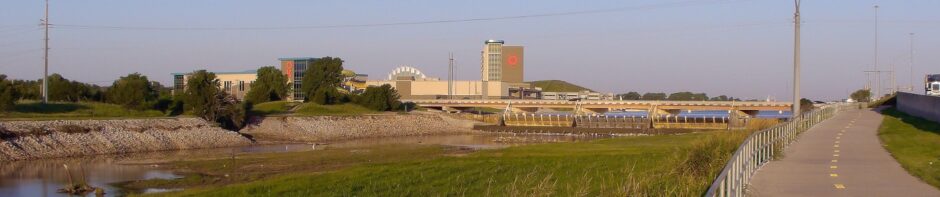
Photo Log 3: Watkins Lake Loop

“It’s good training!” That’s what we tell ourselves when something unexpected mars your training exercise.

Today’s journey takes us straight east and into Pottawatomie County. The route is mostly a matter of SE 44th one way and SE 59th the other way, with a detour out around the lake that drops us down to SE 74th for awhile. Today we are going counterclockwise which means heading down Henney Road from the trailer park, then starting our long eastward trek on SE 59th to Dobbs Road, where we turn south to SE 74th. This runs us just south of the little town of Newalla. Normally we would run down the south side of the reservoir to McLoud Road, but today we will try to add an extra three or four miles out on the end to catch a glimpse of Dale Bottom in the North Canadian Valley from a landmark ridge that rises above it on the west side. Then we’ll come back a long hard ride on SE 44th until we return to Henney Road.

At least, that was the plan. It didn’t quite come out like that.

Henny2SE59th

It’s an easy run down Henney Road two miles south to SE 59th, but it drops off to a very picturesque valley that feeds into Hog Creek, a major water course that in turn feeds Lake Thunderbird. We’ll be seeing that one in a later journey, but today we see that Henney dead ends at SE59th and climbs steeply off to our left, westbound.

SE59th2Hiwasee

It’s a brutal climb as we can see looking back (the far horizon runs up over Interstate 40 near Hiwasee Road). The next hill is also brutal, and the next. Three in a row, after which it gets much easier for awhile. Not flat by any means, but the hills are lower and less steep all the way out the Dobbs Road, where we turn south to SE 74th. It’s just another mile to Harrah Road but you can tell that we are near the lake by the increased dampness in the air. Cross Harrah Road and you will catch glimpses of the swamps on the high end of the lake.

It's the same from both sides.

Looking back over Choctaw Road at the first hill. It’s the same from both sides.

Wes Watkins Reservoir lies mostly east and west, feeding from the west and dammed on the east end. The original water course is called Deer Creek, and the name appears in reference to the area. The road is humpy, though not brutal, all along both sides where the east-west roads cross numerous feeder streams. Lots of old money here, too. None of it picture-worthy, but really nice homes and virtually none of them in the MacMansion style. There were a few partial washouts where the traffic is diverted from the edge down to one lane, but this is a new road surface with a good asphalt covering.

If you turn left at McLoud Road and head north to come back on SE 44th from there, it’s just about 30 miles for that loop. I decided to explore a bit this time. Crossing McLoud Road we drop down slowly to the North Canadian Valley. SE 74th becomes WesTech Road here, and is gravel for a mile, a washboard in some places. Not easy on my mountain bike, I suspect you’d have to be nuts to do it on a road bike. The large gravel size would be dangerous by itself. I crossed a sheltered narrow arm of the valley that runs parallel quite a ways north. Upon hitting the North Canadian Valley proper, it’s flat for a long ways.

Firelake

Just a bit south is Firelake Grand Casino on I-40, owned by the Potawatomie Nation (they spell it with one “t”). Oklahoma government complained that the lack of state taxes made it too competitive so the tribe simply charges their own tax and feeds it back into lots of giveaways. This facility has a huge fuel station that is popular with truckers for obvious reasons, plus a host of other amenities that you and I can’t afford.

The infamous Dale Bottom highway is a three-mile stretch that descends only slightly from McLoud and parallels the North Canadian River. This used to be State Highway 3, one of the earliest paved routes that ran from somewhere in the Panhandle all the way down to the southeast part of the state. So you can imagine that this was a popular illegal raceway from well before I was born. The sign on our road back west says Garret’s Lake Road, but the maps vary with other names. It’s not too much of a climb back into some old money homes. We turn right on Blackberry Drive, which seems to have been asphalted at one time, but mostly dirt now.

BlackberryDrive

It passes a fairly famous combat pistol range quite popular with folks seeking the concealed carry permit, but nothing I could capture with the camera. The facility out back sits on the crest of the rise about Dale Bottom but is concealed by trees. Next door to that I encountered a woman digging at the edge of her driveway. The recent heavy rains really tore this road up, and her paying someone to drag a boxblade across it didn’t help much. We chatted awhile and then I rode on down. Technically the road is closed, but passable on my bike. I wouldn’t drive any motor vehicles without a high clearance there, as the repairs are quite preliminary — big rocks were dumped but not graded out.

Eventually we turn back west on SE 44th. My bike bogged down frequently in loose sand during the first half-mile climbing back toward McLoud Road. Some of the edges were washed out, but it appears the local flooding mostly washed slowly down the road itself, leaving large stretches of sand.

SE44thNearMcLoud

SE 44th is all sliced up. It was washed out between McLoud Road and Arena Road, requiring a detour of just about a mile by heading north to Seikel Boulevard and passing in front of the newly built McLoud High School. That wasn’t too bad, and it took me past a copy of the new trend in “Cowboy Churches”. This has gotten very popular, a sort of rural answer to the monster urban entertainment “worship centers.” As you might expect, you can show up in your agrarian work clothes and have a good time in the Lord, they say. There are several of them scattered across my favorite cycling loops, affiliated with the likes of Baptists, Methodists, and some I’m not too sure about.

RockingCross

So while I could still get to the lake, it’s usually not worth it. You have drop south a mile off SE 44th. The City of McLoud used to charge for entrance, but it’s free now. There is a substantial number of picnic tables and a couple of pavilions, and you can swim, but it’s by no means remarkable. If you run low on drinking water, you can refill all your containers there for free. It wasn’t worth the diversion today. Just a mile down the road was another washout. Since the detour would have added two miles, running all the way north back to SE 29th, I decided to skip it and just roll on home. Our trailer park fronts on SE 29th, anyway.

SE44thFishMkt

However, this used to be State Highway 3 (continuing from Dale Bottom east of McLoud). It remains very busy and the whole point is avoiding high traffic areas. The only real advantage is that is still well maintained and was better engineered — no washouts and the hills are much gentler. Twice I passed signs indicating there was yet another detour off of SE 44th; that poor road took a beating in the heavy rains.

By the time I rolled into the trailer park gate, it was 4.5 hours and about 38 miles (61 km), and the temperature was a muggy 85°F (29.4C) and climbing.

Posted in Uncategorized | Tagged , , , , , , , | Comments Off on Photo Log 3: Watkins Lake Loop

Another Freak Show

Two whole books on human sexuality aren’t enough (one and two) merely to introduce how utterly freakish Westerners, particularly mainstream Western Christians, are about human sexuality. The just don’t have a clue. Discussing what the Bible considers normal in this realm immediately makes us space aliens to everyone in the West. I put it off all day thinking about it and dreading the necessity of discussing it again.

If you aren’t aware of the current soap opera regarding a certain family named Duggar and how one of their 19 kids recently came under embarrassing attention for something Western Christians regard as scandalous, then never mind; maybe it’s better you don’t bother with it. Look them up if you are curious. In essence, the Duggars had a TV series showcasing their standard American right-wing evangelical Christian religion. This is the Bible-thumper homeschool type family. I was once immersed in that American subculture, so I know all about it.

One of their sons got a job with an appropriately political active right-wing evangelical organization. It made headlines among such folks, and got the attention of their political and philosophical opponents. Then someone leaked records an investigation into how this famous son had admitted fondling little girls in their privates. Some of his victims were his own sisters. Cue the weeping and gnashing of teeth. Cue the snarky outpouring from those who hate such people.

Both sides are full of crap. So is the rest of the Western Civilization entirely.

Nobody is interested in what the Ancient Hebrews thought of such things, and you’ll see an endless supply of reading their freakish values back into the Bible. This is part of why the Hebrews were so very harsh about keeping the sexes apart from a rather young age. Notwithstanding the peccadilloes of certain ancient royalty who did not live by quite the same social restrictions for a lot of good reasons (again, no one seems to care why), the average Hebrew family watched their kids like a hawk.

And does it occur to no one a fellow’s little sisters might be altogether willing victims of such “abuse”? All the more reason to keep them away from each other most of the time. We can dispute and debate all day long at what point someone can validly volunteer for such behavior. However, I can assure you Hebrew parents didn’t panic when the kids were caught examining each other’s privates. They were utterly lacking in our pseudo-Victorian freaky prissiness about such things. They also didn’t suffer from the moral depravity half of Americans refuse to admit is inherent in Western mythology.

Children touching each other doesn’t mean the kids are evil, just fallen. To the Hebrews, it also meant the parents needed to pray and consider ways to stop it from happening again. It wasn’t a question of whom to blame and publicly castigate, just a matter of pursuing moral justice within the context. The question in biblical morality is: What do we do now, Lord? There was no deep angst over such horrifying loss, because they wouldn’t think of it in those terms. They didn’t exacerbate things by shrieking in terror at the permanent emotional scars because that’s not how they viewed reality.

Don’t buy into the false dichotomy offered by the current popular blather on this. That’s the real horror here.

Posted in eldercraft | Tagged , , , , , , , | Comments Off on Another Freak Show

Photo Log 2: Biking East OK County

XXX-washout
Today’s journey takes us to Harrah (pronounced hair’-uh), but also the spot in Choctaw where the river has already eaten a house and is now threatening a major thoroughfare. The original story of the house, with pictures, is here from 2013. It’s a poignant story of the Buford folks who lost their old family farmhouse. During the immediate aftermath, their poor dog Bo was stuck out there alone for a while. On one of my rides, I passed by and out of sheer boredom and loneliness he chased me, sneaking out from behind the trash carts. I stopped and we talked for awhile, which left him in a brighter mood. I’ve included here a satellite view after the structures were removed, but prior to more cent flooding. And here you can find a recent aerial shot of the same site now completely gone as the river cuts near the road.

(Side note: The southern border of Oklahoma County is SE 89th, just a few miles south of here. Draper Lake is mostly south of that line, resting in Cleveland County. The northern border of OK County is more like 20 miles north, so I’m not likely to ride there without more careful planning. I’m hoping I can get some shots of a ride to Luther up on old Hwy 66 later this summer. The eastern edge of the county is just about eight miles east of here and I also have a trip planned to Watkins Reservoir out south of McLoud in Pottawatomie County.)

xxx-site
The route from my house runs east on SE 29th, but I usually diverge onto SE 29th Place to avoid the high traffic on the main SE 29th itself. SE 29th Place follows the old railroad bed that used to run out to Shawnee, but was dismantled when I was a teenager. We finally get to Indian Meridian (historical reference), one of the quietest and flattest routes running north. I stayed with this all the way to NE 36th, then turned right to Triple-X. That’s where the local government placed the barrier to block traffic from the danger area. They really do not want you going that way. Since the bank is now just a few feet from the edge of the road, you can’t blame them.

The previous driveway to the Buford home site on North Triple X Road in Choctaw.

The previous driveway to the Buford home site on North Triple X Road in Choctaw.


The scene from the bridge on Triple-X shows where huge cottonwoods fell into the river and were carried downstream to sandbars. Notice the power pole on the right almost undercut.from-xxx-bridge
There aren’t that many bridges across the North Canadian River in these parts, so cutting off the use of this one is significant inconvenience for the locals. The next nearest route is at least two-miles in any direction. From the Triple-X bridge just a short way north we turn right onto NE 50th. This takes us over the end of a ridge line that juts out into the North Canadian Valley.
n-cdn-valley2
The valley is mostly flat and used for agriculture. There are some roads crossing it, as noted, but very few in the valley itself. However, evil lurks even here. Don’t get me wrong; I suffer no hypocrisy about using electricity. The Horseshoe Lake Plant is natural gas fired, very clean and efficient. But Oklahoma Gas and Electric (OG&E) is one of the largest monopoly utilities in the state. They are always trying to deny consumers direct access to natural gas, because they don’t want to compete for it. In this part of the country, natural gas is by far the cheapest and most reliable source of heat. I can’t begin to outline what sort of nasty criminal gang runs OG&E. They aren’t the richest, but they are easily one of the slimiest outfits in Oklahoma. Do I have to mention unspeakable cruelty to rate-payers? The state utilities commission wouldn’t dare push them very hard.
horseshoe-lake-plant
We turn south off NE 50th onto Harrah Road. There’s a really fine road running to and around Horseshoe Lake, but it’s restricted access. Still, the gated entrance at NE 36th and Harrah Road offers a great picnic stop with gigantic sycamore and cottonwood trees. I’ve seen river bottom cottonwoods as much as 20′ (6m) in diameter and solid through the middle.
36th-n-harrah
The North Canadian wanders all over this end of the county. Where Harrah Road merges briefly with US Hwy 62 it crosses the river again. Locals have been thrilled as the last couple of years the heavy rains have cause the river to shift around and exposes vast sandbars for off-road sports.
winding-nc-river
The primary reason the town of Harrah exists is because of the granary and the railroad running alongside the North Canadian River. The town is out on the far eastern edge of the exploding mini-mansion developments. They have a decent but bug-infested park with a fitness path of sorts, and even a bike path running between the high school and one of the grade schools. Where US Hwy 62 turns west, I usually head left into the Baptist church parking lot, then work my way over a block west and two blocks south to the high school sports field. The bike path runs a snaking route south from there through the woods and alongside a graveyard before it hits NE 10th.
harrah-path
On the path I ran into a couple of mulberry trees. They are about the middle of their fruiting season right now. Most Okies no longer know about them, too suspicious to eat them, so it’s not hard to get a sample. They are mostly sweet with a very subtle flavor. Just a few and you really can’t taste much more than the sweetness. Turn right on NE 10th and we immediately pass the grade school. At Dobbs Road I usually turn south. Right there on the west side of the road is a huge patch of mostly late-crop blackberries. However, there are plenty of early-crop, as well. Here we see both kinds growing together — the one in fruit with the other still blooming. You’ll find both kinds all along Dobbs Road for at least the next two miles south.
two-bberries

There I typically turn right on SE 15th. Yes, we are back into the hilly terrain. This picture looks west from Nixon Avenue (halfway between Luther and Peebly Roads).
se15-west
From there I run back to Indian Meridian to go home.

Posted in Uncategorized | Tagged , , , , , , , , , , , , | Comments Off on Photo Log 2: Biking East OK County

Cycling My Way

I felt I should explain the cycling itself that I do.

Bike

As near as I can recall, I found this just over seven years ago, on sale at Walmart. Using my tax refund that year, I paid a little less than $200 (US). Of course, this is the smallest common frame size available. Somehow it turned out to be just right for the way I ride, even though I’m 5’10” (1.78m). I’ve kept this thing longer than any bike I ever owned.

The first thing I did was add a rear carrier rack. It was junk, so I upgraded, but that required some ingenuity because the frame is not typical geometry. There is a thick piece of flat PVC cut from a square decorative fence post between the rack and the mounting arms. Later I found out about handlebar risers and got this thing up to a reasonable height for someone with arthritis in the shoulders and elbows. The seat post was never long enough and I kept it up just past the “safe line” until someone recently discarded this alloy post that was just the right length, but just a little thinner. A standard automotive hose clamp helps keep it from slipping in the frame clamp. That’s the third saddle and is actually comfortable. I use that rear-mounted kickstand a lot. Those are not the original pedals, either. The front shocks are just springs and the boots cracked open years ago.open-road2-xxx

The front rim is the second, the rear is the third — a high quality seamless steel rim. I’ll never buy another alloy rim. Steel is far, far better for my use. The guy at the bike shop told me the tires were called “Asphalt” and are used by our municipal police departments. They run 1.95″ wide and these have lasted a very long time already. I prefer thorn-proof tubes and thorn straps, too. In case you haven’t caught on, with my weight running 220# (100kg) or more, I don’t find that much advantage in stressing over ultra-light bicycle accessories.

The original shifters and derailers were the cheapest junk from Shimano (Tourney). I upgraded to the good junk (Alivio) and really like how smooth and consistent they shift for me. If there’s anything I’ve spent time on, it’s fine tuning the shifters. This is also the second cassette and chain. I use heavy gear oil (95w or higher) on my chain, and re-lube about every quarter. Gear oil cleans its own residue while sticking nicely to the metal.

I ride mostly on paved surfaces. While a mountain bike is slightly more work than those hybrid or road bikes, this is the first bike I’ve had that didn’t break down all the time. It just keeps rolling under my considerable weight.se29thpl

During the summer months, I carry lots of water. In the picture you see two US military canteens saddle-bagged on the rack. I found an old chunk of plastic-coated wire rack and cut it to fit. The standard Alice clips work just fine, but I use bungees to stabilize against the legs of the rack. The bag atop the gooseneck is a newer type 2-quart canteen cover, loaded with a patch kit and essential tools I actually use while riding, including the shortest air pump I could find. For rides above 25 miles, I tend to carry two 24-ounce bottles with two canteens. Even over 100°F (38C) I’m fine as along as I keep moving and have enough water. That Oklahoma tends to be windy year-round helps.

Oklahoma has a 3′ (1m) passing clearance law and most folks try to pass almost completely in the next lane. Around 10% ignore that, but I’ve never felt threatened by someone passing too close. Okies tend to be decent, though plenty are still resentful. You have to understand that back 35 years ago when it became a federal standard to ride with the traffic, Okies refused to change their laws for a very long time later. Even now I see lots of folks riding against the traffic.

I’m not an activist and I don’t try to make people behave according to some strict standard. I wear bright colors or even reflective safety vests at times. I have lights for when I expect to ride in darkness and my primary concern is actually not impeding traffic. I try to avoid the busiest routes. Inside the cities I take the back routes as much as possible, learning my way around the twisty streets of those trendy suburban layouts. When a bike route is available, I try to use it.

Most days the routes I take end up running 25-28 miles (40-45km). If I really hurried and powered through, I might make it in 2.5 hours. Taking pictures, stopping for a snack or lunch, etc., adds an hour. This summer I’m trying to hit some rides closer to 40 miles (64km), maybe more.

Posted in Uncategorized | Tagged , , , | Comments Off on Cycling My Way

Prayer Request: Digital Camera

Folks, I’m not a camera gadget guy. I like taking pictures, cropping and adjusting things (I love GIMP), and I like using the images to talk about things. So I have zero interest in researching which camera I should seek; I’m much more interested in something I can use that tends to record more or less what my eyes see. My current digicam is a cheap toy that pulls in a far wider field of view and cannot be adjusted. It’s not even as good as most smartphone cameras, but it was a good deal at the time.

So now I feel the urge to work on my photography interests. I’m not all that interested in a buyer’s guide. What I ask is that you pray with me and let’s let God pick one out for His glory. If you have one you wish to share or sell cheaply to a guy who lives off his VA pension, let me know.

Regarding previous prayer requests: I can report that the Volvo is in really good shape. The day we bought it I replaced the front rotors and all the brake pads. Over the past few months, we replaced all the motor mounts (five of them), the alternator, starter, some electronic parts, the right-front wheel bearing and tie-rod ends, and three of the tires. It turns out the fourth tire we kept from the previous batch is apparently in pretty bad shape after all — deep tread left but the sucker bounces like a basketball. It was balanced, so I’m guessing the belts are separating. At any rate, I’ve got a plan to replace it this week. My son and I did virtually all the work ourselves and we bought most of the parts online. Your prayer support on this car, both before and after buying it, has a concrete and measurable result: This is a really fine vehicle, blessed and dedicated to the Lord.

I’m still living with a powerful sense of anticipation about taking my faith out into the wider world. I don’t worry about how God arranges to sponsor this mission; in the past it was always military service. That’s not an option any more. I’m ready for just about anything in those terms, but there are simply way too many people who might need to hear this message and they won’t be getting it online. Some of you have been sharing and I’m so grateful that you find my teaching that useful. But I know that God isn’t finished with me on the mission field. I’m convinced it’s coming, but I pray that I’m ready for whatever worldly form it takes. I look forward to telling you all how this turns out, and how it goes once it begins.

Posted in personal | Tagged , , , , | Comments Off on Prayer Request: Digital Camera

Photo Log 1: Biking SE OK County

Hiwasee Road at SE 74th, looking south. The road crest at the far horizon is roughly two miles south.

Hiwasee Road at SE 74th, looking south. The road crest at the far horizon is roughly two miles south.


Background: Oklahoma was surveyed in a square-mile grid. From what I understand, the surveyors simply cut a straight line path between corners, and locals kept using that path they cut, which eventually saw improvements in some places. So most of the backroads in Oklahoma are laid out in that same mile-square grid and we call them “section lines.”

Southeastern Oklahoma County is hilly. At least a couple of times I pedaled over a crest that would have given you a roller-coaster sensation at the legal speed limit in a motor vehicle. It’s a good workout. Today’s route was the Draper Lake Loop. From my home it’s about seven miles to the lake, about thirteen miles around the lake, and another seven miles back. However, I decided to take a detour of a couple of miles to capture this image of a washout. I have no idea where the filmy ghost came from, but you can still see that there is no way past this mess.

Washout just north of SE 89th on Hiwasee Road.

Washout just north of SE 89th on Hiwasee Road.

If you want to follow along in this journey, open a browser tab to your favorite mapping service and see if they can show you Tinker AFB. I live about four miles east of the north end of the airbase, and Draper Lake is directly south, under the flight path. I approached the lake on SE 74th and headed south on Post Road. This simply turns into one of the few curved roads in the area, that which rings the lake. This put me on the northeast corner of the lake area and I headed straight south.

Blackberries grow all over this part of the county.

Blackberries grow all over this part of the county.


Because of the heavy rains, the berries are quite large. The eastern side of the lake is dense with them, visible all along the road. If you took off through the woods, you would see them in pockets where the soil is sandy. However, you would also be eaten alive by chiggers and deer ticks.
Sand plum growing over a culvert.

Sand plum growing over a culvert.


Even the sand plums, usually no bigger than the end of my thumb, are quite large this year. This one growing over a drain culvert was bigger and better tasting than I’ve found in years past. Plum bushes usually grow into small trees clustered together thickly. You can’t walk through them easily because they all sport very long thorns.

The lake is pretty full after all the heavy spring rains this year. This was taken on the west end of the dam. The lake is fed by streams mostly on the north side, which is about the only hilly part of the lake ring road.
HighWater
The longest arm of the lake chases a low valley that runs up toward Tinker. There’s a spot there where the water easily comes up over the road and the bed is slowly dissolving. This year the asphalt is badly broken. Since they are rebuilding the roads elsewhere around the lake, I suspect they’ll have to replace that section before summer is out.

Once I got around the entire loop, it’s time to head home. You can see the strangest things out on these hilly back roads.

Abandoned church house.

Abandoned church house.

BullNettle Someday the various city governments and the county hope to join Draper Lake by bike path to the one that now runs down both sides of the Canadian River downtown. Various segments have been built already. This path runs west of the lake for a mile or so, but the next section is three miles away.BikePath Maybe some day I’ll get a decent camera.

Come ride with me!

Posted in Uncategorized | Tagged , , , , , , | Comments Off on Photo Log 1: Biking SE OK County

Open Source Software Hijacking

It’s one thing when the folks running an Open Source software project admit to crossing over to “the dark side” and wrapping their installer with advertising software — which most people call malware. Such a project would be FileZilla, the FTP client that used to be so popular. So if you want a clean version of FileZilla, get it from Ninite. If fact, if Ninite lists anything at all that you want, theirs is probably the easiest and safest route.

But it’s another thing entirely when the folks running a project have their installer hijacked by someone else when they really don’t have much choice. In the past, SourceForge has pulled this stunt with other projects and is now doing it with GIMP for Windows. Don’t get it from them. Now, I use GIMP and recommend it for image modifications when you can’t afford PhotoShop. It’s okay for most simple uses.

So if you want a clean install you can still get it from Ninite of from their official downloads page. It doesn’t show the Windows version immediately; you have to scroll down and click on an orange link “Show other downloads”. The page will shift in most browsers so you’ll probably need to scroll down again so you can see the big download button for whatever is the current version for Windows.

I can recall when SourceForge was the very symbol of Open Source ethics. Seems to me some years ago projects started fleeing them for other services like GitHub, Savannah, etc. Recently I’ve seen a similar exodus from projects hosted by Google. Gotta watch them like a hawk.

Posted in computers | Tagged , , , , , , | Comments Off on Open Source Software Hijacking

Blackberry Day 2015

My hands holding a few of the giant blackberries.If you live east of the Rockies, you have seen plenty of rain and maybe some snow this spring. If you live anywhere near Oklahoma, or followed the news, you know we’ve had an endless supply of storms and tornadoes. But there is good from this: a bumper crop of wild food. And just in time, because the rain pattern has broke for a while.

The blackberries this year are astounding. They are huge and some of my favorite picking spots are just carpeted with them. Literally; you have to watch where you step because sometimes the biggest and juiciest ones grow right down on the ground. At one point it got boring just standing in one place for a half-hour and picking. That’s only going after the choicest monsters as big as the end of my thumb. In two hours I picked well over a gallon.

This is just the early crop berries that grow on thin, spindly thorn vines and small bushes. They’ll keep putting out for the next two weeks at least. A month ago I kept my eyes out for the telltale white blossoms in the underbrush so I’d know where to pick. Right now the late crop is in blossom. The difference is easy to spot: Late crop blackberries grow on a very heavy, very thorny woody vine that tends to flex very little even when the berries are ripe. Picking early crop will have you a few scratches that might bleed a little, but the late crop will saw you into pieces if you aren’t careful.

I have enough to make one nice blackberry cobbler (wheat-free, of course) and the rest will be turned into a sludge I make for freezing. Instead of all the bother with jars and jelly-making, I just put them in the blender with some coconut sugar (or anything similar) and freeze it in blocks to thaw later.

It’s a lot of work, bathing in insect repellent first (I use a natural lemon oil based spray), then putting on high rubber boots, long pants and long sleeves, and carrying gloves for when I need to pull stuff out of the way. My enthusiasm has waned over the years; I used to go out every evening during the season and store up three or four gallons, ranging out to several thickets on my bike. This year I could get a far bigger crop with a lot less work, but it’s not as much fun as it used to be. So this year it’s just one day of serious picking and I’m done with it.

And then there’s the sand plums, and late crop berries, and pears that seem to grow wild here…

Posted in health | Tagged , , , , , | Comments Off on Blackberry Day 2015

Drug War and Propaganda

How many people reading this today can remember where you were when JFK was killed? If you are old enough to remember that, it’s just possible you might remember when the Gulf War started and our official involvement in Iraq began. Not many of you are likely to remember a reporter for a big newspaper in California who reported on the connection between the CIA and rising crack cocaine distribution in the US. Could you recall the name of the series of articles or even the name of the newspaper?

To this day, there’s a good chance you somehow connect the Gulf War with stories of preemies being tossed out of hospital incubators as the Iraqis plundered parts of Kuwait. It never happened, but we tend to remember it because of the propaganda efforts. And maybe you have some lingering image that Gary Webb was murdered before he could finish reporting on the CIA-cocaine connections. And how does someone manage to pull the trigger twice when shooting themselves in the head? I will tell you it’s possible because of what I saw in my work in law enforcement. I’ll also tell you it’s exceedingly rare, but so is a clear memory of historical events. Webb died some eight years after that series was halted by editorial decisions. That doesn’t mean he actually committed suicide, but it does put things in perspective.

By the way, you can still download for free a book that shows beyond all doubt how the CIA most certainly was involved in heroine trafficking in places like Viet Nam: The Politics of Heroin in Southeast Asia [PDF], by Alfred W. McCoy. It’s no stretch to imagine the CIA would also be involved in crack cocaine as the means to some political end south of our border. I suspect Webb simply didn’t get the whole story, and got some specifics wrong.

I wonder how many of us understand that the Drug War is the single biggest sacred cow in the US civil religion. Can you even imagine the US without it? While some portion of the plutocrats have tried to replace it with War on Terror, it’s not working out too well. It’s bad enough for us peons, but if you don’t understand how we got into this Drug War, you’ll never understand the madness of what’s going on right now.

I’m rather pleased with this first article in a series by David Hathaway. As a follow-up, another author has posted on the Lew Rockwell blog an outline of some interesting facts. Granted, if you aren’t a history buff, you aren’t likely to read the whole thing. I will tell you it’s engaging reading, though. And who would have imagined how deeply it’s tied into things like civil rights and controlling the entire range of public discussion on race and culture in the West?

It makes me glad I rejected Western Civilization some years ago.

Update: Part 2 of Hathaway’s writing is now available here.

Posted in social sciences | Tagged , , , , , | Comments Off on Drug War and Propaganda

Psalm 52

This psalm references the narrative in 1 Samuel 21-22. The story is filled with violations against the Covenant. Doeg was an Edomite, a foreigner from a tribe notorious for treachery and shocking immorality at times, though obviously he was a convert under the Law. Saul’s reign was more like that of a primitive tribal warlord than an actual king. Doeg was his chief herdmaster with heavy responsibilities but not treated as a counselor, especially in national politics and warfare. Saul was going insane and Doeg was ambitious to ingratiate himself, so he tattled about David’s quiet visit to the priest, Ahimelech. For this, Saul permitted Doeg to slaughter the inhabitants of the priestly village of Nob and keep the plunder. David’s song of curse on him was not for telling the truth about what he saw, but for Doeg’s self-serving and unjust nature.

It would be typical of treacherous people to enjoy the sorrow and agony of their enemies. Such a man as Doeg would also crow about his rise in status and wealth, all the more so at the cost of lives for which he was contemptuous. David wastes no effort trying to explain why God should protect him and let the entire priestly village be murdered. What he does understand is Jehovah’s promise to protect him personally and make him king. He’s quite humble about it, but seizes the mission implied by this calling while waiting until God deals with Saul His own way. He curses Doeg based on God’s past miracles and upon His revealed character in the Law.

Where Doeg had snickered about his own corrupt prosperity for a short time, the servants of God would live long marveling at divine wrath on Doeg. They would have the last laugh, mocking such an evil man. Thus, David celebrates that God has placed him as an olive tree, the ancient symbol for one of the two primary offices witnessing of His Law and His glory (the other office is High Priest). Rather than trust in his ambition and talent, David always waited on God to deliver him and provide for the mission. God’s loyalty is the ultimate contrast to Doeg’s treachery.

David’s final line is celebration: We who trust in God enough to follow His will have already tasted the goodness of His mercy.

Posted in bible | Tagged , , , , , , | Comments Off on Psalm 52