
 As always, click on any image to see it full-sized. CTRL-click will open the image in a separate browser tab.
Where Lightning Creek crosses Grand Boulevard, it’s called Oliver Park. At this point, once you get below the stagnant stretch coming into this park, there is typically at least a trickle year round. Just across Grand Boulevard and the bike trail is Catchment Basin C. This one the city has worked on recently, expanding it considerably. Here in the basin is another deeper section forming a much longer stagnant pool. You can’t see it easily in this image, but if you look left beyond those two small trees, the basin extends back a ways off-camera so that it has a high point running out in the middle. The creek comes in along the east side, and then wanders slowly across to the west side.
 It departs the basin under SW 29th Street. This is where it floods every time the city gets a heavy rain. As you come off the bridge to the right, the street level drops a good bit and this section of street is where the flood water sits for at least a few hours. However, the basin expansion came since the last big flooding rain, so that may be a thing of the past. This hasn’t been a particularly dry summer, but the rain hasn’t been heavy since early last spring.
From this point, the creek wanders through the eastern half of Capitol Hill. At some time before WWII, this was the ritzy part of Oklahoma City. Now it’s pretty rough, with some ratty little houses nestled on the banks and against Shields Boulevard. The creek disappears at an angle under Shields and a double railroad track parallel to the street, and reappears in another section of the same rough neighborhood. It has been a high crime area in the past, and I believe you can still spend your money on some vice action, but it’s otherwise rather sedate. I didn’t feel comfortable taking pictures, though, and rode through trying to keep an eye on the creek. While it remains a wide concrete culvert, it’s most invisible in this area.
 I caught up with it again at SE 17th Street. In the background stands a rather odd structure with a sign that reads, “Future Home of Harvest Rain Grace Fellowship.” It’s been like that for years and nothing has changed. So the bike path runs on the far side of this dome and off to the right of the image.
 Out on the bike path it’s just a short ride up under SE 15th. The last bridge over the creek is the bike path itself right at the mouth. I have no idea what the fat pipe carries, but it’s got a dressing that catches all the flotsam coming downstream.
For quite some distance upstream, this is the permanent minimum water level for the simple reason that the river water level is kept that high. This is part of the recreational area of the lower Oklahoma River rowing lake. 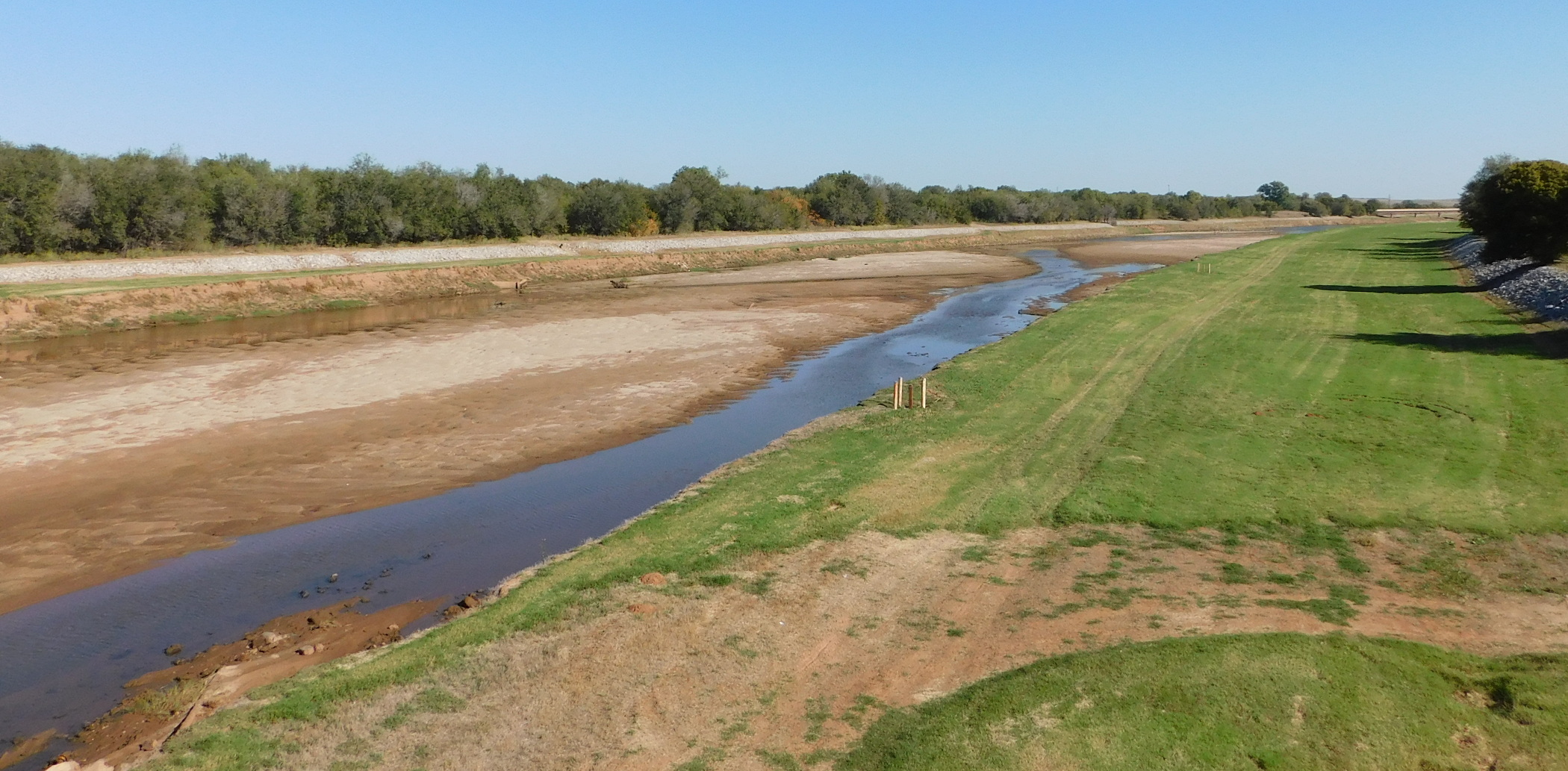 Just around the bend is the big race course, and the middle dam is quite some ways upstream. I rode down to the Lincoln Avenue bridge and hooked around; coming up over the river, I stayed on Lincoln northward until I got to NE 4th. That was my last leg toward home, but I stopped to catch his shot of the North Canadian below that last Oklahoma River dam. We are about due for a good rain.
Over the years, Lightning Creek has given us lots of drama every time it rains hard because it picks up such a huge number of tributaries. Further, over its whole course is plentiful pavement to contribute a heavy rain runoff. With three very large catchment basins now completed, we’ll just have to see whether it makes any difference.