Image 1
The
Tectonic Plate Theory is a good working model. It doesn’t account for everything, but it will get us where we need to go with understanding the Bad Friday Earthquake of 1964 and earthquakes in general.
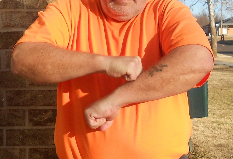
Most major earthquakes are associated directly with the boundary lines between tectonic plates. There are fault lines all over the middle of these plates, but most of the serious threats to human life are associated with where the separate plates touch each other. We have a simple hand and arm model to illustrate how this all works for our purposes.

Image 2
Raise your arms in front of you and bend the elbows so that your hands come near each other in front of your body (image 1). Fold your fingers so your hands form fists. This reminds you that the edges of the plates are massive and blunt, many miles deep. The vertical face of your fists represent something like 60 miles of earth’s crust. Pull your fists apart just a tiny bit, then bump them together gently a few times. The pressure between the various tectonic plates can be unimaginable. In the case of Alaska, the state is part of the North American Plate, and the Pacific Plate is pushing up against it from the south. Something has to give.
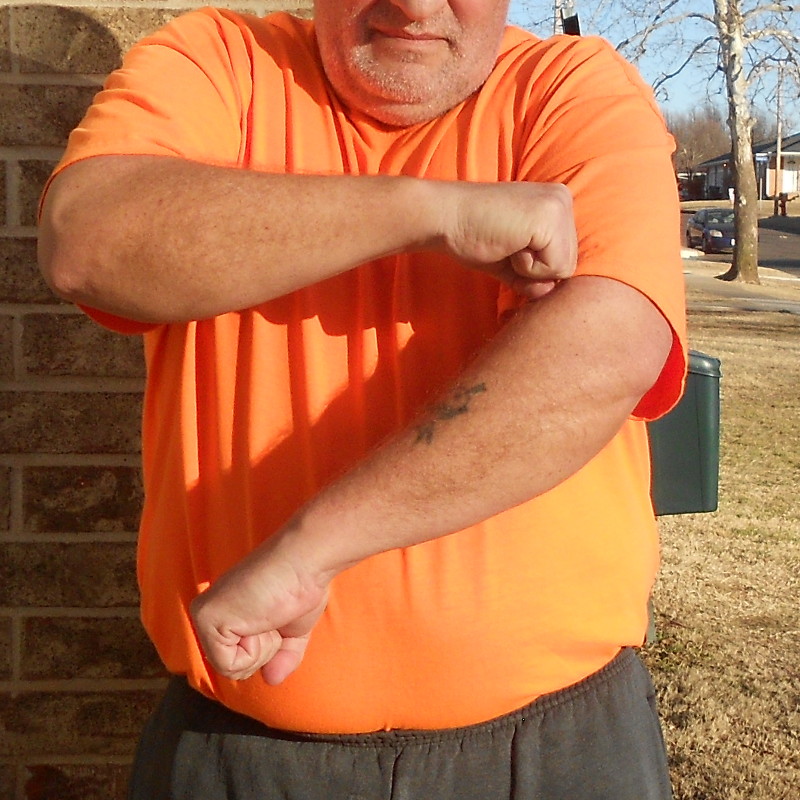
Image 3
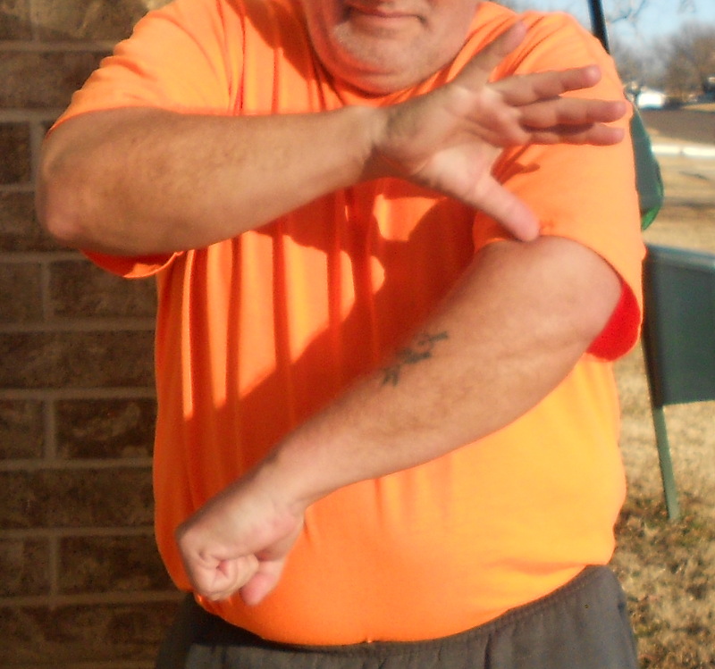
Now push one fist down below the other (image 2). Off the Alaskan southern coast, it is the Pacific Plate that is diving. It’s pretty much like that all around the Pacific “
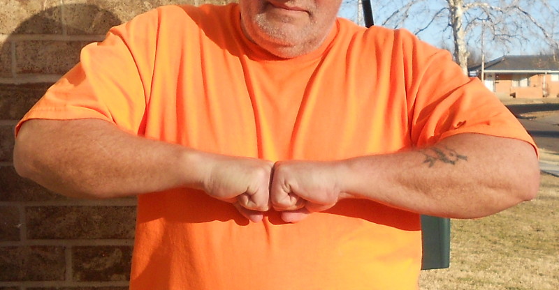
Ring of Fire” — that is, those areas along the Pacific Plate edge where there are volcanoes. All the other plates are riding up on top of the Pacific Plate to create those volcanoes and earthquakes. Now push your plates together a little farther until your upper hand reaches the opposite elbow (image 3).

Image 4
There’s an awful lot of crust being shoved down until it starts to dissolve in the molten liquid layer below. We call this a “subduction zone” and it has a pretty standard set of features wherever it happens. Wiggle the fingers on your upper hand (image 4). That’s where we have earthquakes, where the two crustal plates build up pressure, and occasionally slip in sudden jerky motion. Now wiggle the fingers on the lower hand (image 5). That’s the roots of volcanoes. So you’ll typically find volcanoes sprouting on the high plate somewhere near the subduction zone.
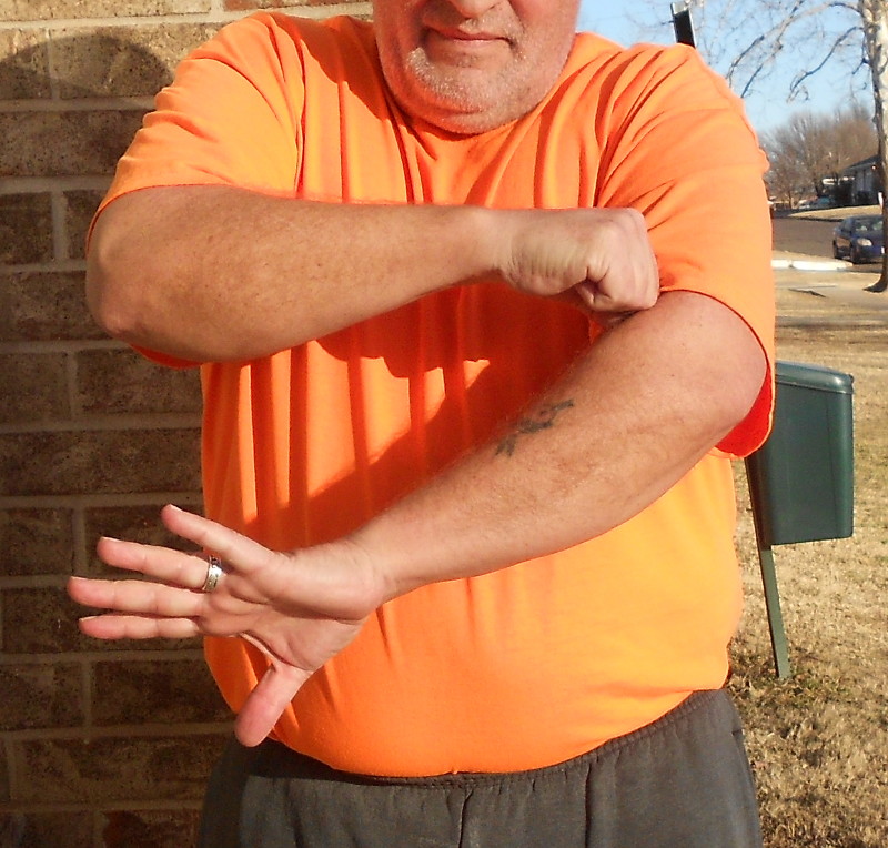
Image 5
The location of the volcanoes represent the approximate leading edge of the plate behind shoved down.
Now picture this dynamic taking place most of the way around the Pacific Plate, thousands and thousands of miles long. Our hand and arm model was just a tiny cross-section.