
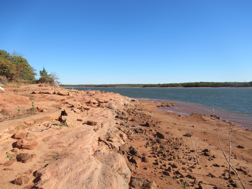
 This past Monday was cool enough to ride off into the bushes without the risk of being consumed by insects. I rode out to Draper Lake resolved to visit the most remote points, 14-16. The trail takes you right out to the end of Point 16, but it’s a couple of miles through the woods. This image shows the eastern side of Point 16, looking back north along the shore. The whole point is to show what it looks like at the current very low lake level.
 There is only one island out in the waters of Lake Stanley Draper, and it’s topographically an extension of Point 16. Not only was I able to walk way out onto the point, but the island is clearly more exposed than usual. There’s really nothing out there; it’s mostly bird habitat because predators can’t get there and humans mostly don’t bother.
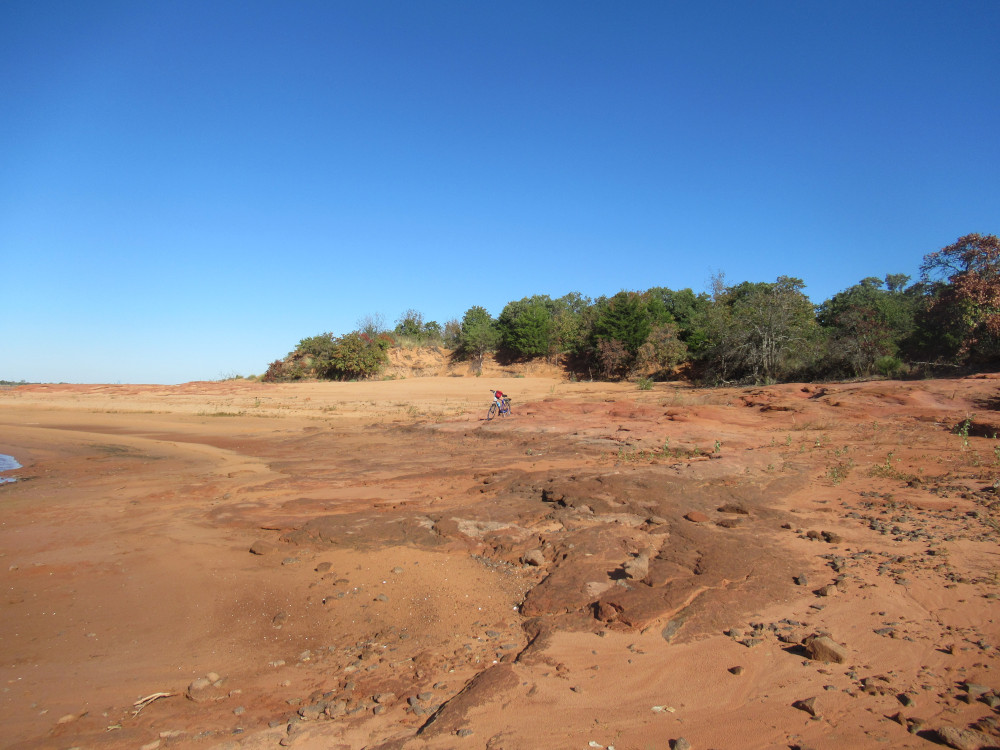 Under normal conditions, Point 16 is a lovely sandy beach with a bit of rock outcropping. At low water, it becomes a very large expanse of sand and rock. I’ve left my bicycle in the picture to give it perspective. It’s easily one of the most attractive places on the lake, but it’s also the most inaccessible. You either endure a couple of miles of rocky and sandy trail, or you have to arrive by boat.
 Off to one side of Point 16 is the rocky projection that is rarely seen, but has been scraped by boats in times past. Low water like this exposes all the hidden shallow spots. The water is clear enough to see threats to watercraft, but you won’t see them until you are on top of them. We have too many silly boaters who don’t pay much attention. That little island is popular with that type of boater, so there are lots of scrape marks. Unfortunately, they don’t show up too well on camera.
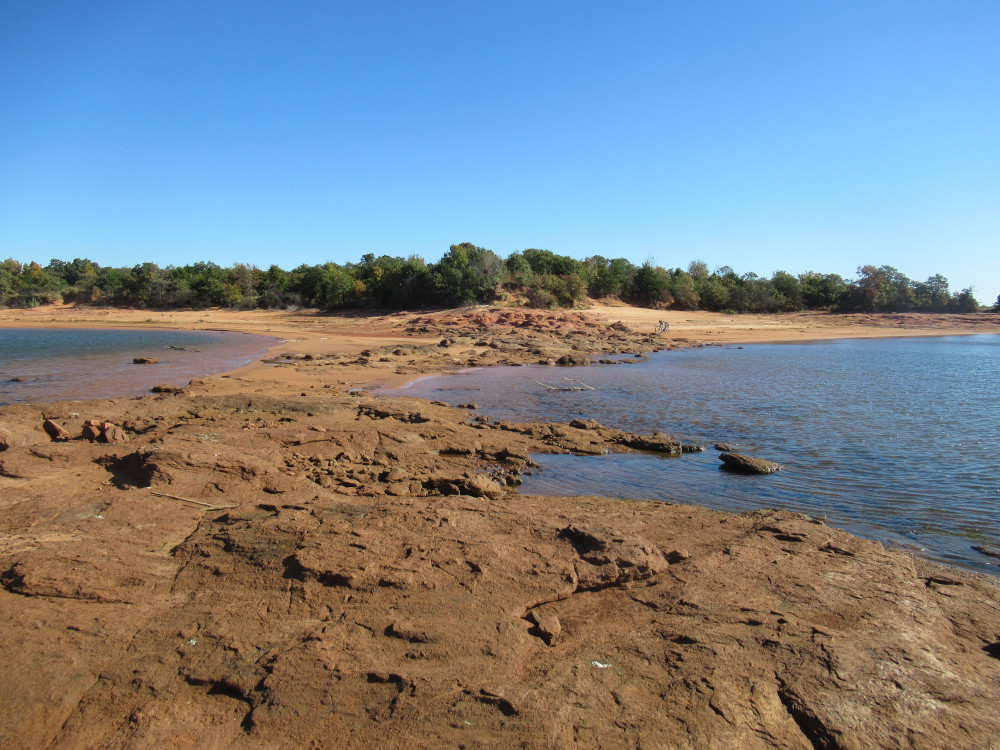 Farther around the shore at Point 15, the normally hidden rock formations are even larger. I’m standing out on the far end near the water, aiming the camera back toward the shore. Again, this narrow neck of exposed rock sports a significant number of boat scrapes. This is the best time to get a look at what is normally obscured by water. I was able to ride most of the way around from Point 16, as the sand is rather tightly packed near the waterline.
 I couldn’t resist capturing these exposed sandbars. You could just about walk on them, but your feet would definitely get wet in the process. Wading is more or less permitted, so nobody cares, and you would be surprised how far out you could get at this spot. What you cannot see in the image is that this sandbar stretches quite some distance out into the water.
 This is Point 14. Normally 14 and 15 are rather difficult to access without going back through the trails, and those leading out on these two points are usually even more thickly covered by brush and grass. At low water, it’s very easy to just wander around along the shore. Here we see the same hidden rock exposure with boat scrape marks. Honestly, the majority of visitors to these three remote points come by boat. The trails show very little evidence of human traffic, and yet the points themselves have plenty of footprints and such.
 So far as I have found, there are just two of these “eye” formations around Draper Lake. It’s completely natural; somehow the sandstone gets deposited in an eye shape, leaving a depression in the center. This one is exposed by weathering, but the other one is set deep into the ground atop a stony hill with just a thin layer of soil growing grass.
Lots of natural blue gradients you captured here 🙂
The eye formation is fascinating…it almost doesn’t look natural. It’s a distant memory now, but some time ago I read up on a lot of natural formations that a lot of people mistook for manmade. Understandable. A lot of them are circular and have to do with water. There were a few straight line formations, but nothing in 2 dimensions (corners) or 3 (cube corners). I guess it takes a mind to make those.