
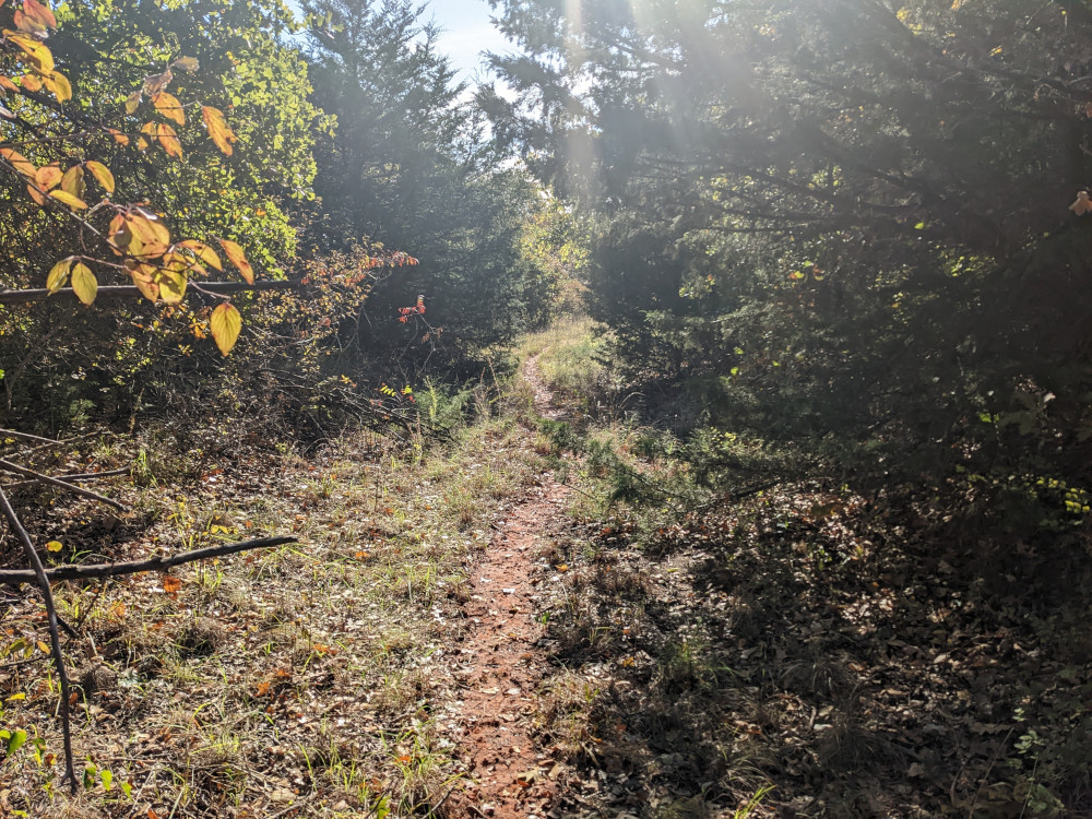
 Today I visited Point 10, the second longest trail ride among Draper Lake’s points. As you might expect, the trail is half the fun. It’s not just going out to visit a remote site; it’s a great workout pedaling along through the forest. This primary trail snakes along the eastern side of the point.
 I was wrong about this purple flower. I was looking for it in the wrong place, maybe 50 yards off. This is the original photo paired with what it looked like today. Not only did it turn gray, but the gray is a fuzz that is easily blown away in high winds. It lost a couple of wads while I was watching, because the breeze was pretty stiff today.
 The trail out to Point 10 is relentlessly wooded until you get to this one spot. The majority of Draper Lake area is thickly wooded with mostly varieties of oak with some elm here and there. The obvious reason for this gap is the huge bedrock formation. If you observe Draper from a satellite image, you’ll see just a few of these dotted around the place.
 From the trail I spotted a thicket of cedars. There aren’t many cedar thickets around the lake, only a lot of singles or twins scattered around the area. During warmer weather it smells wonderful, but then, it’s too buggy to come out here in the summer months. Today was just around 60°F (16C).
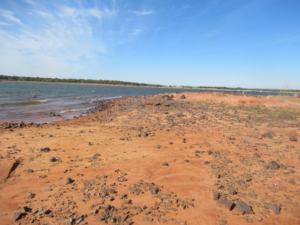
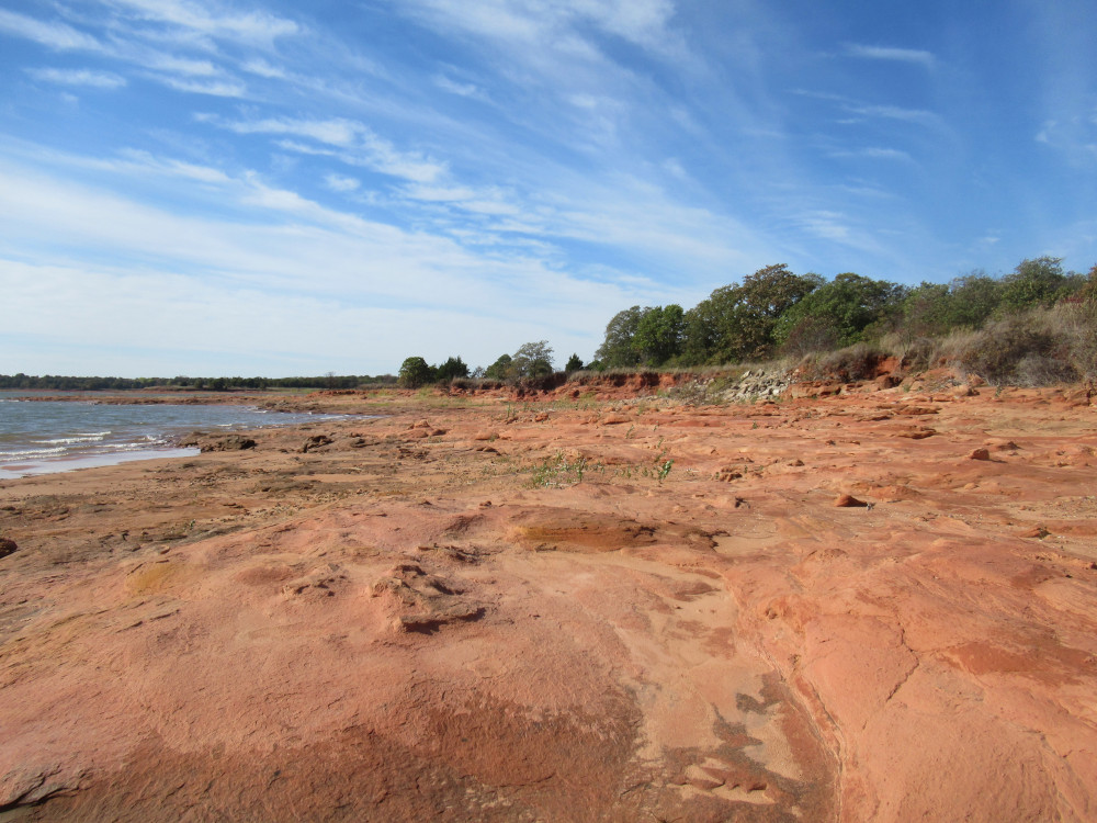 To be honest, I didn’t even recognize Point 10 at low water. It’s exceedingly wide because the rock formations are thick and only slightly sloped. At normal water level, this would all be invisible except the parts where greenery grows up on the small bluff shoreline along the right side of the image. Normally Point 10 looks like a a tiny jutting point of land with a natural stone boat ramp in the middle.
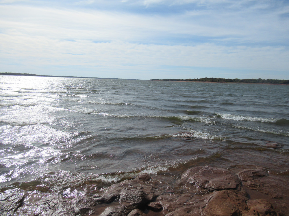 For Draper Lake, this is really high waves. The stiff breeze I mentioned earlier is pushing the water from the south right up against Point 10, which faces south. Further, because of how the rocks lay under the water here, the waves run up from two different directions, with the waves combining to make a constant roar. It was very loud today, and I sat there for a good while just listening.
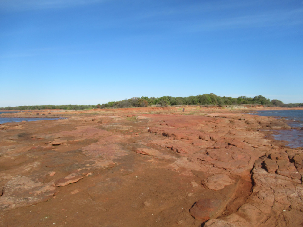 This just shows how big the rock formation is here on Point 10. All of this is hidden at the normal water level. I spotted a few propeller tracks where boats came across without knowing what was under them. I’d say Point 10 is easily the largest expanse of rock I’ve seen this year.
 Even more interesting is this very large patch of black sandstone. This is not exactly rare, but rare in this quantity. It’s considerably harder than the red sandstone, but is also more brittle. It was once quite popular to come out the Draper and hunt for this stuff because it makes a very unusual stone for gardens. That was back in the days when the shore road was well maintained, which stopped in the mid-1980s as I understand it.
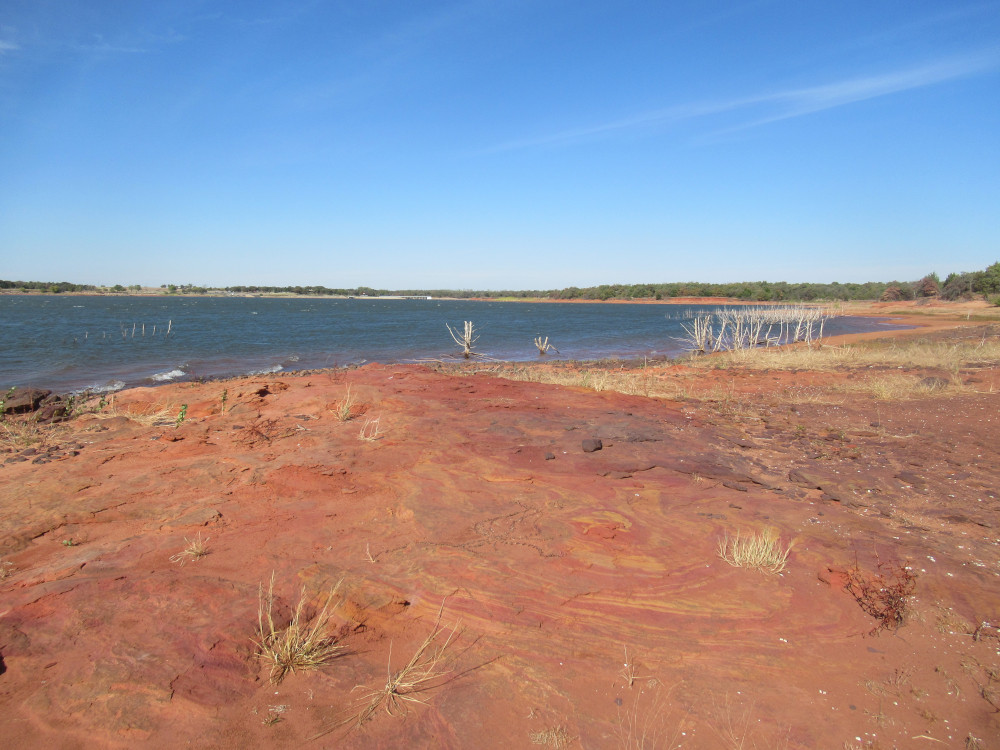 This caught my eye: These trees are uniformly cut off right about the normal water level. That’s how low the level has gotten. With the recent heavy rains, the water level should drop no farther for Draper Lake. If we get a wet fall, it should come back up. There is some discussion among city officials about ways to bring it back up to normal without draining the lake the feeds it, in the southern part of the state.