Ride Photos 12

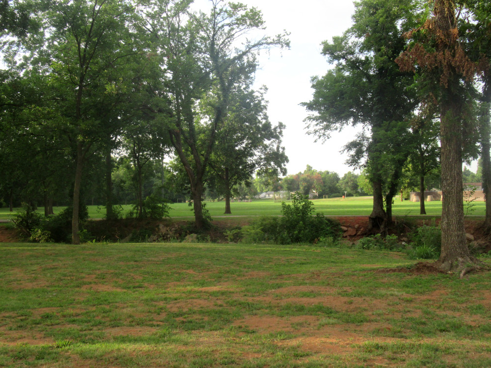
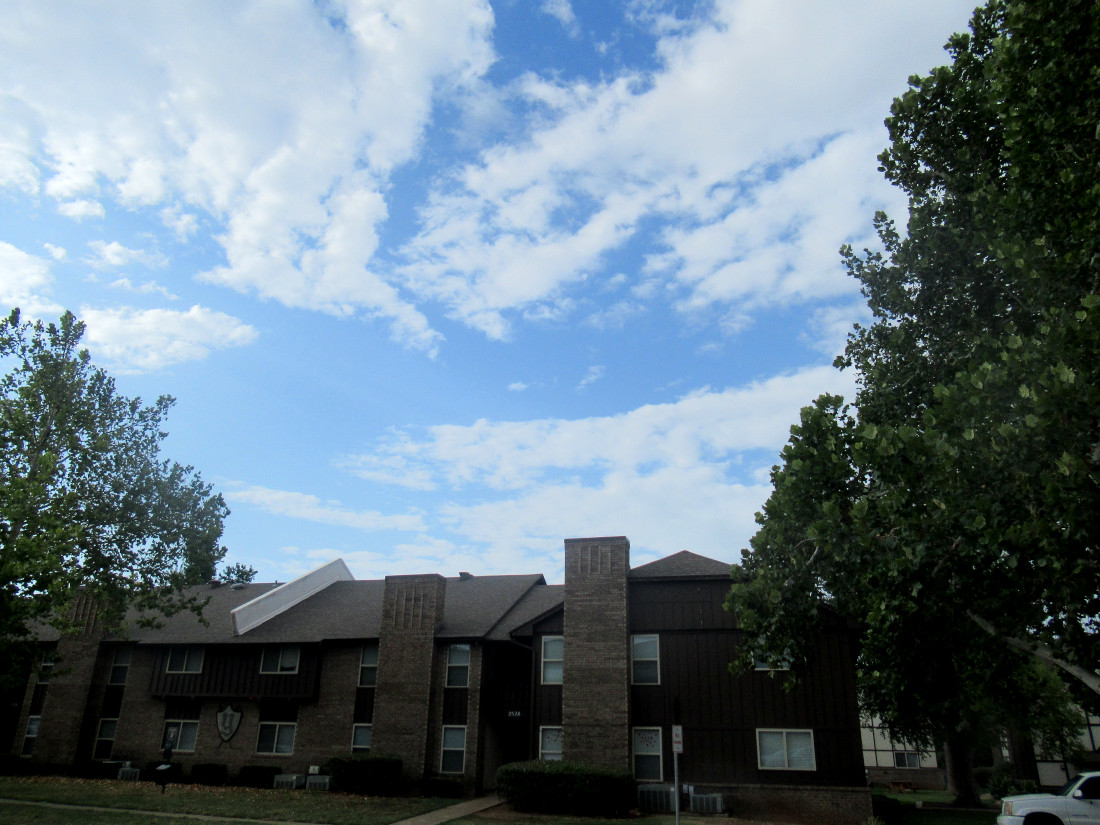
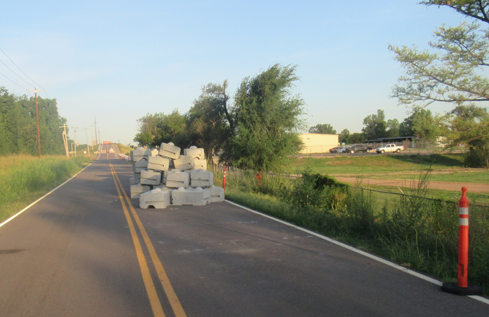
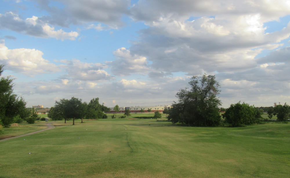
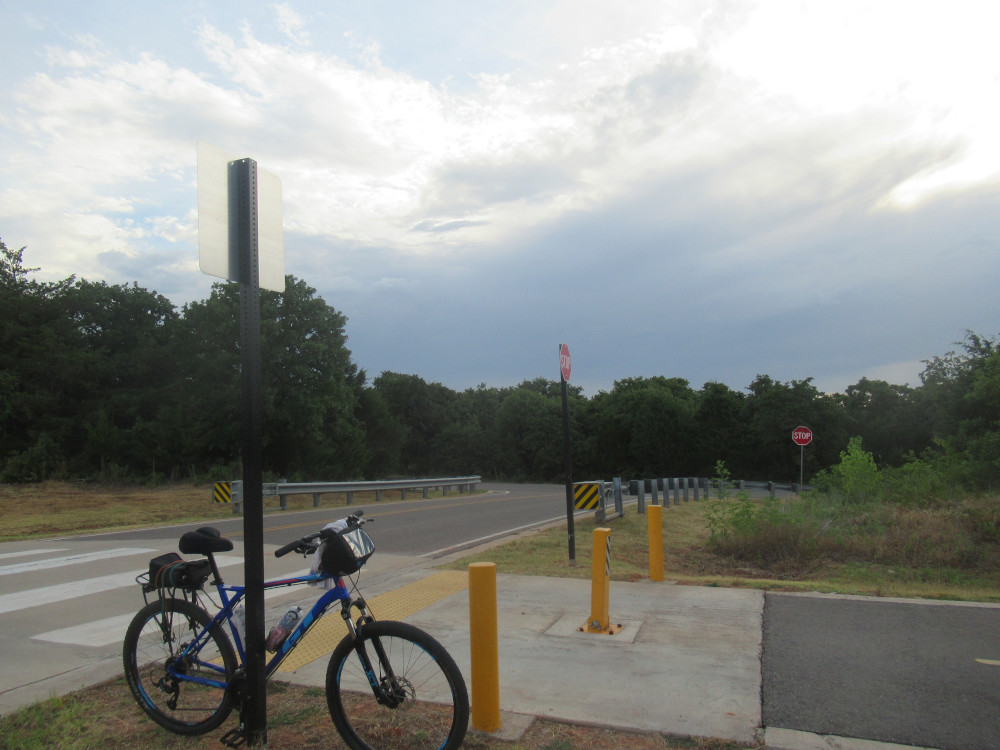
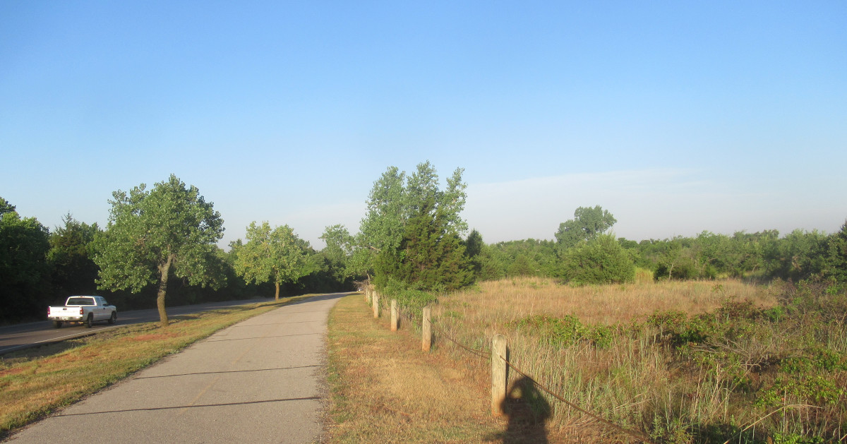
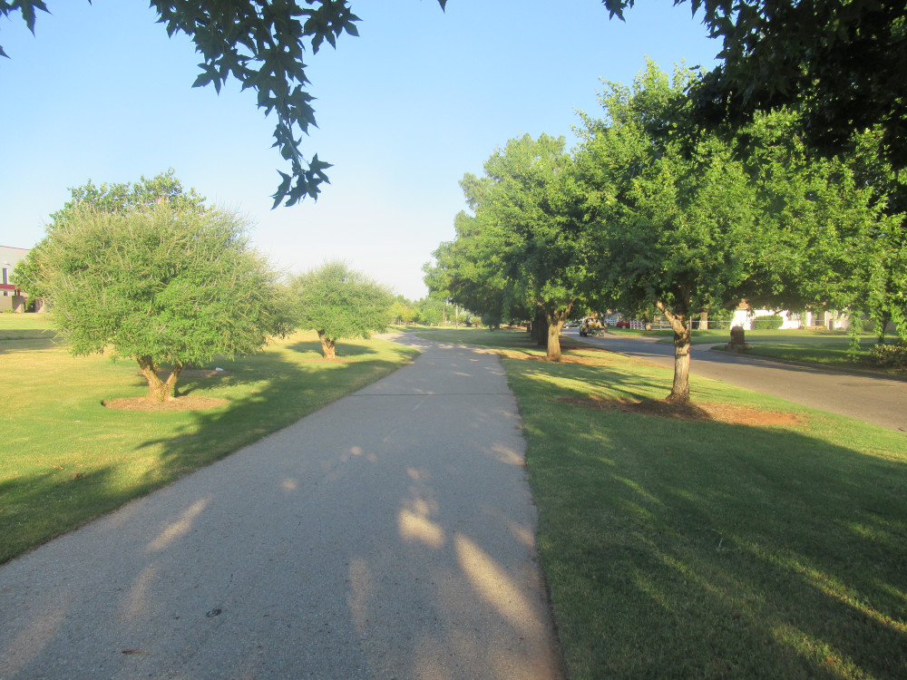
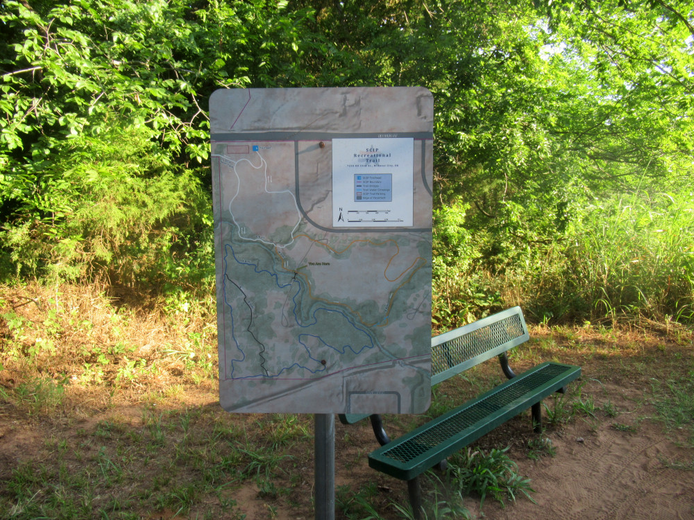
Today’s ride took me past Eagle Lake in Del City. The trail I’m on at the time of this photo connects with OKC’s Eagle Lake Trail, heading to the First Americans Museum (FAM). The crews are still doing a lot of dirt work at the FAM, so there’s still no proper bikeway there, nor is there a valid detour. Notice how the skies have only some thin stratus clouds in the background. That will change.

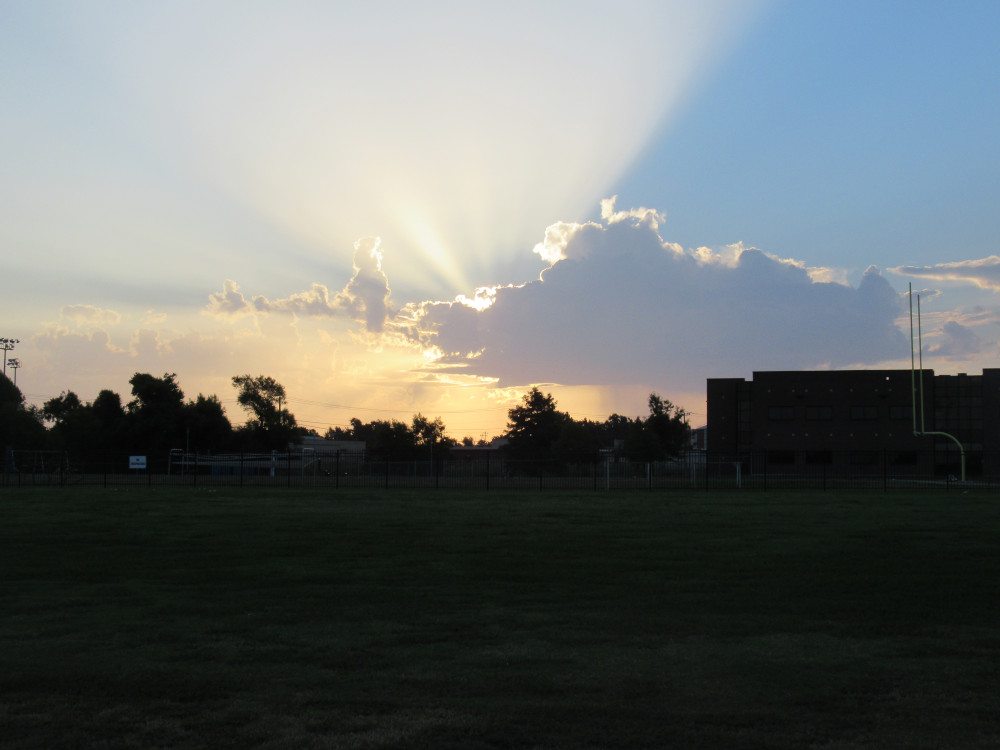
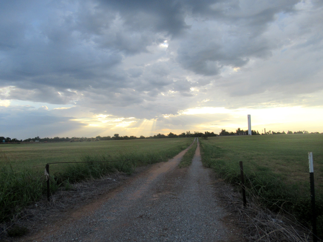
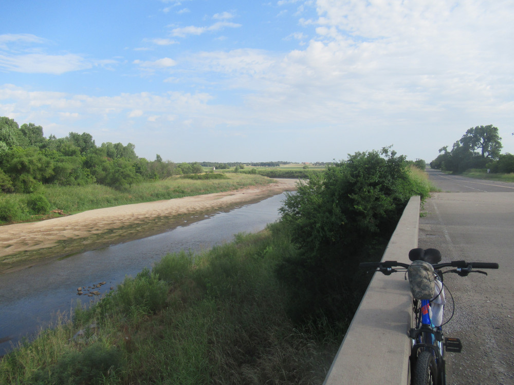
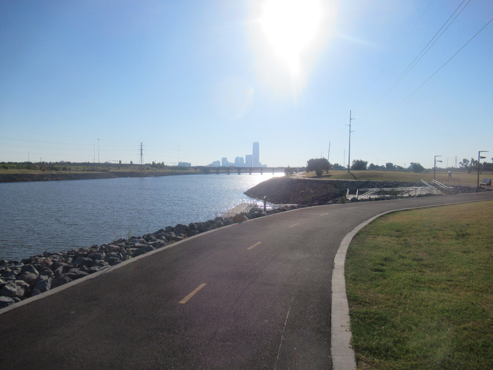
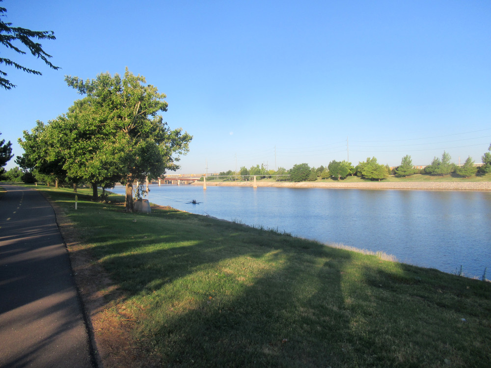
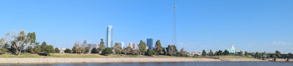
The Canada geese around here seldom do anything alone, but this one goose was waddling along the South River Trail. Just so you’ll know: The rest of the gaggle was behind me where I stood on a rise to capture this scene. There’s a boat ramp to the right and storms forming far to the south of OKC in the background. From the low angle of the sun, you can tell it’s quite early in the morning. If storms are forming around dawn, the air over the state is unsettled. There will be more.

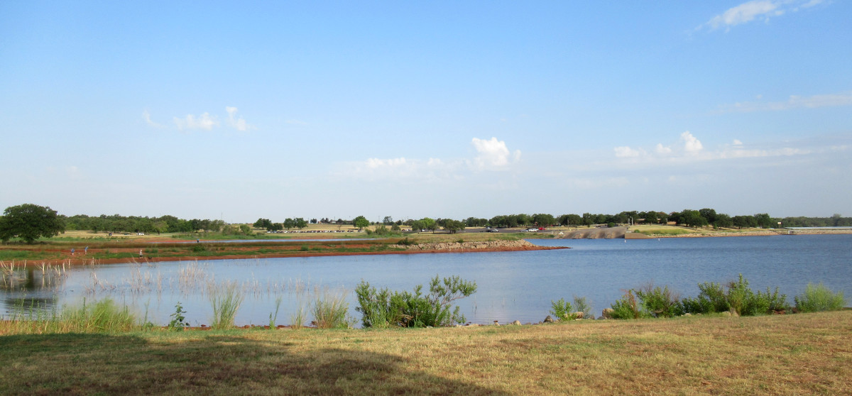
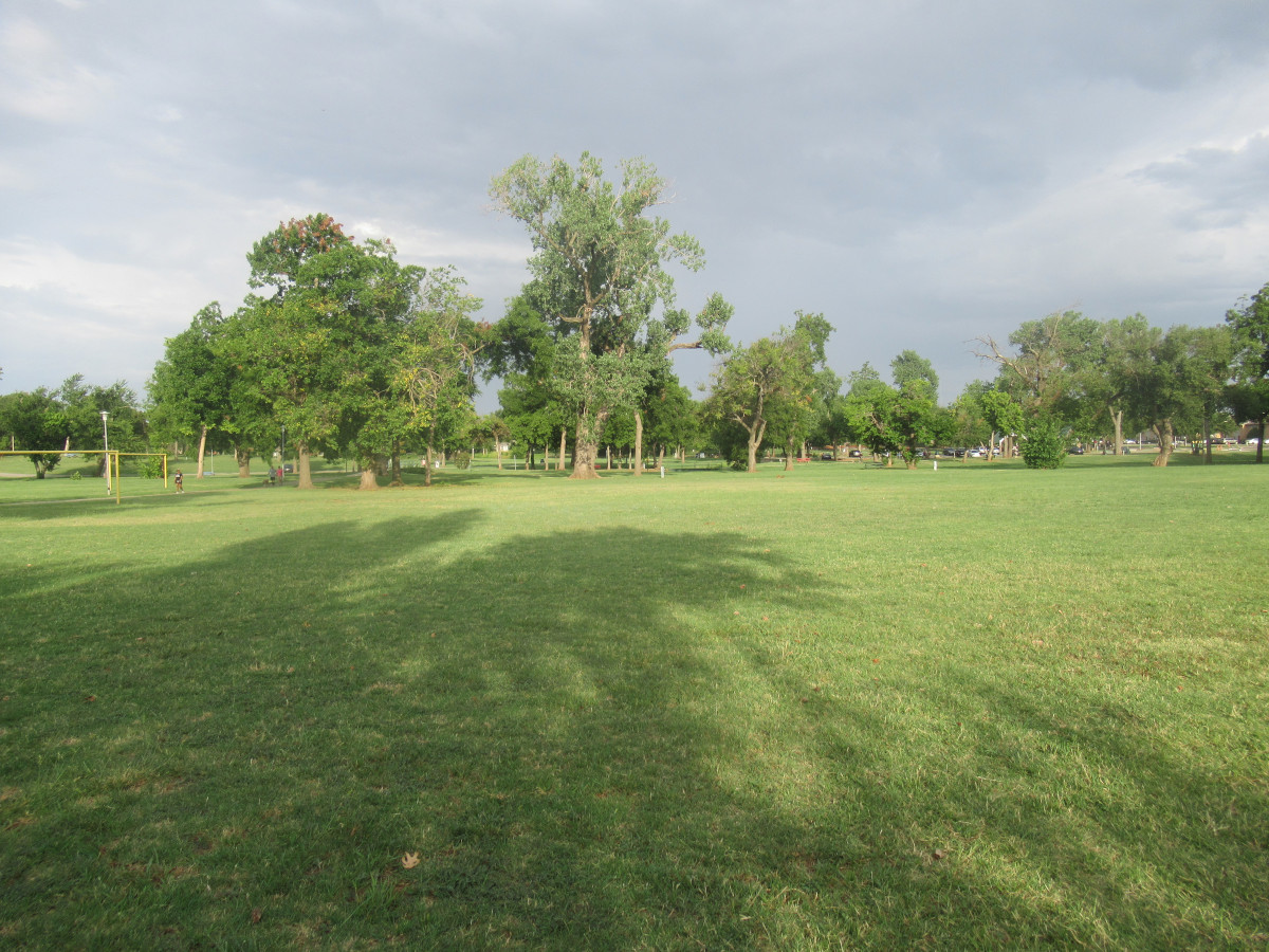
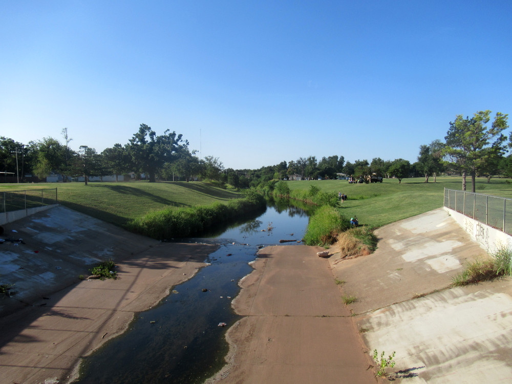
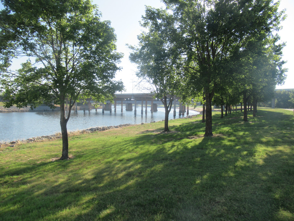
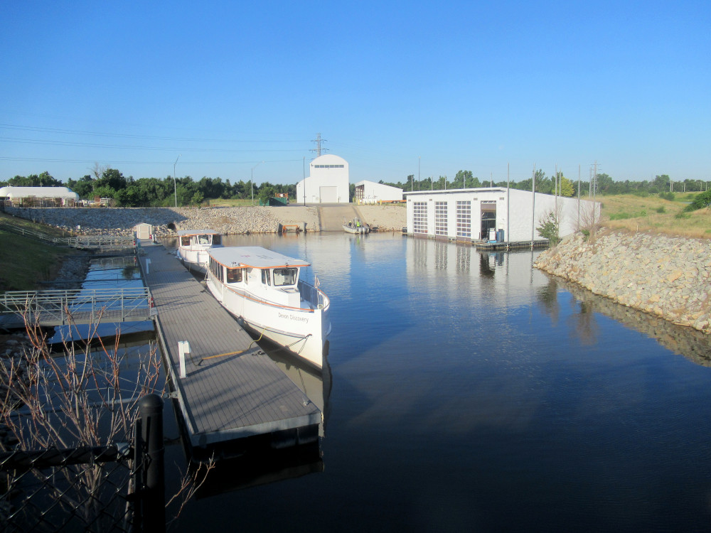
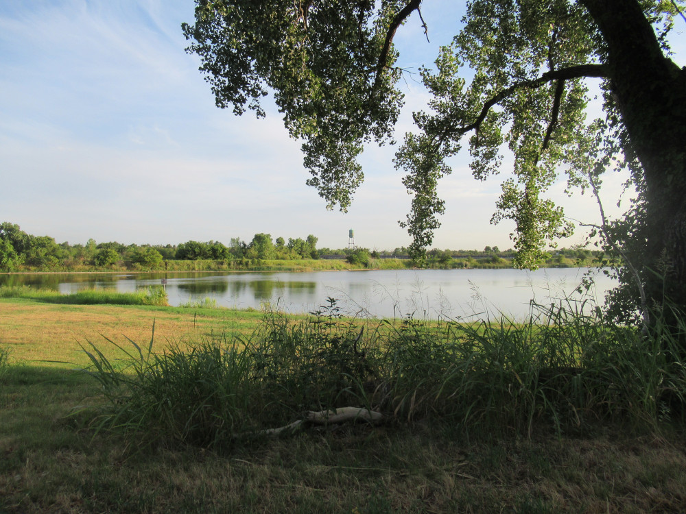
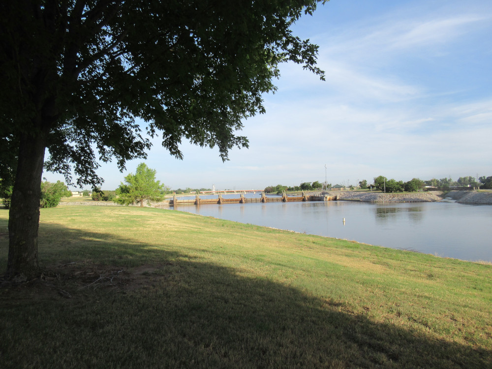
None of this is really new scenery, just the same old stuff I see every week, but from a different perspective. This is the middle dam on the Oklahoma River Recreation Area. There is a slight flow, in part because we’ve had some rain in the state off and on for the past week or so. This is the North Canadian River and it sources way out west in New Mexico, running through the western part of Oklahoma before it gets to OKC. Later today it got some more rain, with storms that blew down power poles northwest of OKC.

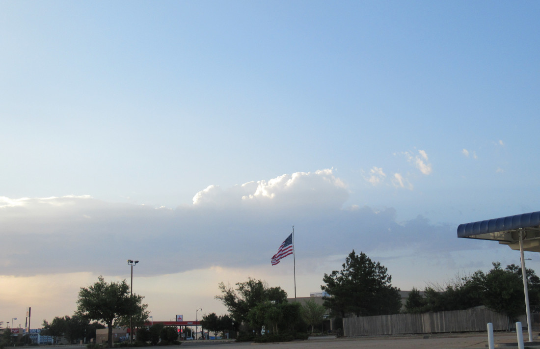
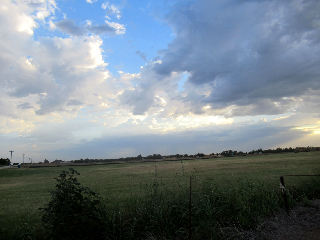
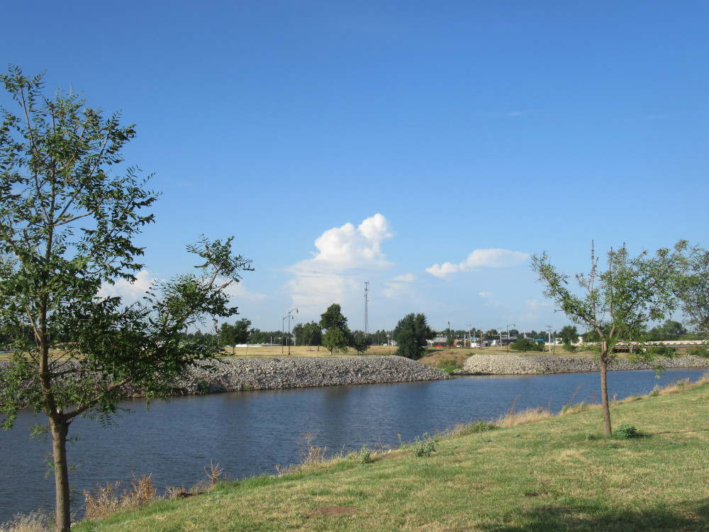
This is that same line of storms in the second image, now bigger and closer to OKC. They didn’t cause problems for the capital, but dumped a little rain in places like Tuttle and Mustang, from what I hear. Because of how the atmosphere is unstable, and we have no mountains high enough to interfere for a very long way in all directions, storms in this area can rise while you watch. These developed rather quickly.

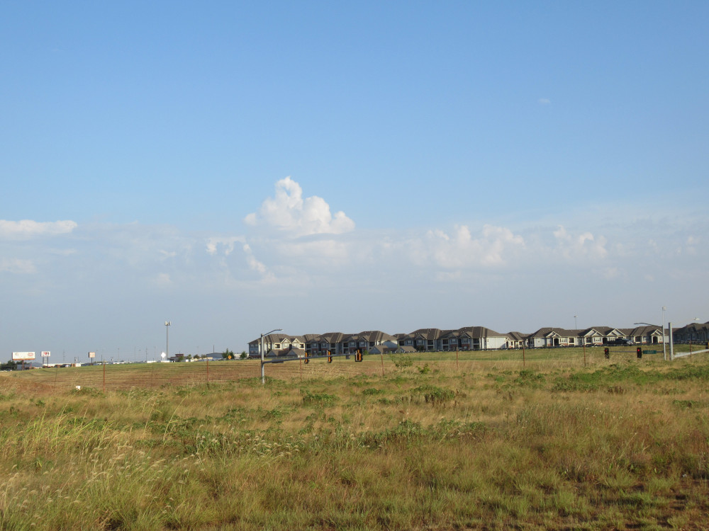
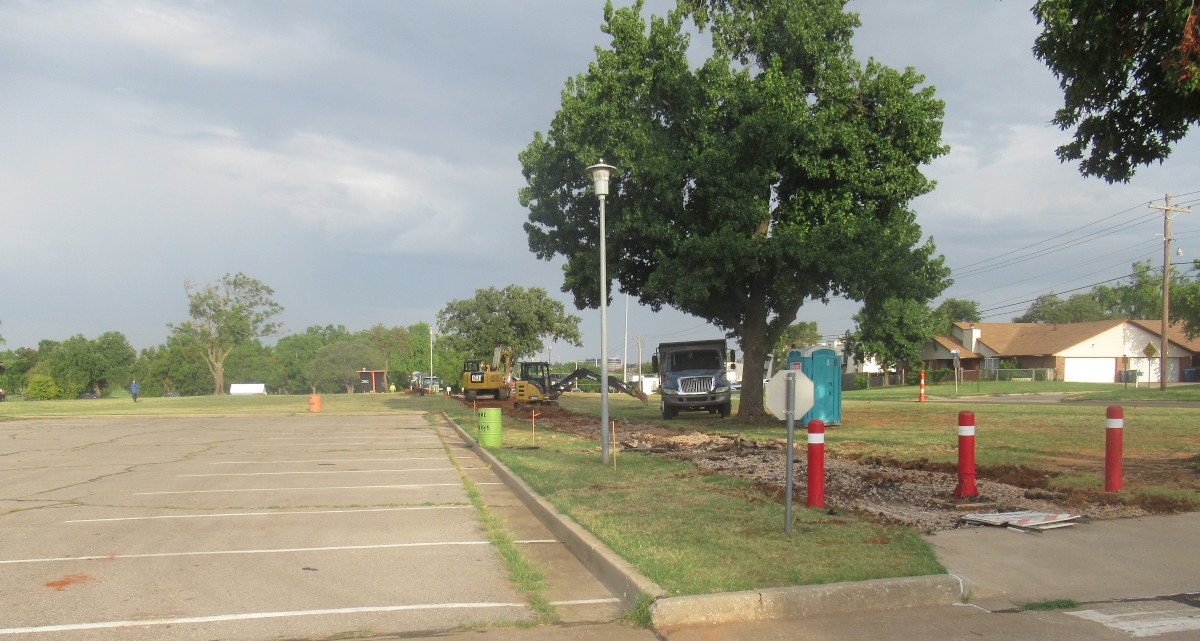
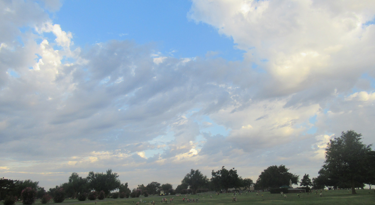
This line of clouds northeast of OKC mark the boundary of an unstable air mass. We could call it a storm front, but it’s more complicated than that. It’s not moving much. Later in the day from this picture it was part of what provoked some pop-up storms about a hundred miles northwest of OKC that collapsed and pushed out some fierce wind gusts with damage to power lines. But there was rainfall all around the state.

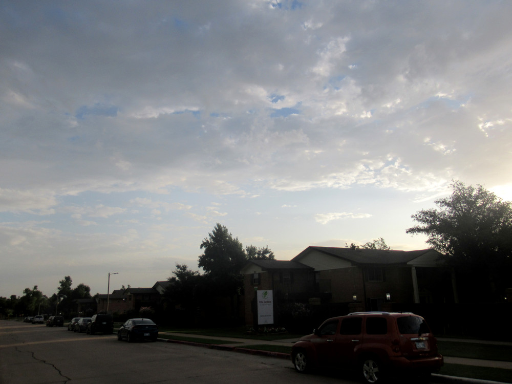
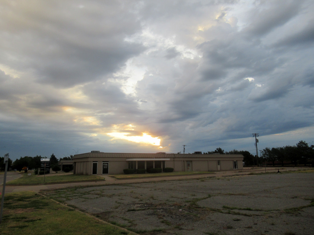
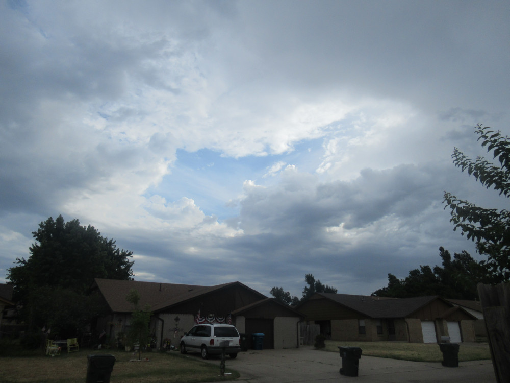
After I got home, this storm cloud rose up very quickly later in the day. Within minutes it expanded in all directions and thundered a bit. I didn’t see any lightning strike the ground, nor did I see any rainfall by the time I posted this. Still, our weather today is rather dramatic statewide.

Posted in photography | Tagged , , | Comments Off on Ride Photos 12

Ride Photos 11

I left the house around sunrise. The clouds were just starting to form a rain cell on the eastern horizon. The sun had to rise a good bit to get past this stuff. The dark buildings in the foreground are the Midwest City High School campus. Staff were starting to show up, but students don’t start until next week.

This is another edge of the same storm cell forming. As I rode south toward Draper Lake, I watched this thing rise and come to life. The cloud in the foreground is on the edge of an unstable air mass. By itself, it just rose up, then flattened, and drifted off to the south (our right). But because it formed up so quickly, I wasn’t sure if it would rain closer to my destination. Thus, I kept an eye on it during my ride out to the lake.

Off in the opposite direction, about twenty miles out, this was what I could see of the storms I knew were dumping rain on northern Oklahoma City. Notice how similar the foreground clouds are to the previous images. If such clouds stand alone, they are often harmless, but when they are adjacent to darker clouds, this is a storm edge.

The marina is in the background. Just six months ago, this slender finger of land across the narrow cove here was partly underwater. The outer end was a sort of island. This helps to visualize just how low the water has gotten during this drought. So, as you might expect, this was the perfect time to roam the shoreline trail and see what else is exposed that most people seldom see. That was my goal today — not to ride the bikeway around the lake, but to visit isolated shore areas that require riding on rough trails.

Between Points 3 and 4 you’ll find this area that most people don’t even know about. The trails are open, but few bother to get off the pavement much. I saw just one other bicycle track from the past few days, one set of horse hoof prints, and an odd mixture of about three sets of human and dog footprints. This is one of the easier areas to reach. I’m waiting for cooler weather to visit the even more isolated shore points, lest I be eaten alive by summer insects.

I’m standing way out on the end of a sandbar that formed between a rock outcropping and the shore. This rock had scoring from a few propeller blades across the top. Despite the rising heat, I stood there a while and absorbed the sound of the waves driven by our southerly surface winds. The sound evokes a sense of Eternity for me.

The buoy says, “No Boating” referring to the space between there and the shore. When the park services set out these buoys, they dropped the anchor on high stuff like this when its hidden underwater. The blue Lowe’s bucket is the anchor, filled with concrete with a chain set in it. The anchor is attached to the chain by a steel cable. The water level dropped so low that it left the buoy and anchor high and dry. As before, somehow a sandbar formed between the the rock and the shore. In previous years that sandbar was absent.

This is the same rock with the buoy viewed from the shore. I saw a small fishing skiff crawl by, keeping its distance. There are far fewer boats than normal when the water is this low. Myself, I’d love to get a canoe or kayak out on the water to visit some areas that are hard to reach in warm weather, because of the fore-mentioned voracious biting insects. They aren’t waterborne.

During high water, Point 3 can be a little more dramatic with its high bank. However, with the lake so low, you get to see how placid and ordinary it looks. The slope trails off long and slow, far out into the water. There’s not a lot of rock formations, and those are all flat and unremarkable. The nearest rocks of any character are quite a ways around the shore.

As I rode farther around the shore toward Point 2, I ran into this rock outcropping that is atypically rough. Most of the lake stones are smooth layered sandstone. This stuff is very rough, with various sizes of cavities. It reminds me of dumped wet concrete that hardened as it was. However, this stuff is dark red. It’s also what you see around pockets of rose rocks. I didn’t spot any rose rocks, but this the area I would search if I were looking for them.

The earlier storms over northern OKC had moved off to the north by the time I finished my trail jaunt. This formation is now more like a hundred miles away now, almost invisible. In the foreground is the former police and ranger station. It’s not being used by Parks and Recreation for storage and offices. The fence runs around quite a substantial acreage where heavy equipment is parked.

Posted in photography | Tagged , , , , | Comments Off on Ride Photos 11

How Globalism Is Like Communism

I’ve said in the past that globalism is communism. I was not referring to the active policy of how economics are handled. Actually, economics is not the whole story about communism. Rather, the primary moral flaw of communism is materialism in the extreme. If there is anyone who worships Mammon, it’s a socialist/communist.

Still, in the minds of many, it can miss my whole point: Communists are convinced that human nature is malleable. That’s a critical element in materialism. They are utterly certain that if you change the circumstances, humans will eventually adapt to communism and it will work. It’s part of that false doctrine that humans can discern ultimate reality without God, and make appropriate decisions without reference to the moral domain.

Thus, we can easily discern that the globalists have been expecting that their seizure of academia, entertainment and all media, should have turned humans into complete idiots. While that has happened to some degree, it is not a permanent change in human nature. Rather, it is catering to some flaw inherent in human nature. All that catering does not change what people are.

Globalists are expecting people to be irretrievably lost in sheeple-dom. They haven’t calculated for the few whose personality makes that impossible. They didn’t count on the persistence of people who think for themselves and resist social conditioning. They failed to realize that all their effort would would not gain them the high degree of compliance when they finally make their move to take over the world.

The resistance from Russia and China to the US hegemony is proof of this. Those two nations understand how the West (under US dominance) has chipped away at the smaller governments around the world. They have come to a clear grasp of how the US sent agents into the cultures and meddled in government affairs through manipulation and corruption. And these two giants have managed to resist that influence sufficiently to retain their own unique heritages.

But at the same time, within the US there remains a strong element of culture that refuses to be herded over the cliff. As the current economic depression continues, it will become the provocation for states to pull away from federal controls. The Union will dissolve, at least in the sense of big chunks pulling away. The globalists were counting on something that never existed, in that their expectation of turning everyone into sheeple permanently doesn’t work. Take away the hedonistic comforts and those sheeple grow teeth and claws.

Yes, we will have a severe depression, and it will last some years. However, the solution is so obvious no one has to write much about it: decentralize the economic system. It will happen because it’s unavoidable. People are going to eat if there is any way to get food. Artificial policies meant to control food won’t work when there is still access to fertile soil. Locking up that soil under centralized ownership will simply require that the people cease to honor the laws that protect that ownership. Fences built by humans won’t keep out humans when the pressure of survival gets strong enough.

Globalism is the same doctrine as communism in moral terms.

Posted in sanity | Tagged , , , , , | Comments Off on How Globalism Is Like Communism

Ride Photos 10

I didn’t ride too far today. I was exploring routes in my area, in part because storms were too close again, and I didn’t want to get too far from home. This image shows us under the edge of a storm cell at dawn.

Later, when I had made my way to the Regional Parks system, I caught the last wisps of morning mist above Soldier Creek (below). This is Pecan Grove Park. It had rained a little overnight, just enough to recharge the run-off in the creek a little, but not enough to cool the stream much. It was a sweaty morning.

Midwest City has been replacing a lot of sidewalks along Reno Avenue. The sidewalks turn into a bikeway (“multi-use path”) in the park (below), so it’s just the same work the crews have been doing for months, just a wider and more curvy path. It’s not a wholesale replacement; this section had a lot of tree-root humps that were breaking up the pavement.

As it turned out, the storms missed us. This is looking across Barnes Park to the west. The winds at surface level are from the south (our left) but the winds aloft are from the north. It’s because of a massive heat dome over the southwestern states and those spin clockwise. Thus, the storms moved from north to south, exiting to the left, and missing us by just a dozen miles or so. I could have easily ridden into the storms this morning.

At one point my route brought me within just a few miles of the storm cell (right). There was a wide spot that projected very close to us as it passed (right to left in this image). The darker the clouds, the higher the storm tops, and the more intense that action.

But when you see this sort of fleecy stuff overhead (below), you are safe. The storms aren’t even thinking about coming for hours, if at all. This is just across the street from where I live.

Posted in photography | Tagged , , | 2 Comments

Cloud Shots 01

I’m trying to learn how to capture clouds. With our storms out here in the flatlands, the views can be dramatic at times. The problem is that, if there’s anything where the camera viewscreen deceives you, it’s surely with cloud formations. I can never tell how it’s going to turn out. Also, keep in mind that the sun was behind this particular cloud formation in almost every image, so the light balance was pretty tough.

So a major issue is dodging utility lines and capturing something in the foreground that helps to convey perspective. This image shows a storm forming out northeast of the OKC Metro. That means it’s not coming our way, since winds aloft from the east are exceedingly rare in this state. However, the unstable air mass can be large enough for the storm to grow outward and reach back to us.

Meanwhile, from the northwest we have these broken clouds moving slowly to join the storm cell. As it turns out, the storm did grow quite a bit. My ride took me up very close to the rain curtains as the storm kept growing back my way. I lost one image of them on the far corner of my ride due to camera malfunction. Had I stayed there, I would have gotten wet.

This is the bridge at the apex of my loop, but facing back to the west, whence the clouds were moving into the storm cell. The wind picked up and the smell of rain was quite strong, so I mounted up and got out of there after this shot.

As it turned out, the prevailing winds aloft pushed the storm on eastward just about the time it stopped expanding. Radar shows that the bridge got some rain after I left, but not much. The smell of rain followed me most of the way home.

Posted in photography | Tagged , , | 2 Comments

Ride Photos 09

This is the trailing edge of a passing storm front. It didn’t rain all that much right where I was at the time. We fell into a gap in the system, which is partly why the opening appeared as it did. We had a week of intermittent rain from a front that stalled out over the state. This was its last gasp before moving on.

This morning I managed to get through the NE 4th Street construction area before the workers showed up. These are large concrete blocks used to build retaining walls and terracing. They look like giant Legos all piled on the side of the road. The new bikeway will be built on the right side of the road and these are necessary to bring it up almost level with the road. The surrounding terrain is about 4-5 feet (1.2-1.5m) below the road bed.

This is the NE 4th Street overpass at Interstate 35 in OKC. To accommodate the new bikeway, the old concrete barrier was chipped away, making the sidewalk double width. You can see the rough surface still exposed. The new concrete barrier will be poured where the rebar is now positioned. I’m pretty sure the lane markings painted on the roadway will be changed, too. The shoulder on the left side will probably be merged into the traffic lane.

This just shows the landscaping along the North River Trail. It was all barren for the longest time, but they came along about five years ago and added a bunch of trees. It’s one of the few places to get such regular mowing in the city. There’s a heavy investment here because of the water sports. This part of the river is used almost year-round for training.

And it’s not just landscaping, but several bridges were replaced completely with something more decorative. This is Exchange Avenue crossing the Oklahoma River. It runs from western Downtown over into “Cow Town” — the old historic Stockyards section of the city. For the longest time it was quite the blue collar place, but in the late 1970-1980 time frame, most of the cattle trading moved out of the Metro. Then it started going upscale. There is still a rescue mission in the area, but the main drag on Exchange Avenue is all fancy now.

This is nothing more than attempt to capture the bridges and upper dam in alignment. Just so you’ll know: The stiff cross breeze imparts a small chop to the water surface so that you can’t see how brown the water is. It’s not too highly polluted, but it does carry a lot of silt. Every ten years or so the water is drained and excavators have to remove tons of silt that build up behind each of the three dams. And that’s after it passes through at least one more upstream dammed lake (Overholser) still within the Metro area. Rivers in this state seldom run clear.

Speaking of bridges, the Grand Boulevard South Trail has its own bridge over Lightning Creek, separate from the Grand Boulevard Avenue bridge. This is looking downstream, which is toward Downtown OKC. You can’t miss the Devon Tower sticking up for all the world to see. What you cannot see is the massive flood basin just on the other side of the bridges.

Looking back upstream I spotted some volunteers working alongside the creek bank. In the distance is some heavy equipment used from purpose I can’t discern at this point. However, it looked to me like the volunteers were pulling litter out of the greenery along the bank. Lightning Creek is so named for a very good reason. I surveyed it once, and there is an awful lot of pavement run-off upstream that fills this thing like lightning whenever it rains. That’s after two different containment basins are filled before the one mentioned with the previous image. At any rate, it floods high enough to deposit trash in the high foliage along the banks here.

Back over in Del City, this was once a bikeway running under Interstate 40. There was a long-winded project improving access to I-40 along the entire Del City-Midwest City corridor (called “Tinker Diagonal”). Today an excavator was restoring the landscaping between the two halves of the highway. It’s finally winding down, and the bike path will be restored, but it’s still months away.

Posted in photography | Comments Off on Ride Photos 09

Ride Photos 08

Shot from a distance over a golf course, this fancy building is the infamous Douglas High School. It’s all minorities and violence is quite common. It’s run almost like a prison, I’m told.

Sylvester Stalone is in Oklahoma filming a TV series called Tulsa King. A lot of scenes are shot in OKC, though. I saw this back portion of the Outdoor Sports/Bass Pro parking lot (left) filled with these mostly generic vehicles several months back and wondered what it was. I rather thought it looked like stuff used in movies and TV, and it turns out they are connected to Stalone’s project.

Along the River Trails, this field of grass isn’t dead (right), just hibernating through the drought. The first time it gets some rain, most of this will green up in a day or two.

This morning the storm clouds started on the east. There was an odd break that allowed the only real daylight (below) for a few hours. Keep in mind that our storms here in the Midwest almost invariably come from the west, so these have already passed over. The radar history offered on one site shows they formed over our heads, but didn’t rain until passing east of us.

However, a decent amount of storm clouds continued forming overhead, and eventually gave us some rain. I had planned to ride out to the North Canadian River bridge on Hefner Road to trim some foliage, but never even got halfway before the rain started falling. It was heavier north of my home, and Hefner Road is quite a ways north. Anyway, I turned back and went to our local park and started trimming some parts of the park I had missed last week. It drizzled for a short while, but it was enough rain to get everything wet. This is a shot of the storm clouds breaking up (right).

Posted in photography | Tagged , , , | 2 Comments

Ride Photos 07

On a ride around Draper Lake a couple of days ago I was enjoying the fact the clouds were hiding the sun, keeping the temperatures down. These were rain clouds about 50 miles away, over the next county east of us. Unfortunately, the rain never got near us. I’d have been glad to ride through a decent cooling rain shower. Still, just the clouds kept the heat away for most of my ride.

The drought hit just as the blackberries were forming, so they never got to grow much. What few there were hidden in these brown vines were tiny clumps of no more than six globes each. They were so small that you would have to stand very close to see any. How sad; no blackberries this year out around Draper Lake.

However, a couple of days later I was riding up near Jones and spotted this bush along Westerminster near Hefner Road. They weren’t fully ripe, but close enough to offer a very fine taste. The water table in this are is rather high, since it’s right along the North Canadian River. This is quite a ways downriver after a couple of creeks had been able to add some water. Not much is getting past the dams upriver in OKC.

To emphasize that point, here we have the North Canadian River far upstream from the previous photo. This is right before it merges with Crutcho Creek. Crutcho catches water from Soldier Creek, and both have some run-off from lawns, one golf course and agricultural use. Plus, Crutcho is a very long creek running 20 miles or so from its source. I’ve seen several droughts, but Crutcho Creek has never stopped flowing since I can remember.

Here’s a study in contrasts: a grain silo from the previous century still standing alongside new horse barns. It’s common for folks to keep these things standing, as they were generally built before WW2. It’s composed of clay tiles and concrete, typical of Depression Era building when steel siding was nearly impossible to get. The wooden doors have long since rotted away.

I just missed getting hit by this. I was crossing NE 23rd behind a garbage truck. I remember thinking it wasn’t too smart for him to have his rear dump hatch open, since it reaches up about 10 feet (3m). He caught the lines running across the street here (Midwest Boulevard) and down came the pole with much zapping and sparks. The driver stopped and almost immediately closed the hatch. I called 911, and then proceeded to drag across the street some traffic cones standing along the curb for some forgotten purpose. This kept drivers from heedlessly turning onto the street where the live power lines were down.

It knocked out the stop lights here and a couple of other intersections, along with power to various businesses and probably some homes. Not shown is that two other poles were snapped. They are all quite old and too low in the first place.

Posted in photography | Tagged , , , , , | 2 Comments

Ride Photos 06

I once rode in 112°F temps. I learned that you have to ride slower than normal, but be careful not to stop without shade, and stay hydrated. In order to make my rides right now, I have to leave at sunrise so I can get back before it gets too hot. Thus, there was no way I could keep my shadow out of this shot. It’s the Grand Boulevard Trail as one approaches Trosper Park. Off to the right in the underbrush once stood a very popular BMX race track. It fell into disuse, and then rain and weeds took it apart.

When the nearby new Cesar Chavez School was opened, a lot of nice landscaping was added to this section of the trail. There’s at last one spot where teachers can sit in the shade to take a smoke break, since smoking is forbidden on the actually school grounds. Just a hundred yards farther down this trail, it suddenly turns into an ugly run-down suburban look where it crosses the railroad tracks. The bike path becomes a sidewalk that makes no accommodation whatsoever for crossing the tracks safely. It just drops off into the gravel on one side, and jumps back up on the other side, no less than 6 inches on each side. Nice.

I felt like testing the camera’s ability to handle looking directly at the sun. I think it turned out rather well. This is the view from the South River Trail looking toward Downtown OKC. Somehow the sun is filtered heavily, yet the sun’s reflection on the water still shows up well.

This was a similar experiment (below), with the sun behind trees. The camera did pretty well with keeping the contrast between the dappled sun light and the shadows of the trees. This is the view toward the Shields Boulevard bridge over the North Canadian River (AKA, OK River rowing area).

This is the real story for the day (below): catastrophic low water level in the North Canadian River. Only a tiny trickle comes through a small pipe, so the water in the river bottom is mostly stagnant. It smells pretty bad, of course. This is part of the drought conditions for Central Oklahoma. The cranes are doing okay, but the fish are not.

Posted in photography | Tagged , , , , | Comments Off on Ride Photos 06

SCIP Trails Again

The first two shots are from yesterday’s ride on the OK River Trails. Here we have a couple of kayakers training for races. This facility has become one of the premier training areas for kayaking in this part of the country. The city invested heavily in making this qualify for Olympic Trials, and added an artificial whitewater facility that was very quickly adopted for the same level of use. The city leadership claims it’s already paying off in terms of added tourism and boosted tax revenue. Think about it: competition rowing in OKC, of all places.

Devon Energy is one of the bigger investors in all of this stuff. They run tours on the OK River rowing area. This is their boat storage and maintenance facility. To be honest, I rarely see the boats doing their thing, which is almost entirely during warmer weather. Then again, when it’s at or near triple-digits Fahrenheit in OKC, I only ride during the early hours of the day, so I’m sure the tour boating service runs only after I’ve gone home.

The rest of the pictures are taken from today’s SCIP Trails ride. Midwest City (MWC) has a much smaller budget than OKC, but there is a strong biker community here. The city had planned this area for industrial development (SCIP = Soldier Creek Industrial Park), but no one ever bought a single lot. So, when the biking community volunteered to build and maintain the trails, it was better than letting the land sit vacant. The city did kick in some facilities and it became a major recreational feature, since the trails are open to walking or other human-powered wheels. Now the city is investing more planning and money into the whole idea, adding paved biking trails all over the place. This is the trail map posted for the new northern section of the SCIP Trails.

The northern half of the trail system is the latest edition, started a couple of years ago, and finished sometime later. The whole thing follows Soldier Creek until it feeds into Crutcho Creek. Thus, the northern section is along Crutcho Creek. They did a good job, and today I spotted someone doing volunteer trail maintenance. I had no trouble navigating the trails on my new mountain bike. Since there are no serious hills, it’s easy enough to pick a gear and stay with it all the way through. In my case, that was B-4 (middle chain ring and the 4th of 8 gears).

The north trail features a memorial to T. Keeler Quillin, whose house was destroyed in a plane crash. This part of MWC lies in the flight path for the main runway at Tinker AFB. Tinker was built originally as a production facility for Douglas Aircraft leading up to WW2. After the war, the Air Force took over the facility and named it after Oklahoma-born Brigadier General Tinker. This northern flight path all the way down to the end of that runway has seen crashes ever since then, though a lot less in recent decades. I believe the picture of the fighter jet is like the one that crashed.

There’s not much to see of what remains of the Quillin property. The garage is still standing, but whatever is left of the actual house is overgrown in the tall grass native to this area. The pilot did his best to bring the plane down to a safe crash landing, waiting long past a safe ejection altitude. He survived, but the aircraft pancaked, then bounced back up and drifted over to the Quillin home. The impact killed both occupants of the house.

On my way back out, I turned and took this picture of the entrance to the northern section of the SCIP Trails. This paved path runs under the Crutcho Creek bridge on NE 23rd Street, a major thoroughfare across the whole county. It was once part of the famous Route 66. I remember watching the construction crew working on this a couple of years ago. However, the actual trail system was built entirely by volunteer labor. Today it’s associated with the Oklahoma Earthbike Fellowship. I can tell you that Oklahoma is way behind the curve on building open access trails. I’ll also tell you that part of the problem is that the membership of this group isn’t very accommodating of folks who don’t fit into their narrow social pattern. I’ve tried to work with them as a volunteer and never got anywhere because I’m not on Facebook.

This is a sample of what the trails in the southern section look like. This is the older part of the project, but in the past two years, this southern section has been updated and improved. Also, they’ve added extra loops to make the trails longer. In one place on the Blue Trail, a massive dead cottonwood tree fell and cut off part of the trail, so they had to reroute. I rode two miles down to the trails from home, spent about an hour riding the whole system (minus the Black Trail) and I was whipped when I finished. It took a bit of rest time before I was ready to ride back home.

This is the trail map for the southern section. To be honest, this part isn’t that well laid out. There are a couple of confusing junctions and you end up repeating some sections of the trail no matter which way you go. There’s one obstacle on the Green Trail that is too hard for that level. Green is supposed to be an easier level. I’ve seen similar flaws on other trails across the state. I can’t forget how the trail down near Norman (home of OU) was wholly unmaintained, and Norman is a major biking town, with our biggest university and lots of wealthy liberals.

I don’t want to turn this into a bike maintenance blog because there are too many other folks doing a much better job. But let me offer one “pro-tip” for those who buy cheaper bikes like mine. One of the first things you should do is lubricate the pivot points on your derailleurs. This really helps the cheaper components work better. It solves most problems with inconsistent shifting. Just use a good chain lube, the kind that has a gummy grease suspended in an evaporating solvent. Just a drop here and there will prevent shifting troubles.

Posted in cycling | Tagged , , , | 2 Comments